Nominal to luminous range
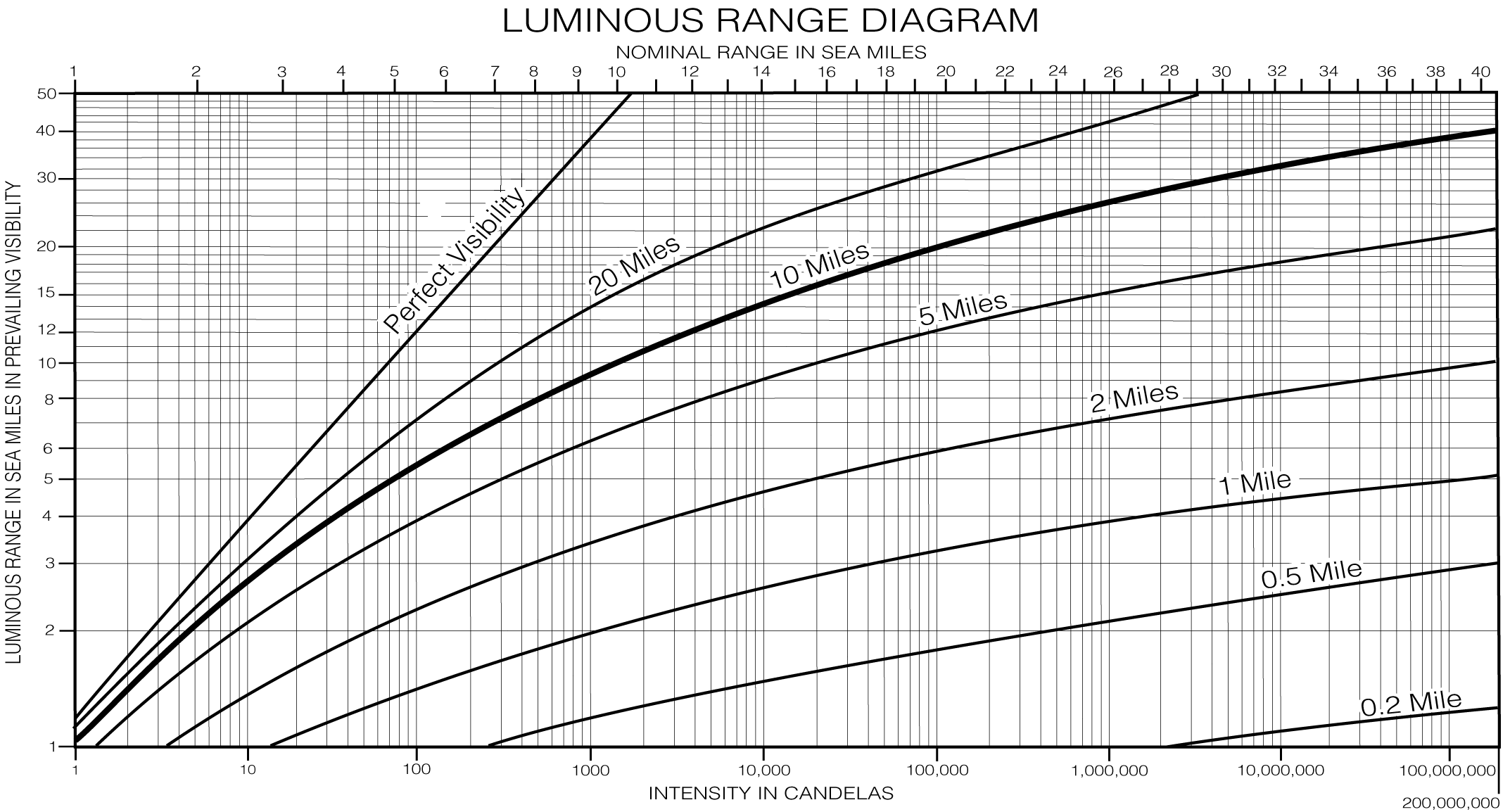
Start from the top border using the nominal range (found in the nautical chart or List of Lights), draw a vertical line down to the current meteorological visibility curve, then draw a horizontal line towards the left border of the diagram to find the luminous range in the current conditions for that light. Back to chapter 9. |
Canadian diagram
A more basic, but similar, diagram is offered through the Canadian Hydrographic Service:
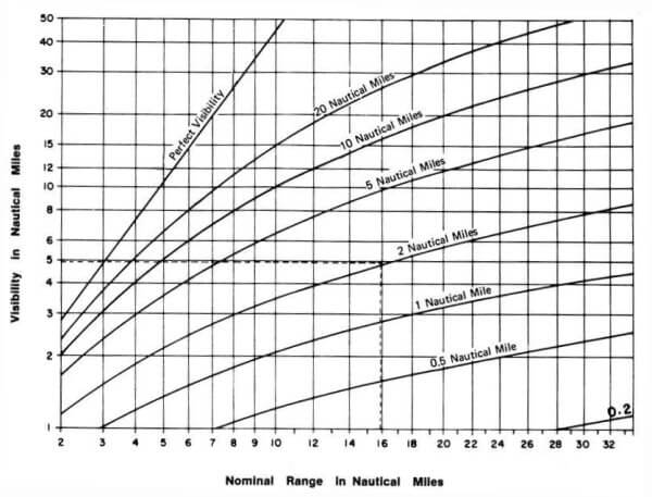
First obtain the meteorological visibility from the weather, then find the distance the light can be seen at night from the graph above.
Example
The light list or chart gives the nominal range 16 NM. The weather report gives the meteorological visibility 2 NM. The point on the bottom of the diagram marked 16 is followed upwards until it intersects the curve marked NM. Follow that height horizontally to the left margin to find that the visibility of the light is 5 NM.
Caution: the nominal range diagram is correct when the meteorological visibility is the same in the whole of the distance between the ship and the lighthouse. Conditions occur when this may not be true.
The American graph is reported to be less specific, but conveniently shows the meteorological visibility codes.