Saronic, Argolic & Athens sailing holidays
The Peloponnese - Πελοπόνησος, once linked to Attica by the Isthmus of Corinth and now breached by the Corinth Canal, is a vast and mountainous peninsula known in the Middle Ages as Morea
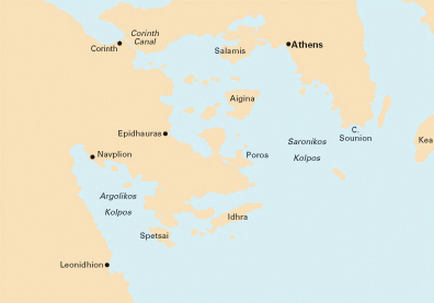
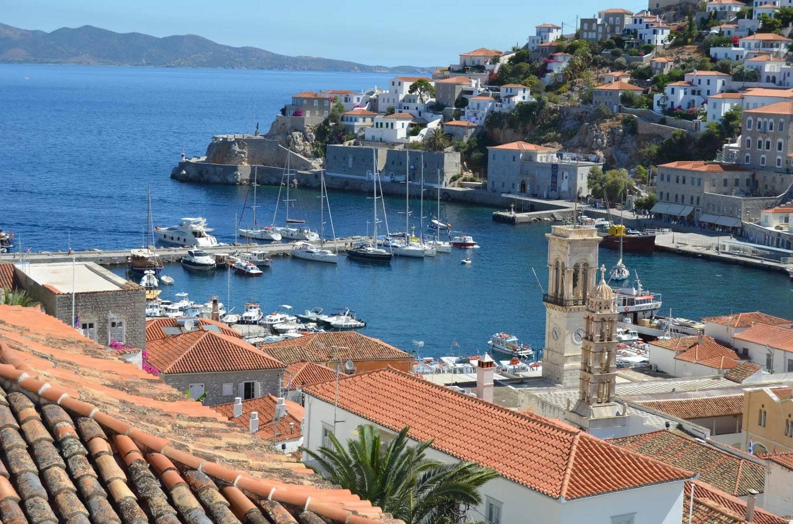
Together, Attica and the Peloponnese enclose the Saronic Gulf, which is by far the most famous sailing and charter area in Greece due to its proximity to Athens.
The second sensational yachting area is the Argolic Gulf, the perfect venue in case the Meltemi winds scourge the Cyclades islands.
Lord Byron's £4000
The Romantic poet who not only gave his live for Greece in the War of Independence, also gave the incipient Greek state a huge financial boost; more… →
The Peloponnese landmass itself is made up of high peaks, inland basins caused by subsidence and verdant irrigated coastal plains.
At the centre, at 600 – 800m above sea level, lie the pasture lands of Arcadia
The eastern coastal plain, the Argolida or Argolis – dominated by the citadels of Argos and Mycenae – is devoted to foodgrains, as well as orchards and market gardens.
The southern coast is split into three fascinating promontories; the central one – an extension of the eastern Taygetos massif – is Mani, with to the east the Laconian Gulf and the the west the Messenian Gulf.
Taygetos mountain is flanked by alluvial plains, free from winter frost: Laconia round Sparta and Messinia round Kalamata port. The smiling fields produce grain and early vegetables while the figs and olives of Kalamata are well known for their quality.
Saronic & Argolic Gulfs sailing areas rated
To help you choose your ideal sailing area in Greece, I selected 11 criteria and gave each region ratings accordingly.
More stars indicate a more valid statement:
→ not valid
→ half valid
→ very valid
Therefore → “ Easy sailing conditions ” means that conditions are *not* easy.
Characteristics
Easy access by plane / ferry
Unspoiled by tourism
Picturesque ports
Tavernas & facilities
Ancient Greek sites
Medieval sites
Secluded anchorages
Sublime scenery
Easy sailing conditions
Fertile & lush vegetation
Wildlife
Characteristics
Easy access by plane / ferry
Unspoiled by tourism
Picturesque ports
Tavernas & facilities
Ancient Greek sites
Medieval sites
Secluded anchorages
Sublime scenery
Easy sailing conditions
Fertile & lush vegetation
Wildlife
See the ratings of the other sailing areas in Greece.
Important reading
Guide to yacht charters: 8 steps towards a successful sailing holiday.
History
The Argolida was the heart of Greece from 1600 to 1100 BCE under the Mycenaeans. With their decline, the Dorians controlled the fate of the region until the conquest of the country by the Romans.
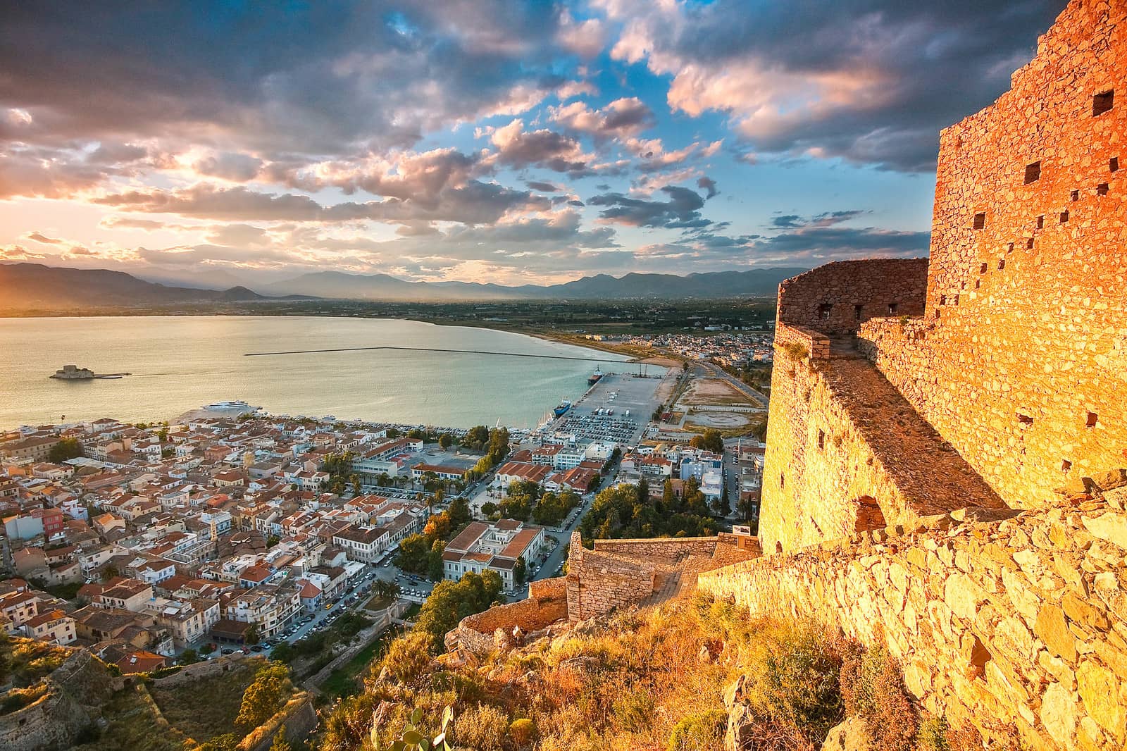
During the Byzantine era the Argolid shared the fortune of the rest of the Peloponnese. It was ruled by the Franks and surrendered to the Turks in 1460, Navplion, however, remained in Venetian hands until 1540. Navplion was the capital of the newly formed Greek state from 1828 to 1834, when this role passed to Athens; Acropolis • Tower of the winds.


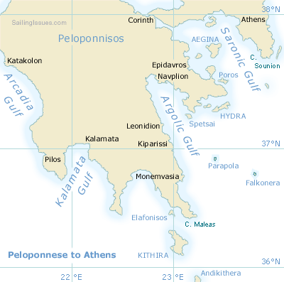
Click on the thumbnails to see a larger image. The satellite images are active maps: mouseover to see the names of cities and islands of the Argolic and Saronic Gulfs.
Books and nautical charts