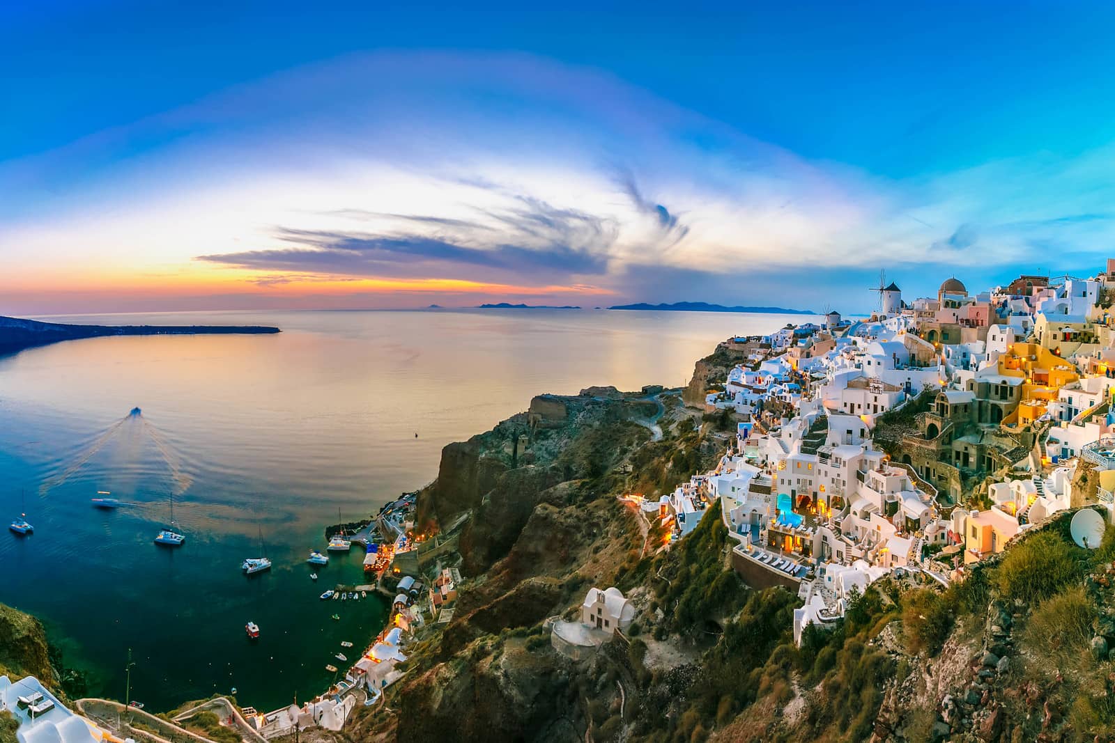
Santorini sailing holidays
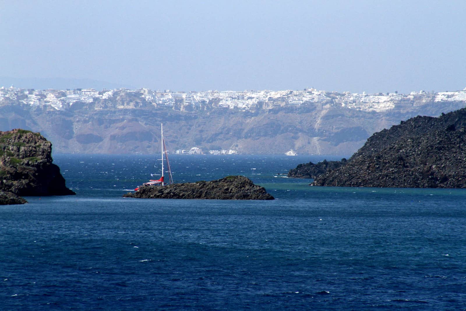
The spectacular approach of Santorini - Σαντορίνη by sea, usually entering the caldera from the north-west, is the apogee of many yacht charter holidays in the Cyclades.
Thira - Θήρα – Italian: Santorino or Santorini after the island's patron saint “Santa Irene” – together with the smaller islands of Thirasia - Θηρασία (9 km2 294 m) and Aspronisi - Ασπρονήσι (2 km2 71 m) are part of a volcanic crater, which has been engulfed by the sea.

Ports / anchorages are clickable . signifies a highly recommended venue, and a truly must-see venue; see other icons.
In the centre are the Kaméni - Καμένη islets, the cones of later volcanoes which came into being in historical times.
Hot springs and emissions of gas bear witness to continuing volcanic activity.
The steep caldera cliffs range in height between 200 m and 400 m, while on the outside the land falls away gradually to the sea, its fertile slopes covered with vineyards.
Yet, the island is treeless due to lack of water, though the artisanal inhabitants achieve a modest degree of prosperity through the export of wine, pulses, pistachios and tomato purée. Santorini also possesses a natural mineral resources such as pozzolana a hydraulic cement used in structures exposed to water (harbour works, canals and dams).
In recent decades large numbers of visitors have been attracted to the island by its extraordinary natural structure and the archaeological sites, which are among the most important in Greece and the Mediterranean. Alltogether, the tourist trade has made an enormous inpact; positive to the local economy and negative for the social structures on the island.
Moreover – with the EU-subsidised Vlichada marina – more yachtspersons are courted towards Santorini.
Geological history of Santorini
Santorini represents the most active area of the South Aegean Volcanic Arc: a 500 km long and 20 to 40 km wide arc that runs from Bodrum in Turkey to the Mainland of Greece, which includes the islands of Aegina, Methana, Poros, Milos, Santorini, Kos and Nisyros.
Volcanism in this Aegean Arc generally first occurred about 3 – 4 million years ago with the exception of Kos where Miocene deposits suggest eruptions 10 – 11 million years ago.
The local volcanic field of Santorini additionally includes the Christianá - Χριστιανά islands 11 NM to the southwest as well as 4 NM to the north-east the submerged Kolomvos volcano, which is ~17 meters below the surface, so it is possible to actually sail over its summit.
Non-volcanic rocks – which are exposed on Thira at for example Mt Profitis Ilias, Monolithos and the inner side of the caldera wall near Athinios – represent a former 9×6 km non-volcanic island similar to the neighbouring Cycladic islands of Anafi, Ios or Amorgos.
Volcanism in the area of Santorini – at that time just a small, non-volcanic island – started about 2 million years ago.
The important stages of Santorini's volcanic evolution:
- ca. 2000 – 500 ka (ka = thousand years back): The oldest volcanic rocks are found near Akrotiri and the Christiana islands. On the Akrotiri peninsula the up-domed areas still are well visible and the marine fossils embedded in the tuffs suggest a minimum age of 2 million years.
- ca. 360 – 1600 BCE: The cyclic construction of shield volcanoes interrupted by large explosive and destructive events like the Minoan eruption at ca. 1645 BCE.
- 197 BCE till today: The formation of the post-Minoan Kameni islands, is recorded by human observation and documented by historians.
The ancient writer Strabo is the first to mention volcanic eruptions inside the caldera and described the rising of a new small island during the year 197 BCE.
After that, at least 8 eruptive phases followed in the years:- 46 – 47
- 726
- 1570 – 1573
- 1707 – 1711
- 1866 – 1870
- 1925 – 1928
- 1938 – 1941
- 1950 as the most recent eruption
History of Santorini
In antiquity Thera was known as Kalliste “the Fairest island” or Strongyle “the Round island” and was inhabited in the 3rd millennium BCE (Cycladic culture), probably by Carians.
Archaean Greeks settled on the island about 1900 BCE, but were driven out by Phoenicians.
The excavations at Akrotiri have shown that Santorini was a flourishing and prosperous place in the first half of the 2nd millennium BCE.
The culture was in contact with Minoan Crete, but had developed a distinctive culture of its own. It can be supposed that at least the city of Akrotiri was not ruled by some central authority but by a plutocracy of merchants and shipowners who had trading links reaching as far afield as Libya.
Philhellenism
This “love of Greek culture” was an intellectual movement prominent mostly at the turn of the 19th century.
It contributed to the sentiments that led Europeans such as Lord Byron to advocate for Greek independence from the Ottoman Empire, but also allowed the “Elgin Marbles” being taken to London, read on…
This trade, and perhaps including an ethnic connection with North Africa, can be deduced from the wall-paintings of astonishingly high artistic quality, which are now in the National Archaeological Museum in Athens as well as in Fira.
The Golden Age ended with the eruption of the volcano, which seems to have taken place in the mid 15th c. BCE, after premonitory activity in the 16th c. It must have been many times more violent than the Krakatoa eruption of 1883. A number of archaeologists, in particular Spyridon Marinatos, believe that it explains the sudden end of the Minoan cities on Crete.
After the eruption Santorini remained uninhabited for 500 years, until the beginning of the 1st millennium BCE, when it was resettled by Dorian (Minoan) incomers from Crete, who established themselves on a limestone ridge south-east of Mount Profitis Ilias.
In 630 BCE their king, Grinos, founded a colony at Cyrene (present-day Libya) – the largest Greek colony in North Africa. Allied with Sparta at the beginning of the Peloponnesian War, Santorini was required to pay tribute to Athens from 427/426 BCE onwards. It enjoyed a measure of prosperity under the Ptolemies, when an Egyptian garrison was stationed on the island. Thereafter it came under Roman rule.
In 1207, after the Fourth Crusade, Santorini was conquered by Marco Sanudo, Duke of Naxos, and thereafter remained in Italian hands for three centuries. In 1539 Santorini was taken by the Turks, and in 1830 reunited with Greece.
The volcanic force which originally built up the island round the older limestone cone of Mount Profitis Ilias and then destroyed it shortly after 1500 BCE continued to manifest itself in later centuries. The last violent volcanic phenomena, combined with earth tremors causing considerable damage, was the Amorgos earthquake in 1956
Cruise ships • Sea Diamond
In the night of 6 April 2007 the cruise ship Sea Diamond sank near the mooring buoy beneath Fira town (Skala) after hitting a reef – just south of Kameni islet – inside the flooded crater of this volcano and making water. The weather and visibility were ideal and these waters are well charted.
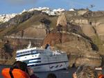
On the photo on the right she is already listing while passengers are evacuated by rescue boats. With a dramatic slow movement the Sea Diamond sank nose-up surrounded by liferafts to a depth of 200 metres ending on the rocky seabed of the Santorini caldera. BBC News: 1, 2, 3.
Several colossal cruise ships visit Thira each day – see the ship arrivals schedule – putting too much of a burden on the island, the locals and even the donkeys: please discourage donkey rides
Wines of Santorini
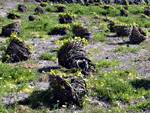
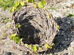
The strong volcanic soil seems to deliver a faint smoky bouquet to the famous local Santorini wines.
The grapevines are pruned in a distinctive way to encourage them to twine around in a basket shape called a stefani. This preserves the scant moisture and protects the vines from the omnipresent winds that scour the surface of these treeless slopes.
Ports & anchorages
Thira island / Santorini
Thirasia island
Anafi island

Ports / anchorages are clickable
Thira island / Santorini
Vlychada marina
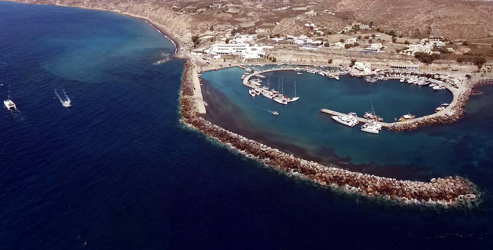
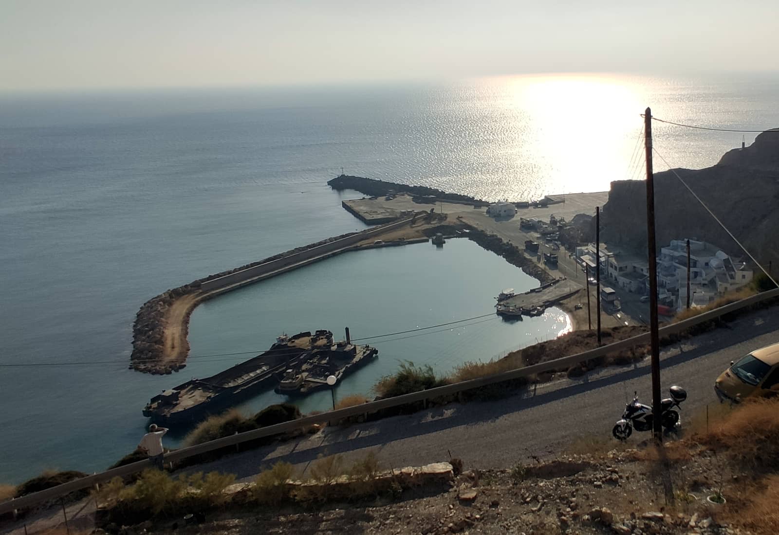
At the south tip of Santorini (Thira island) is the Marina of Vlychada or Vlikádha - Μαρίνα Βλυχάδα, which is regarded as the only port where it is safe to moor the yacht during a (Meltemi) storm or leave the yacht unattended while exploring the island.
After a lengthy process, developments since 2017 mean that most of the planned facilities can finally be appreciated.
The marina was subsidised by the European Union for €3.5 million to stimulate the local economy by attracting visiting cruising yachts, either private or chartered yachts.

Like the other chartlets, also in Eagleray, GWP, etc., it is unavoidable that the depths / situation is not up to date, since silts will build up and subsequently be (partially) dredged. Especially Vlichada is in a constant state of flux.
Further note that the northern half of the outer mole can be used to go along-side or stern-to.
Vlichada approach
The two submerged ancient moles block the most logical ways in, making the approach treacherous. To avoid these and other obstacles: steer a course of 45° towards a point between the chimneys and the taverna / white hotel buildings till you see the entrance of the marina at 90°.
Note, that lots of charts and guides show only one ancient breakwater (e.g. left out of frame in the EagleRay chartlet). And although the north-west one (also not fully indicated in the map above) is shorter, it is certainly there.
This breakwater extends in SSW direction, often marked by one or two red buoy(s).
If present, leave these to port when inward bound; this approach is best shown and described by GWP.
The lighted yellow buoy – which marks the extremity of the south ancient breakwater – is sometimes (re)placed randomly: don't rely on its position, its colour or even its existence.
Inside the marina
Closer in, you still need a watchful eye since the entrance is regularly silted up.
The silts adjacent to the outer mole – which are shown on most charts – were clearly removed when friends of us visited in June, September and October 2020, April 2022 and February 2024, proving that there is periodical dredging.
Caveat: even in the shoulder seasons the best berths are claimed by local day-charter catamarans / tripper boats.
Visiting yachts are not that welcome in this European funded marina.

Note the yachts and catamarans along-side the breakwater. Hi-res image
To check whether the marina has been dredged (after the winter storms) consult the Santorini Port Authority or the friendly staff at the Marina Office via VHF 10 or 12, Dimitris Saliveros, Tel. +30 22860 82119.
In the summer months the Harbour Master will guide you to your berth: likely stern-to or (rafting up) along-side the breakwater, where there are several blue electricity points.
Yachts can also raft up at the tip of the NW mole, half-blocking the entrance to the inner basin.
Heavy weather, from all directions, can affect the outer basin.
We were able to use the showers in the Notos Spa Hotel, which overlooks the marina.
The adjacent “To Paraki” Taverna is highly recommended.
Since many decades Mark's Bikes, based in Perissa village, will deliver scooters right to your yacht, which is the best way to explore Santorini.
In somewhat particular order, the following essential museums:
- Akrotiri Museum
- Archaeological Museum of Thera (Fira)
- Museum of Prehistoric Thera (Fira)
- Tomato Industrial Museum (Vlichada beach, near the marina), seemingly irrelevant – I know… – but compelling old machineries and heritage
- Maritime Museum (Oia), dainty and small
- Museum of Minerals & Fossils (Perissa)
- Musical instruments Museum (Oia), exhibits from 2800 BCE (for some of my crew, this is the premier museum in Santorini)
Monolithos “port”
The minute port of Monólithos - Μονόλιθος is as close to the Santorini airport as Skiathos port is to Skiathos airport (where airplanes appear to graze the masts), fortunately equally few landings / takeoffs.
The land flows gently into the sea, in stark contrast with Fira's rocky heights. 
During Meltemi winds the short mole provides some shelter, but with any easterly component the little port becomes untenable.
Fully exposed to the NE – S; very shallow; go stern-to or bows-to the end of the mole, i.e. take a long line to it; mind the two unlit buoys 300 m north of Monolithos; on the approach steer ~300° towards the power station.
In the right conditions it can be a convenient – yet far from captivating – place from which to explore Santorini.
Constructions for a future marina are “in limbo”, see
monolithos-marina plans.
Various anchorages
Finikia
Below Finikiá - Φοινικιά village, on the north of Thira, there is a short L-shaped pier usually filled with caïques, and a large rusty mooring buoy (regularly a second buoy as well). Lat Long The pier is situated between the villages of Oia and Finikia; the steep winding road leads to Oia first. Going alongside is not recommended due to the wake of the myriad ferries and cruise ships that can push the yacht on the concrete.
East of Finikia in the inlet of Armenis (Mouzaki bay) there is a 20 × 5 m pier Lat Long but there is no path up… so only useful in an emergency: very safe in strong northerlies.
Further east you can explore the Chapel of the Seven Children, only accessible by boat and built inside a cave Lat Long approach the disembarkation pier with the dinghy.
Ammoudi
On the north-west tip of Thira – under the famous village of Oia – is Ammoúdi - Όρμος Αμμουδίου which has a short mole for the ferry to Thirasia. We have only sailed past this miniature inlet; exposed to most winds and there is a ground swell; many local boats Lat Long.
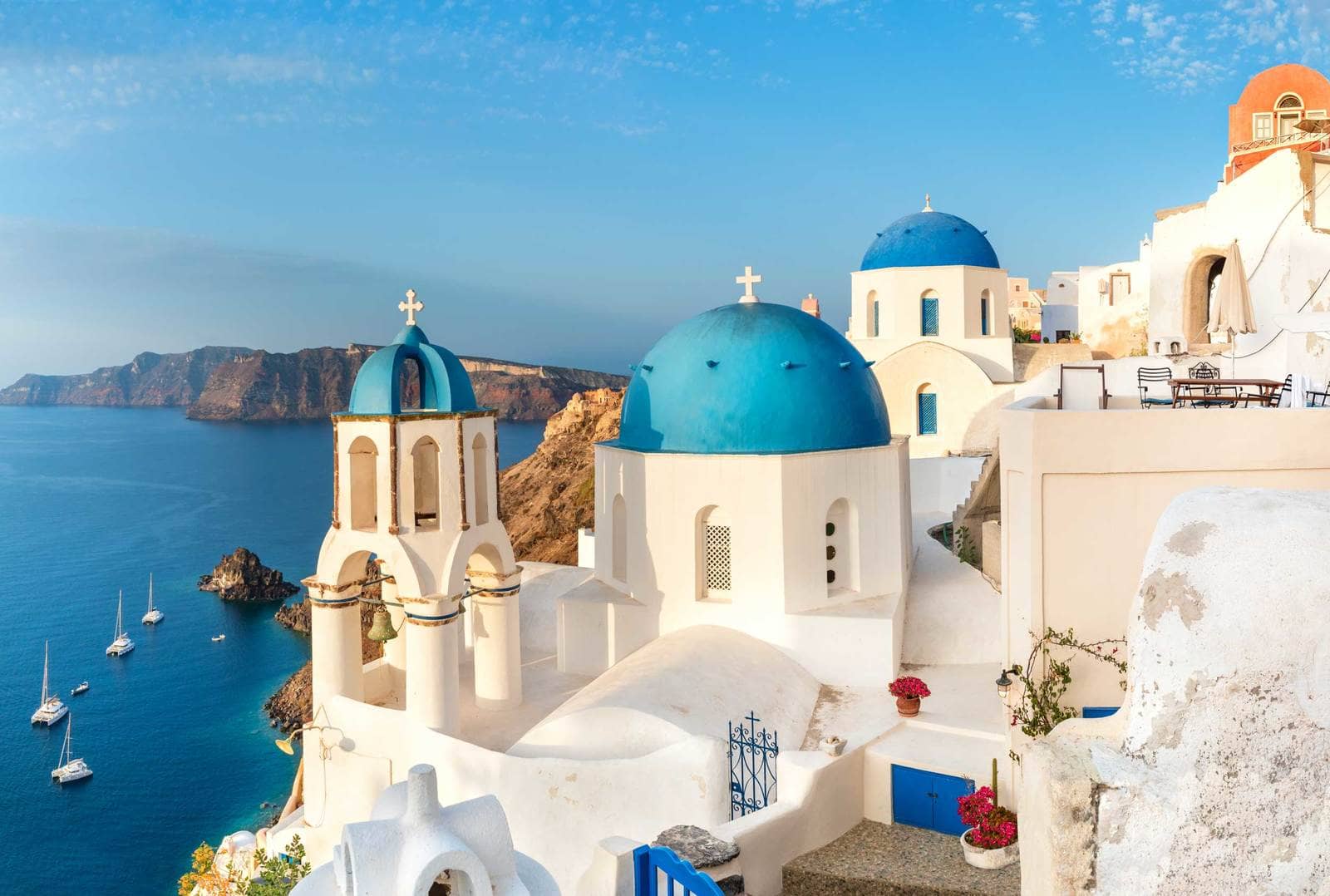
Picture-perfect Oia village is a must-see, ideally visit by scooter via Vlichada.
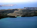
Kameni
In the middle of Santorini, the new (Néa) Kaméni - Νέα Καμένη islet has a tight rectangular inlet on the SE; caïques and tripper boats “own” the quay and will jealously guard all available moorings for their highly lucrative business, so it is difficult to find a berth.
The venue itself is very rewarding with remarkable views especially towards Fira, plus the experience of stepping on an active volcano, equalling Nisyros.
The SE inlet is the "original" gateway to bring in all these tourists, but now 4 or 5 other inlets are exploited as well.
Our last visit was via the new quay on the north side of the island; uncharted and exposed to the northerlies Lat Long.
March 2026 update: up to 7 pointy and spherical buoys on the south side of Kameni; free of charge to stay the night after the tripper boats have left.
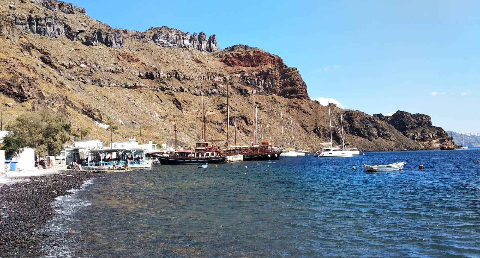
Akrotiri
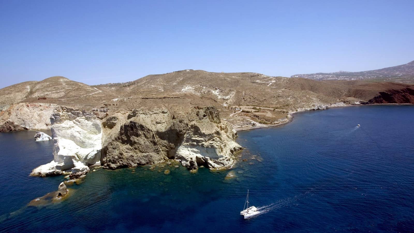
South of the Akrotíri - Ακρωτήρι peninsula and cape (SW Thira) there are several suitable anchorages in lighter conditions: “Black beach” Lat Long, and further east “Red beach” alias “Kokkino” Lat Long (shortest walk to the Akrotiri Museum); open to the south; use a trip line.
A third option lies between these main options Lat Long, but is smaller: “White beach”; there are reefs plus several rocks further offshore the headland.
See chart symbols for e.g. ![]()
The fourth option is furthest east and in front of Ancient Akrotiri: 12+ (pointy) buoys Lat Long, 2 yellow buoys are owned by the friendly restaurant owner of Τα Δελφίνια - (The Dolphins), tel: +302286081151. In the summer months most buoys are reserved for tripper boats.
Mind the dangerous rocks and reefs near this headland.
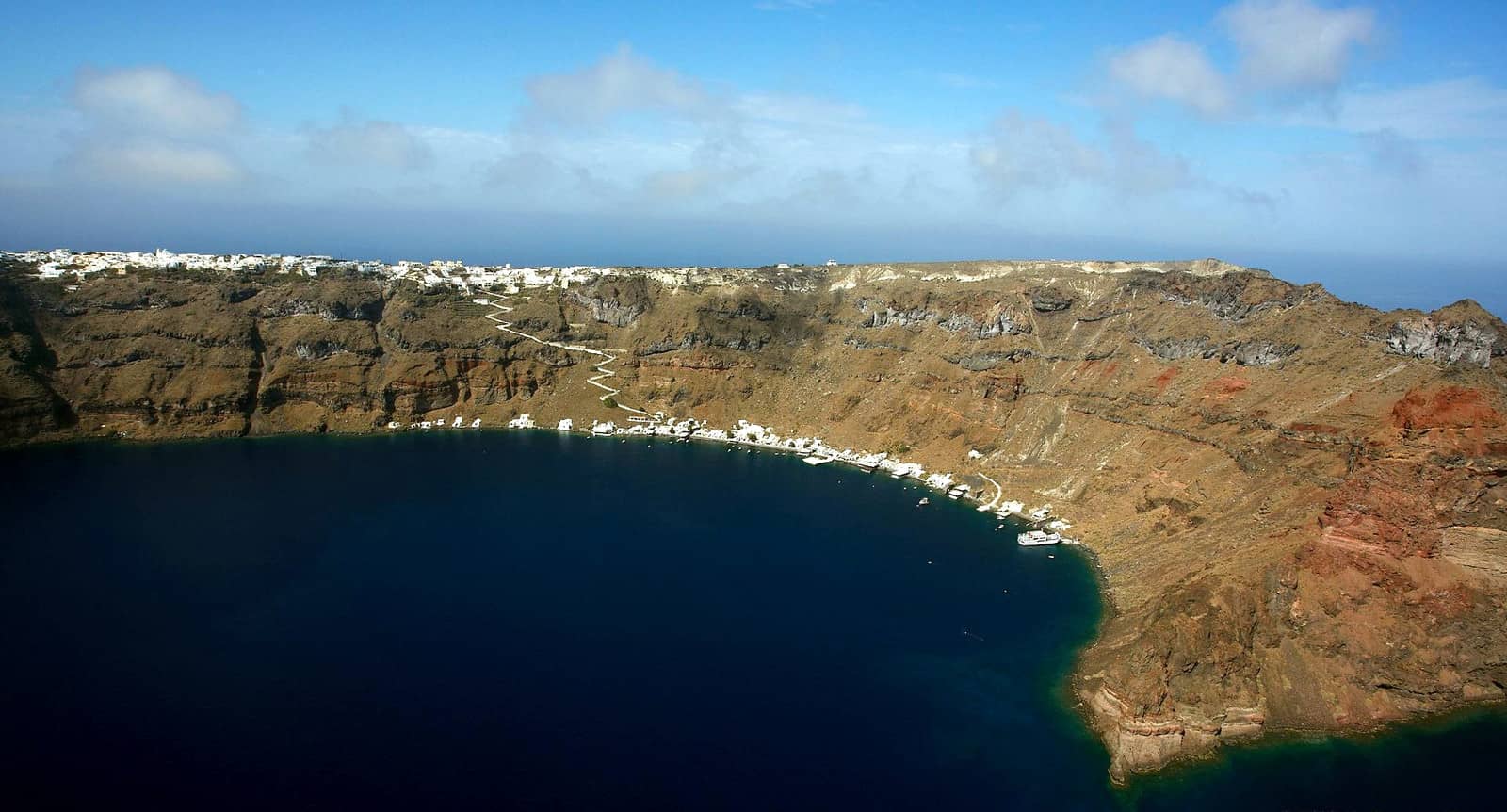
Skala • Fira
The port of Skála is aptly named as it provided access to Fira town via 500 steps – see Skala toponym. Please note that a donkey ride can amount to animal cruelty, while the cable car / funicular provides the perfect alternative to avoid an arduous ascent.
Fira or Chora – the capital of the island – was established in 1810 and grew into an elongated settlement along the steep caldera rim. The first houses were half-dug out of the softer rock in between steep alleyways and small cobbled streets of steps.
Since the development and recent expansion of the “ferry port” at Athinios 6 NM to the south, Skala is called the “cruise port” or “old port”, yet is very recent, i.e. 19th c., compared to the rich cultural heritage of the island.
It is prudent to treat Skala as a difficult anchorage rather than a port.
Most yachtspersons will not want to leave their yacht unattended at Skala.
- Difficult to anchor: the rocky seabed will likely snag the anchor or foul the chain or cut your trip line. Moreover, the bottom drops down to abysmal depths even just a few boat lengths away from the quay.
- Open to SE – NW winds, and note that the prevailing summer winds are NW.
- Mind the wash from the cruise ships as well as the – rather regular – bothersome swell.
- Several bitts are fitted at the shoreline for larger vessels, there can be (crossing) mooring lines.
There are three – far from optimal – options to consider:
- Anchor stern-to the outer side of the pier (the inside is very shallow), use a strong trip line to cope with the boulder-strewn seabed.
The pier seems however claimed by the surplus of local tripper boats and cruise ship tenders, overflowing the island with so many tourists that even the Santorini residents wants to cap the amount of cruise ships.
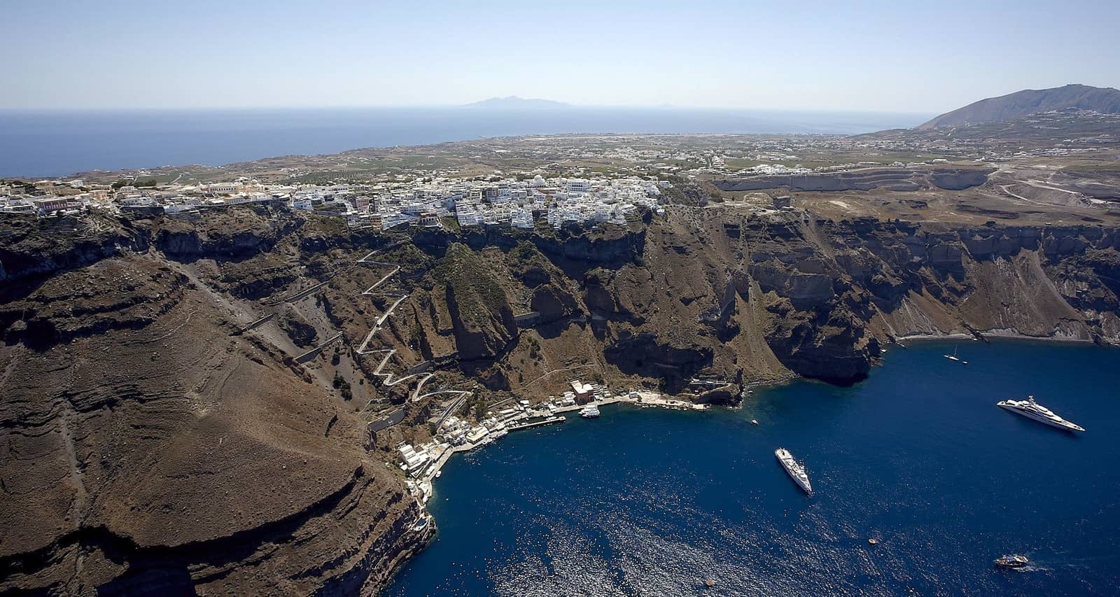
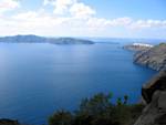
Fira town on top of the cliffs and Anafi island on the horizon.
- Under the funicular you can share the single buoy with a bunch of yachts all connected to the shore, so the middle yachts cannot leave. This is our preferred option, but only if conditions and neighbours are right.
- Moor on one of the buoys south the pier, if present / available, while making sure that the yacht cannot come in contact with the metal buoy; similarly, here it is possible that more yachts will share; make sure that riggings cannot touch.
When crowded you can be summoned to leave; Port Authority Tel. (+30) 22860 22239, VHF 12. Even outside the sailing season cruise ships will continue to overburden Fira and Skala.

In general: residents in Oia, in Ammoudi and oppositely in Thirasia have their own buoys for safety reasons, either for their boats or sometimes for rent. A good size dinghy and a strong outboard are vital here. The large iron buoys can potentially be dangerous for smaller yachts.
More photos and information can be found in the logbook of our trip from Athens to Milos, and in my Guide to sailing holidays and yacht charters in 8 steps.
Restaurants
- “Parea Tavern” in Fira mid-town
- “Το Κofini” in neighbouring Imerovigli village
- “Casa di Te Santorini”, north side Fira
- “Theoni's Kitchen”, south Fira
Thirasia island
Thirasía - Θηρασία, the east island of the Santorini Archipelago, offers fabulous views towards Skala / Fira – and most importantly – is drastically less overwhelmed by tourists.
When securely moored to a buoy, you can take the ferry to explore Thira's marvels, and afterwards escape the tourist madness by returning to “tranquil” Thirasia.
For the construction of the Suez Canal, these volcanic islands where heavily mined, during which, in 1866, a Late Bronze age house, skeleton, utentils, etc. were excavated near the south cape of Thirasia. These findings sparked the excavations at Akrotiri, revealing its Early Bronze Age treasures.
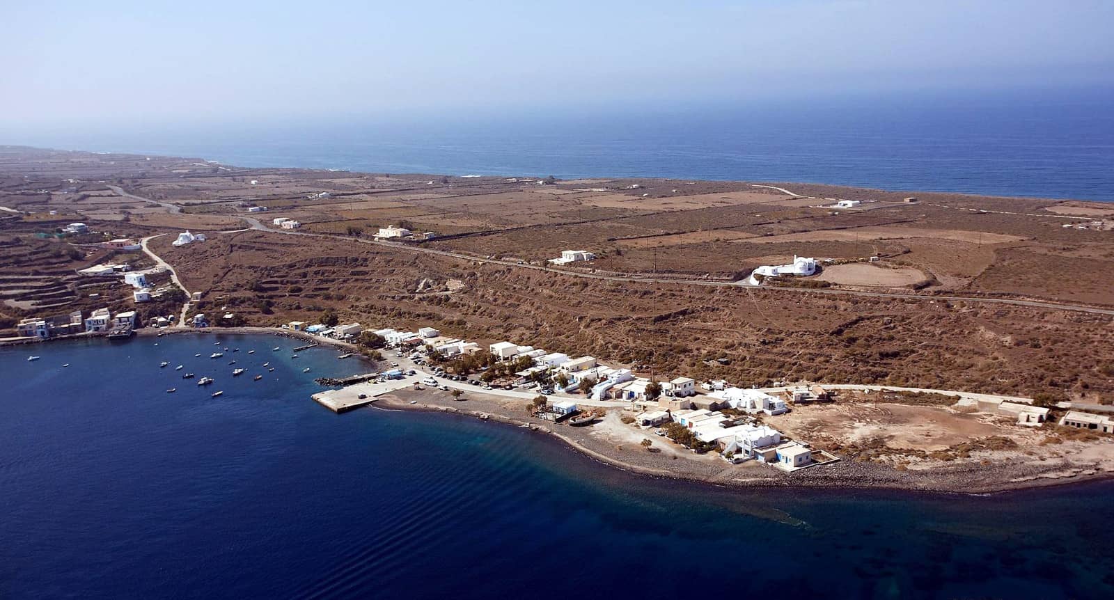
Ag Nikolaos
The bay of St Nikólaos - Άγιος Νικόλαος is the most sheltered anchorage Lat Long on Thirasia. The settlement below the cliffs is known as Kórfou - Κόρφου after the brighly coloured local Church.
Take a line (see how) to the least minute pier, 100 m to the north of the conspicuous serpentine trail that leads up to Manolas village. The quay is supposed to be free from 18:00 till 11:00; wonderful bay; tavernas ashore and quite sheltered against the Meltemi; use a trip line to cope with rocks and the many permanent mooring in 1 – 12 m depths; mind of the small ferry, which is befittingly named: “Nissos Thirassia”.
Captain John (restaurant as well) can offer a spot on his mooring buoy below Manolas village in about 60 m depth: costs €25, and you can stay as long as you like, Tel. (+30) 6974650720 or 22860.29042
Smaller mooring buoys in front of the restaurant.
Ferry to Oia or Fira once a day €1; Watertaxi €60.
Riva
The exposed bay of Ríva - Ρίβα at Agia Eiríni - Αγία Ειρήνη village on the NE tip of Thirasia Lat Long is open to NW – NE as well as to SE – S winds.
The supreme EagleRay mentions that you can use some of the local moorings: be sure to ask Captain Nikos of the Agistri Taverna, just north of the ferry pier, Tel. (+30) 2286 029084, excellent dining.
Agia Eirini / area is quite unspectacular compared to the rest of Santorini. Take the bus or a taxi to the villages of Agrilia with its “kanaves” (old wine cellars), Manolas and Potamos (built in a ravine with cave houses), all roughly 45 minutes on foot from Riva quay.
Thirasia is a fisherman's island where one eats fish in fish restaurants - “psarotavernas”.
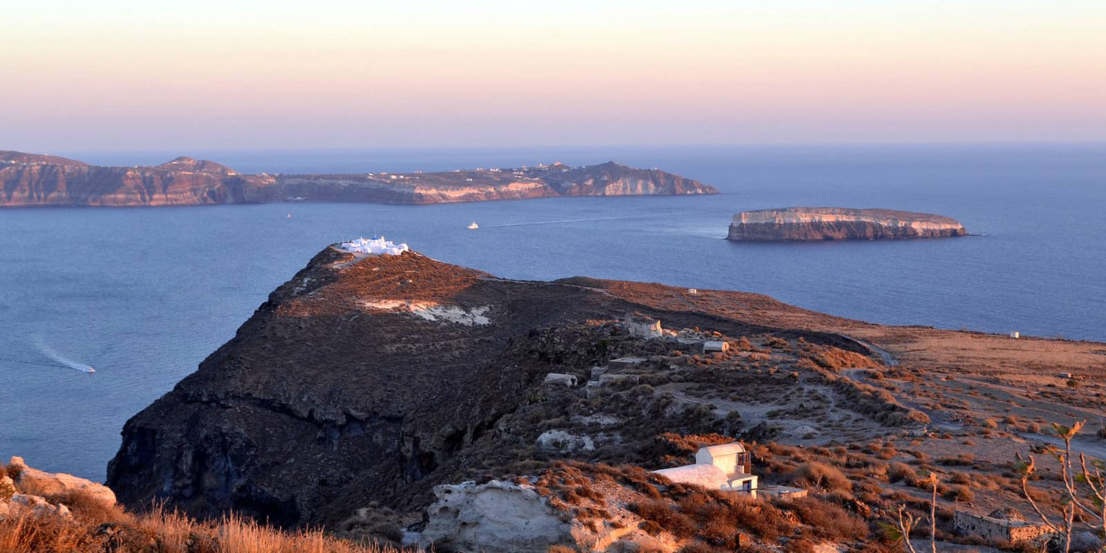
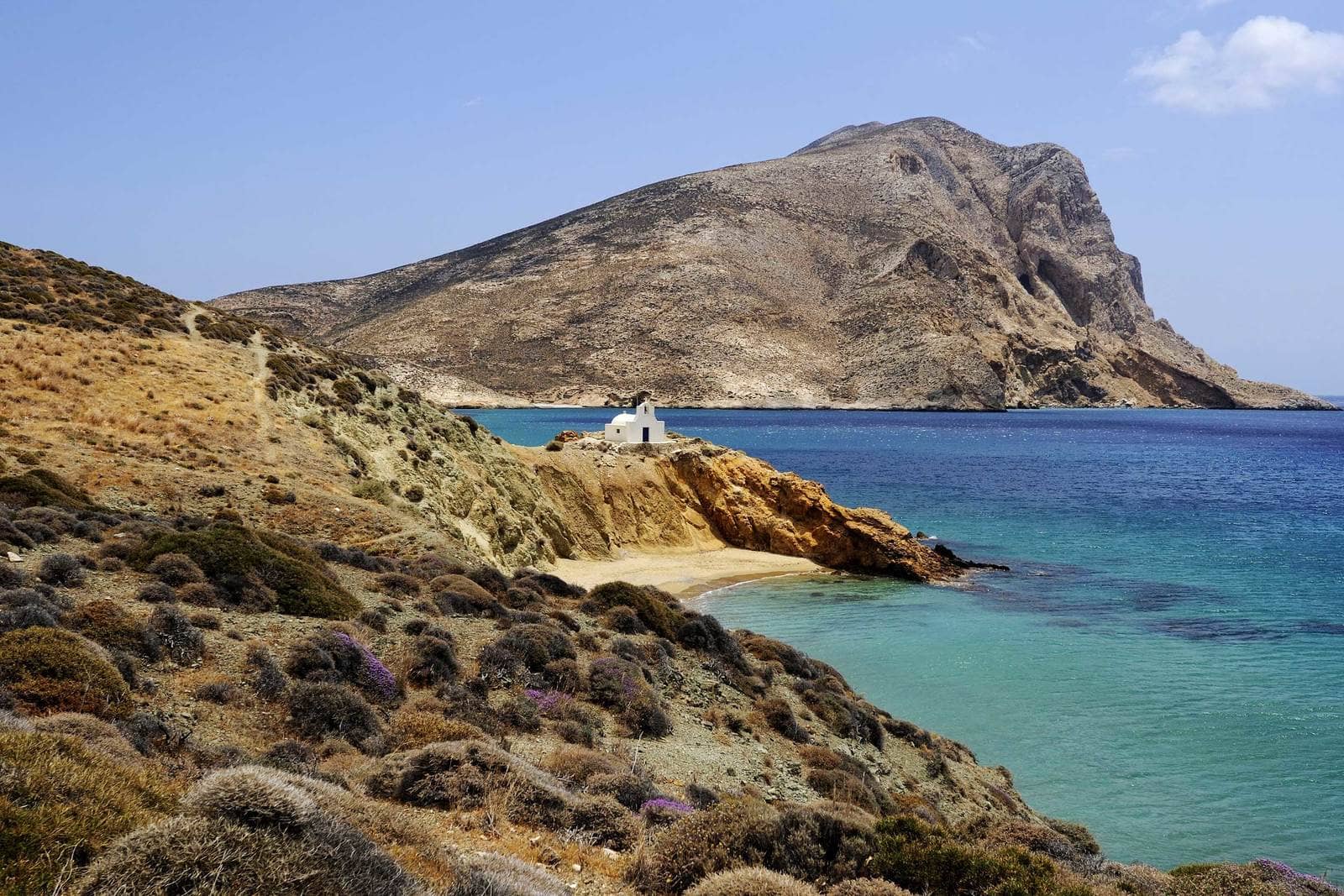
Anafi island
The hilly island of Anáfi - Ανάφη lies 12 NM east of Santorini. According to the myth Apollo caused it to emerge from the sea to provide a refuge for the Argonauts on their return voyage from Colchis.
The inhabitants earn a modest subsistence by farming and some fishing.
Central on the south side of the island is its chief place, Anafi (Chora), which was increasingly being abandoned by its inhabitants before tourism – propitiously – discovered this nonpareil. Above the village, on a spur of rock, are remains of a 14th c. Venetian castle.
North-east of Chora, on the round-topped hill of Kastelli, is the site of the ancient city, with remains of walls and fragments of sculpture.
Near the east end of the island is the Monastery of Zoodochos Pigi “life-giving spring”, - Μονή Ζωοδόχου Πηγής built with stones from a Temple of Apollo which had previously occupied the site. The famous Apollo Kouros is on display in the British Museum. Further north are the ruins of another Venetian castle.
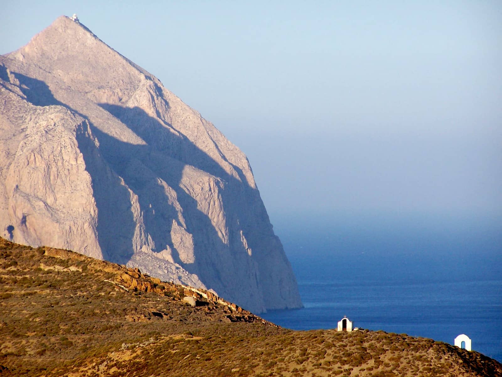
At the extreme eastern tip of the island is Mount Kalamos (396 m) which is the second largest monolith after Gibraltar in the Mediterranean. Prominently situated on this tremendously steep limestone crag is the little Church of Panagia Kalamiotissa - Ιερά Μονή Παναγίας Καλαμιώτισσας (1715). From the summit there are far-ranging views, extending in clear weather to Crete.
South-east of Anafi are the rocky islands of Ftená - Φτενά (Flinia islets), Pachia - Παχειά and Makrá - Μακρά.
Rokana Rock has a height of just <1 metre and is not always correctly positioned on charts, approximately Lat Long 370 m off the south coast of Anafi.
Skala Anafi port
The ferry port of Ag Nikólaos - Άγιος Νικόλαος or Skala Anafi was unwelcoming since it provided no berths for visiting yachts. The only solution was to stay at the east ferry dock provided that you learn the time tables and leave before the liners arrive.
Very auspicious, therefore, are the new harbour works, which started August 2019 and have, broadly, finished in January 2020.
Still no facilities, but there is water and a hose in the toilets.
Expect silts near the entrance and in the basin.
See below for recent updates on the (nearly fully) completed harbour works.

Note that GWP, C-MAP etc are not up to date – June 2024 – rely on Garmin.
Port Authority +30 22890 22218; EagleRay mentions that depths near the entrance and basin are 3 – 4 m.
No anchoring: use the mini red plastic buoys – with handy rings – to pick up the lazy-lines that are attached to the quay and go stern-to the SSE or NW sections.
See, how mooring with lazy-lines works.
There are toilets on the ferry dock, and working electricity+water pillars at the yacht berths.
Alternatively, anchor in 3 – 5 m depth, as far east of the new yacht port as possible, off the sandy Kleisídi - Κλεισίδι beach Lat Long.
The ferry and yacht approaches are regularly dredged; the anchorage is completely open to the SSW – SE; gusts from NW and / or NE.
Enjoy the local cuisine at Taverna Kleidisi - Ταβέρνα Το Κλεισίδι.
Megas Potamos
Mégas Potamós • Prasíes - Μέγας Ποταμός • Πρασιές bay Lat Long is a marvellous anchorage in the prevailing summer winds. In stronger northerlies the orography can cause wirlwinds, so only mildly-Meltemi proof; solid holding in sand (some rocks reported).
Livoskopos
In earlier days the bay of Livoskopós - Λιβοσκοπός was used to embark / disembark when southern winds made it unviable to do so at Ag Nikolaos • Skala.
Nowadays its importance has shifted towards being Anafi's top beach, attracting tourists from Chora despite the distance, a 1½ hour walk or 15 min by car or (in the height of summer) a caïque.
Excellent shelter at a golden beach dominated by cliffs; use EagleRay; only exposed to NW – E winds; solid holding in sand; ashore just a farm, a few donkeys and Chapels. Anchor in the north-west corner Lat Long.