Kefalonia & Ithaca sailing holidays
Kefaloniá - Κεφαλονιά (or Cephalonia, Kefallinia; Italian Cefalonia), the largest of the Ionian Islands, is made of bare limestone hills rising to 1628 m in Mount Ainos and is slashed by fertile valleys with luxuriant subtropical vegetation.
It is generally accepted as being the Homeric island of Same, yet for Wilhelm Dörpfeld's divergent view, see my Lefkas page.
The island's main sources of income are agriculture and the tourist trade, with a steady increase of yacht charters aiming for the stunning ports of e.g. Sami, Fiskardo, Assos and Argostoli.
- All Greek islands
- Ionian overview
- Corfu, North Ionian
- Lefkas, Meganisi
- Kefalonia, Ithaca
- Zakynthos
- Sailing itineraries Ionian islands
- Waypoints south Ionian
Mythology and history
In the Odyssey the two islands of Same and Doulichion are described as belonging to the kingdom of Ithaca, but Odysseus's subjects are also called Cephallenians.
In the 6th and 5th c. BCE the island, like Corfu, was under the influence of Corinth, then in 456 BCE Tolmides compelled it to submit to Athens. At that time there were four city states on ancient Cephallenia – Kranioi, Pale, Pronnoi and Same – which Thucydides refers to as a tetrapolis. The cities were members of the Aeolian League, and Cephallenian vessels fought against Philip V of Macedon (220 – 217 BCE). They fought, too, against the Romans, but eventually the islands fell into the power of Rome. Thereafter, Kefalonia shared the destinies of the other Ionian islands.
South Ionian ports & anchorages
Kefalonia island
Clockwise ↻
Ithaca island
Clockwise ↻

Ports / anchorages are clickable . British Admiralty Chart 203. signifies a highly recommended venue, and a truly must-see venue; see other icons.
Kefalonia island
Argostoli
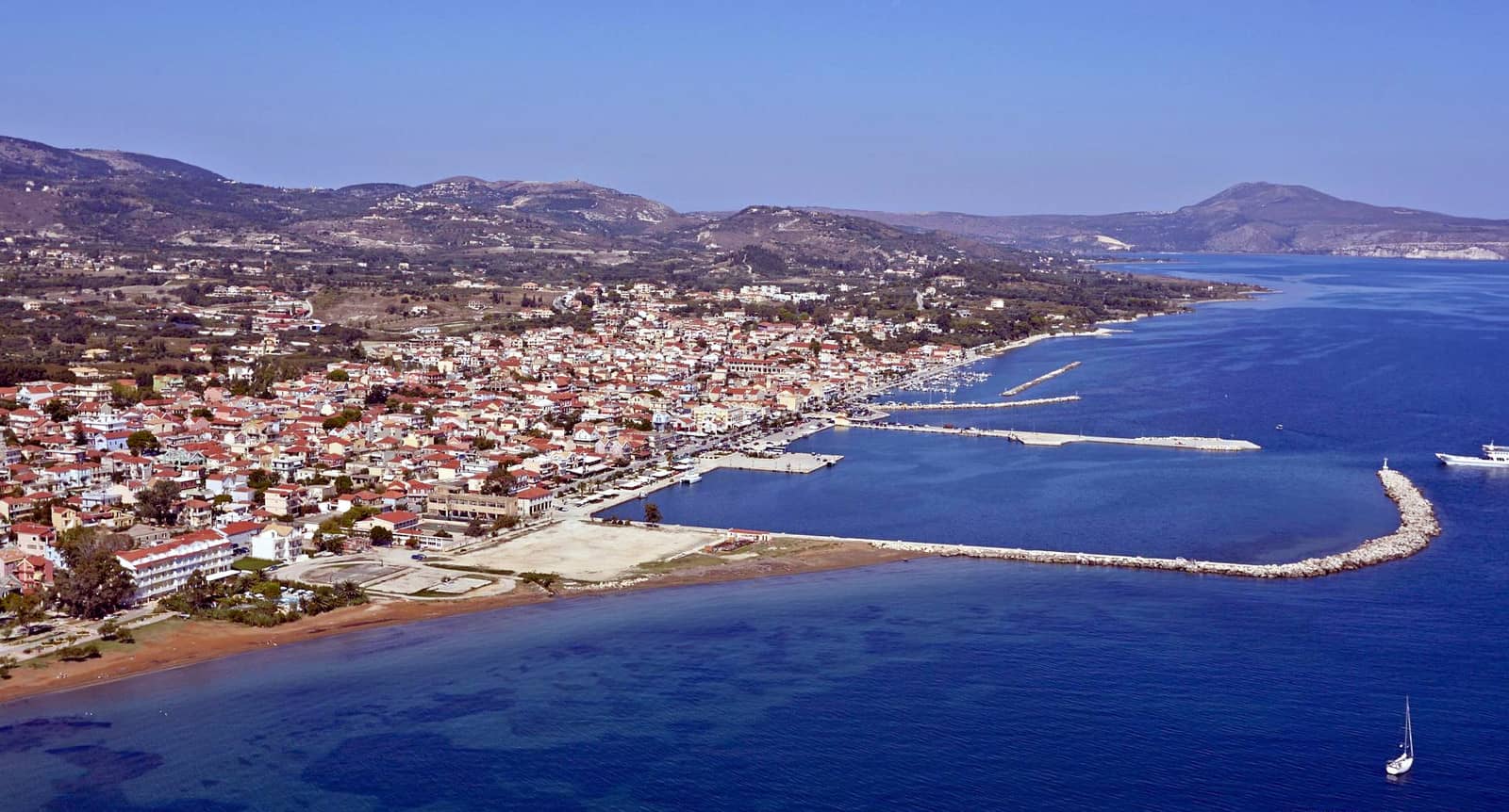
Kefalonia's capital Argostóli - Αργοστόλι lies on a peninsula projecting into the Gulf of Argostoli / Livadi bay, which cuts deep into the south-west coast of the island. Once an attractive old town, it was almost completely shattered by the 1953 earthquake and has been rebuilt in modern style with wide avenues, stately squares and ornate public buildings. The cruise ship herds come and go.

The marina (not indicated on the chartlet) is even by Greek standards well below par and should not be used. It is abandoned and free yet miscreants will attempt to steal your outboard engine, burglarise, or worse: do not leave the yacht unattended here. Moreover, the litter attracts rats and turtles . In rough weather aim to get a berth in the shallow fishing harbour of Maistratos.
In Argostoli go stern-to the boulevard quay south of the rectangular slab of concrete that serves the commercial vessels: the waterfront isn't overly pretty; good holding in mud; several areas with depths <2 m. To reserve a berth call Leo +30 694 4730 789 who operates the Compass Café on the quayside.
The Archaeological Museum contains Mycenaean and Roman material.

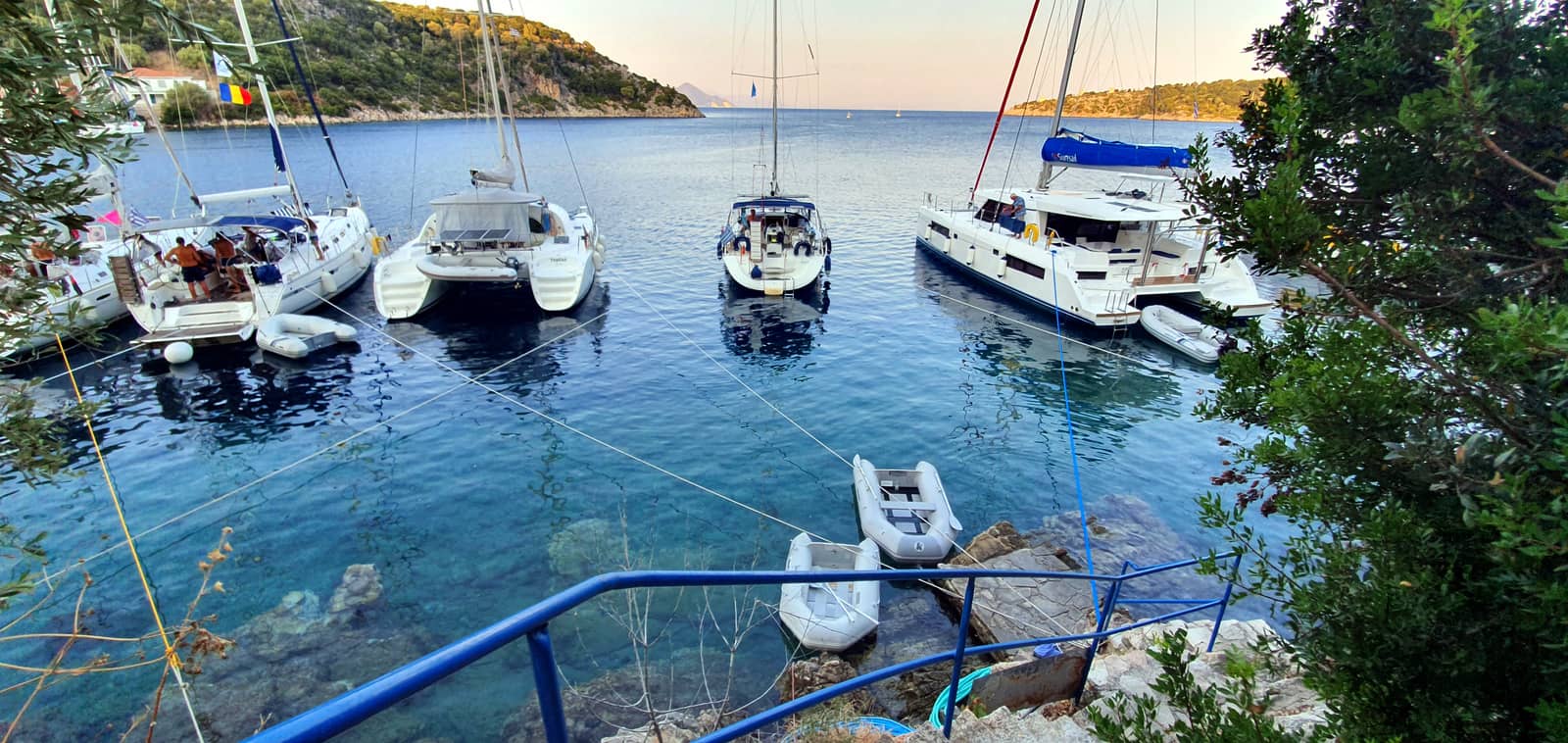
In the middle the cargo ship area with the yacht quay directly left. Further north a tall sailing yacht is docked to the cruise ship terminal. Hi-res image
North of the town are the famous sea mills, now partly buried as a result of the ravaging earthquake. The mills are driven by sea water surging along a channel cut through the rock and then disappearing into hidden underground passages through the limestone, to emerge on the east side of the island in the Melissani Cave.
Lixouri
North-west of Argostoli, on the Paliki peninsula on the far side of the gulf, is the port of Lixoúri - Ληξούρι. North of this flourishing town are scanty remains of ancient Pale / Pali which was abandoned as recent as the 16th c.
The port is a vast array of breakwaters, and only the south basin (large port) should be approached in bad weather or darkness. Moreover the situation has been in flux after the tremors of 2014; damages mostly repaired by now.
Very expensive, yet no electricity and often no water.
In the large port, in the south part there is bad holding due to soft mud, go along-side.
In the small harbour make a careful approach via the channel – sometimes marked by 3 pairs of buoys – and use the first basin; often most berths will be taken by local boats.
Seabed is mud; only once through the soft upper layer of mud your anchor will hold.
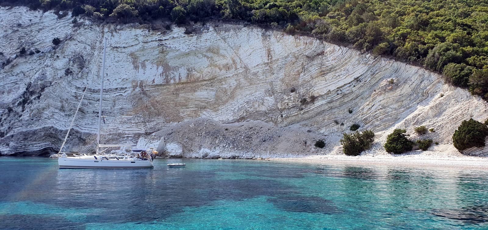
At Cape Xi - Ξι is a phenomenal beach of bright red argil clay – ἄργιλλος is Greek for “clay” – which can be daunting to reach by yacht Lat Long otherwise 8 km south by scooter or bike from Lixouri port.
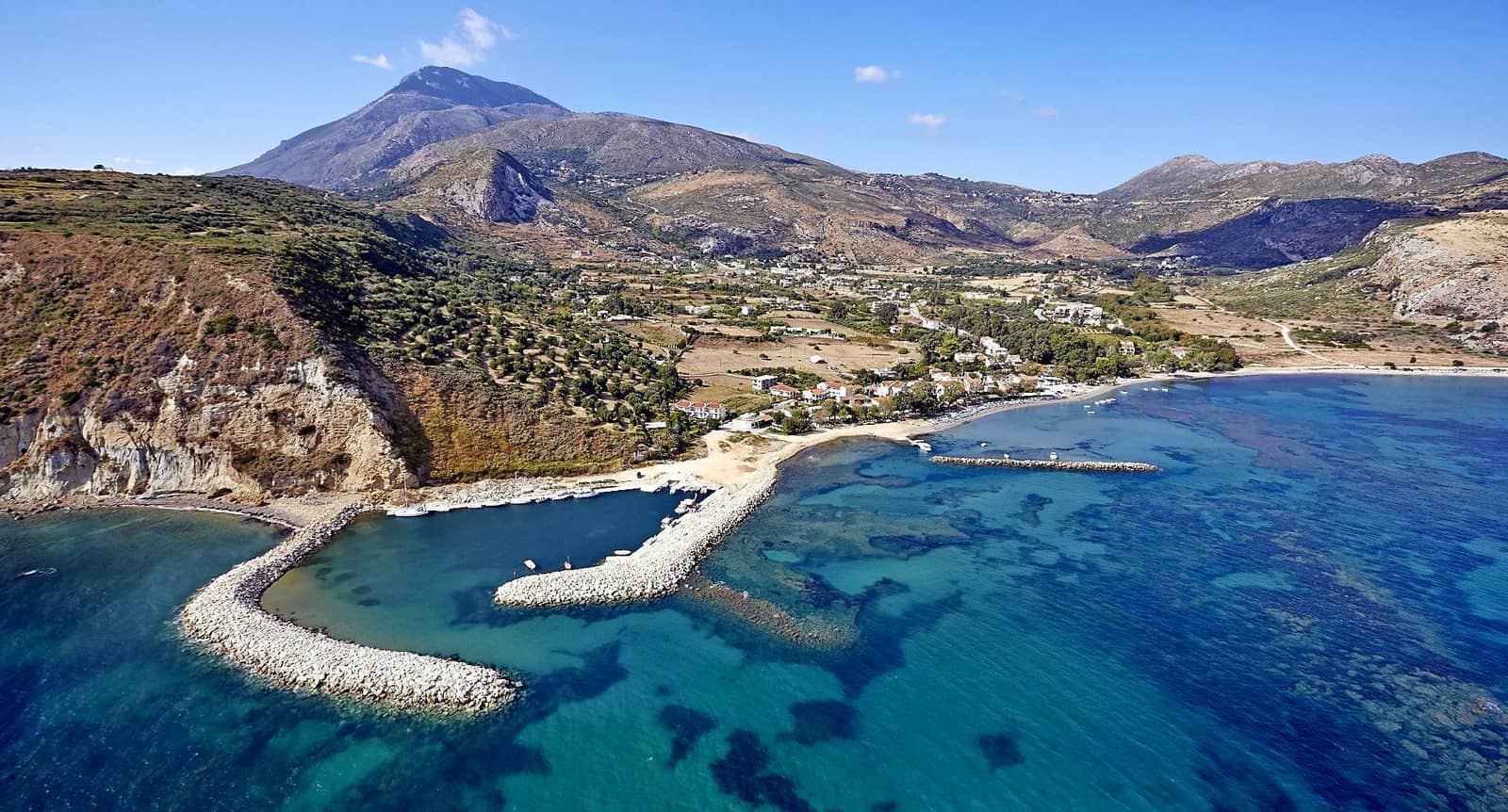
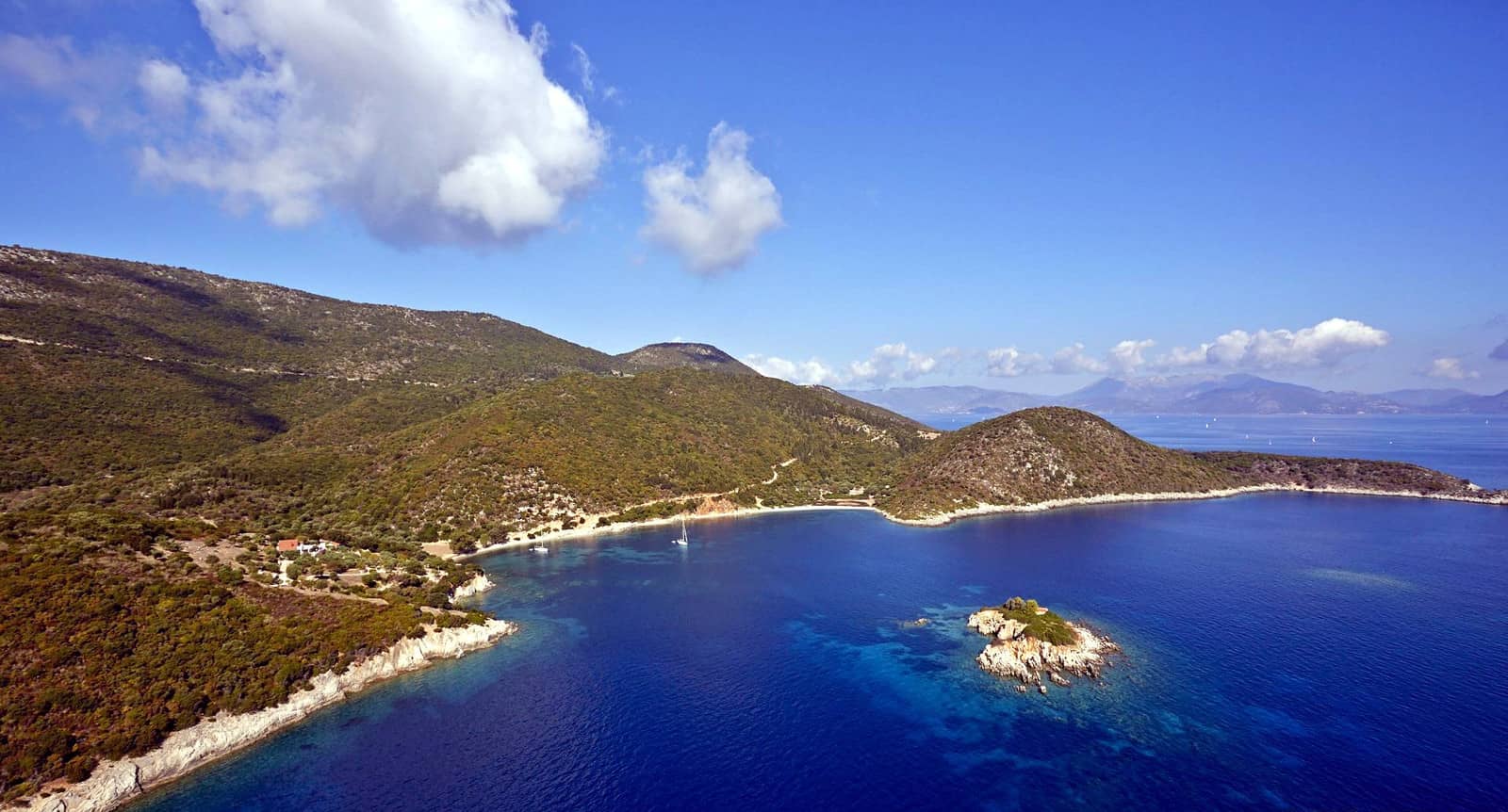
Atheras
The underappreciated Pórto Athéras - Πόρτο Αθέρας provides remarkable shelter despite being open to the north (hence this bucolic bay isn't mentioned in the GWP).
Fortunately, even in prevailing NW winds the islet of Atheronísi guards the anchorage from the waves.
The requisite berths, however, are behind the ~35 m long breakwater Lat Long alongside the strikingly blue & gorgeous Church of Agios Spiridon.
The mole / breakwater isn't indicated on C-Map or Imray, whereas Garmin and OpenSeaMap show the correct situation.
Anchor near the sandy beach in 3 – 5 m, by preference with a line to the mole.
Tavernas ashore were closed at time of visit – reported open in season as well as both praised.

The bucolic bay of Porto Atheras, as seen from the south, with a sailing yacht anchored behind the mole.
Looking west. Note, the useful coves for anchoring below the zigzag road that leads up to the Castle.
As seen from above the Venetian castle on the peninsula.
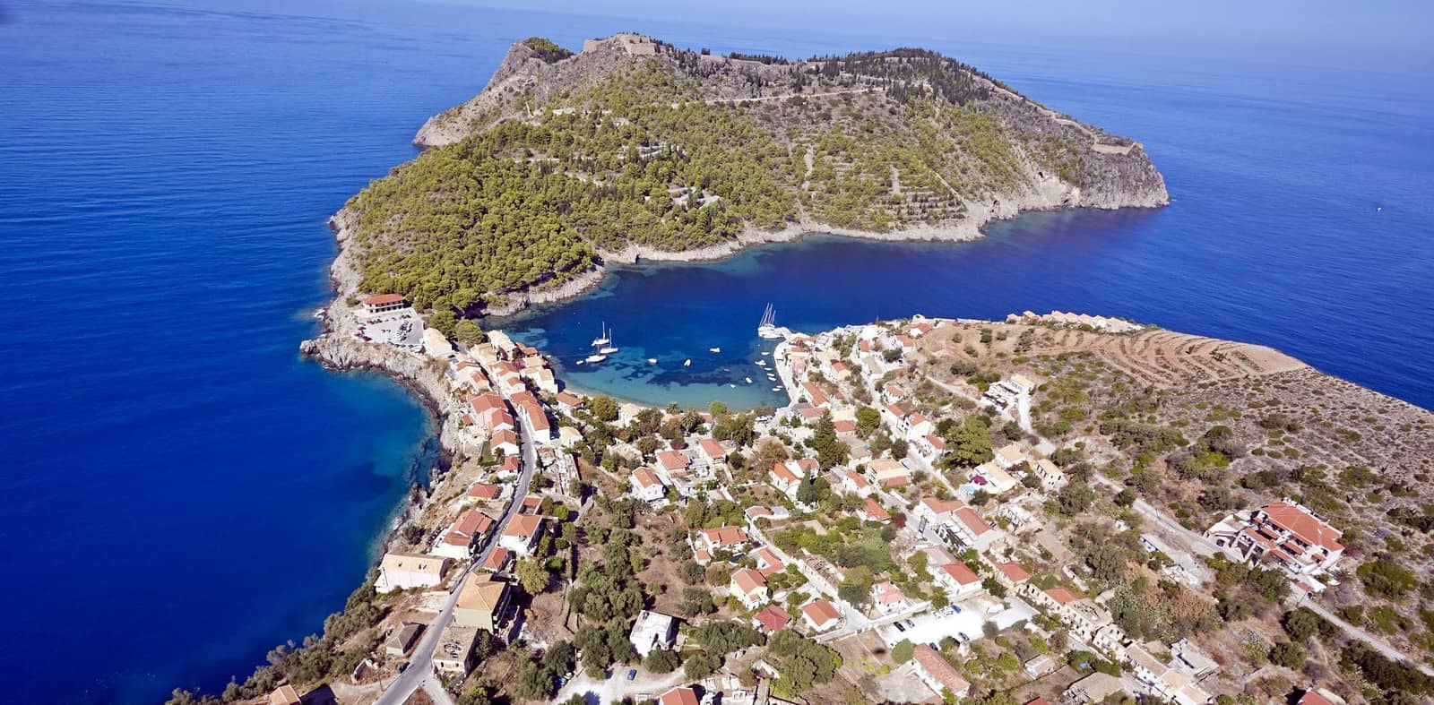
Assos
Although an absolute gem, Assos or Asos - Άσος is only suitable in lighter air; the port / anchorage quickly becomes untenable in rougher conditions.
The most protected berths are “under” the mole (rocks protruding), either stern-to the mole or to the quay.
Second choice would be to anchor south of the mole and take a line ashore there (see photos above).
In the west side of the bight there are several options to take a line ashore, see how to do it. To prevent rolling you might want to take that line to the bow instead of the stern, thus allowing the yacht to point into the wind and waves.
Prevailing winds are northerlies; mediocre holding, certainly in the thick patches of weed; slightly better grip in the sandy areas but mind the (slabs of) rocks.
In strong NE – SSW winds relocate to Myrtos beach to the south Lat Long.
Tavernas ashore (notably “Platanos”), but no marine facilities since only few yachts will visit due to the lack of shelter.
Explore the celebrated Assos Venetian castle dated 1595, grand views.
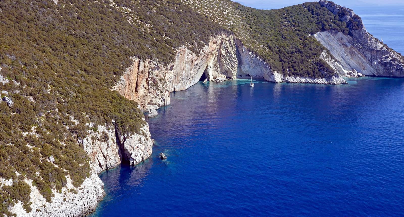
The sea caves – inaccessible to humans – around Assos peninsula support a small population of the endangered Mediterranean monk seal, Monachus monachus.
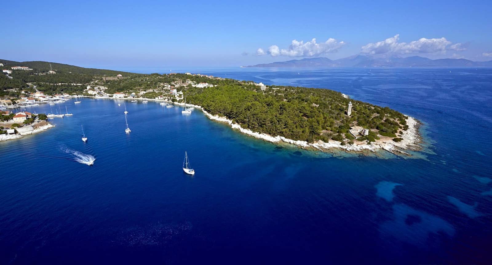
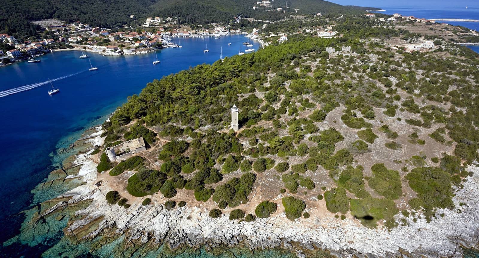
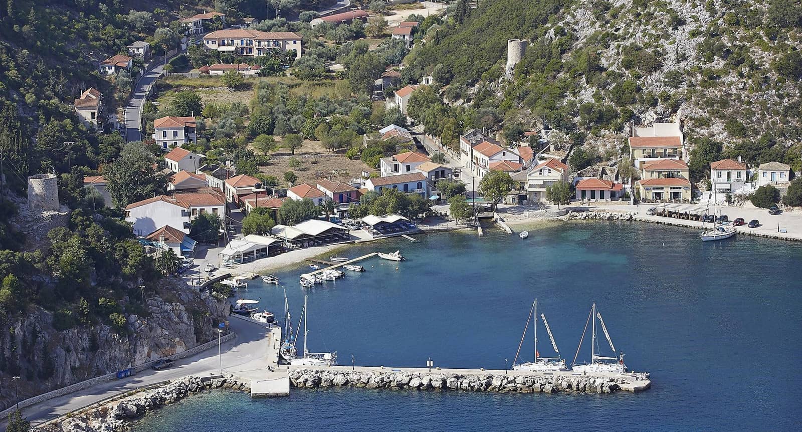
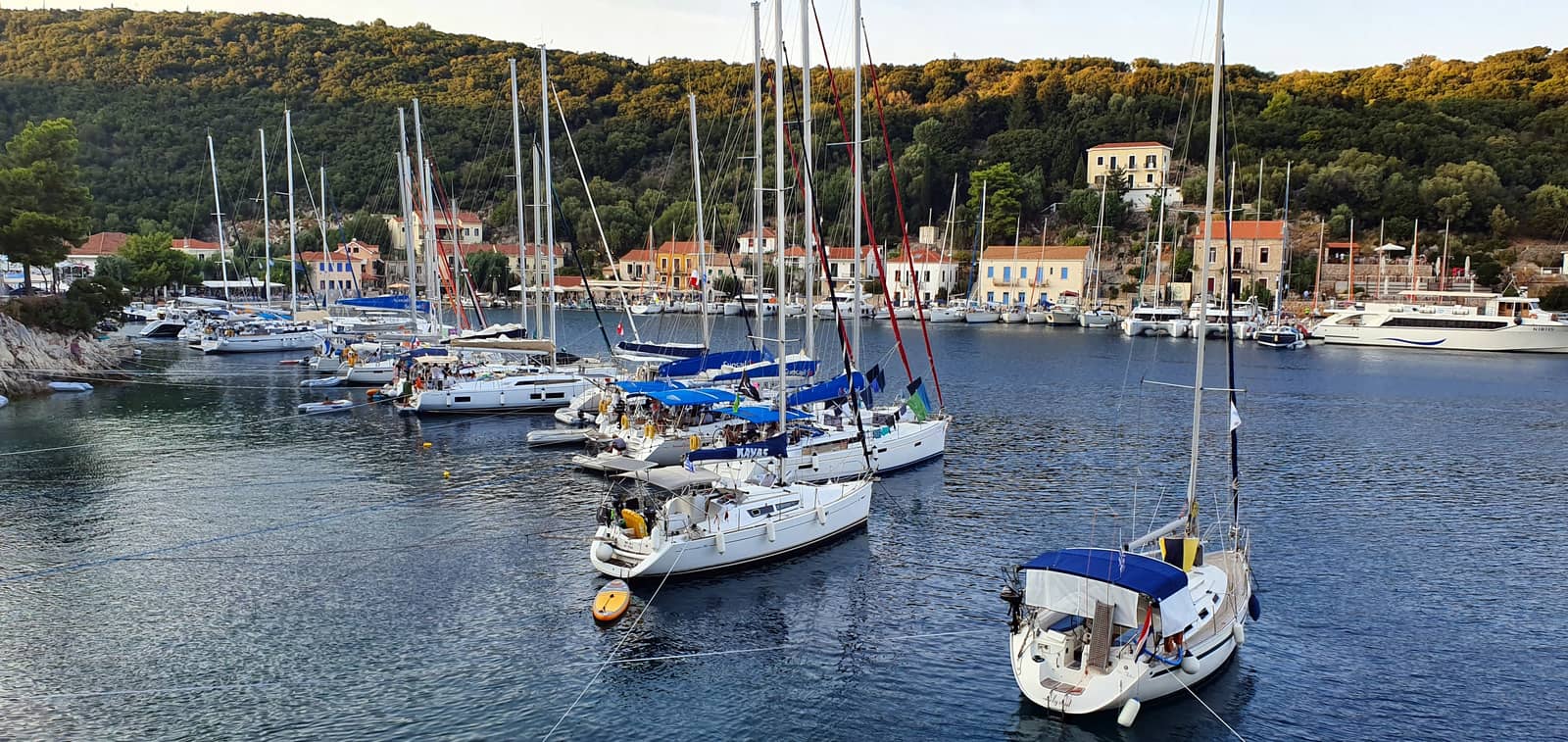
Fiskardo
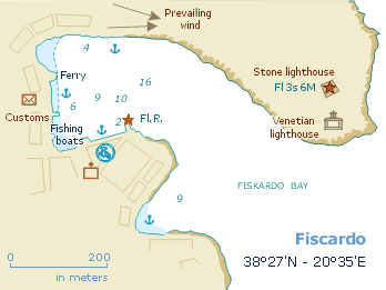
At the north-eastern tip of the island lies the little port of Fiskárdo - Φισκάρδο, ancient Panormos, named after the Norman leader Robert Guiscard, who died here in 1085.
The toponym Panormos refers to the allround shelter found in this bay.
Unlike the lion's share of Kefalonia, Fiskardo was spared by the 1953 earthquake and the port has retained its traditional Italianate architecture; deservedly a particularly popular port.
Prevailing winds in the summer months are NW – N; poor holding in places; we found that an extra anchoring attempt can make a lot of improvement.

In the holiday season all corners of Fiskardo port and bay will be occupied by visiting charter yachts.
To request a berth: Mr Theo +30 69 0704 8814, but this port is best (or only) appreciated before May or after mid-October
We prefer to moor along the north(-east) section of the bay; much quieter + secure with two lines to the windward shore.
Visit the Roman Cemetery.
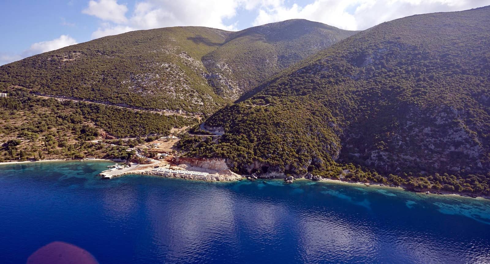
Foki
Fóki - Φώκι is the first inlet south of Fiskardo without major touristic developments; the sea caves are frequented by Mediterranean monk seals Lat Long; anchor in 3 – 5 m.
Further south is another lovely cove Palaiakáravo or Paliokáravo - Παλιοκάραβο Lat Long. Note that the GWP mentions a loading gantry, which is actually situated around the corner in another bay called Evreti, moreover, the gantry is still up and running.
If you follow the coast past the islet of Daskali – identified as the island Asteris (another contender is Arkoudi) where the suitors planned to ambush Telemachos; “Odyssey, 14, 6.” – there are even more anchorages…
Idiot
An idiot doesn't vote!
Originally a totally different meaning, from Ancient Greek ἰδιώτης (idiotēs, “a private citizen, not involved in politics”), from ἴδιος (ídios, “one's own, private”), read on…
Kalo Limani & Platy Limani
Kálo Limáni (GWP mentions Kalo Limeni? - Κάλω Λιμάνι, also known as Ayía Sofía - Ἁγία Σοφία (“Holy Wisdom”), is a superb anchorage Lat Long with a decent & unelaborate taverna as a bonus. See other Greek chart terms.
Its twin bay Platy Limani - Πλατύ Λιμάνι also known as Chorgotá - Xοργοτά, is even more arcadian Lat Long.
In Giagana bay, further south, anchoring is prohibited.
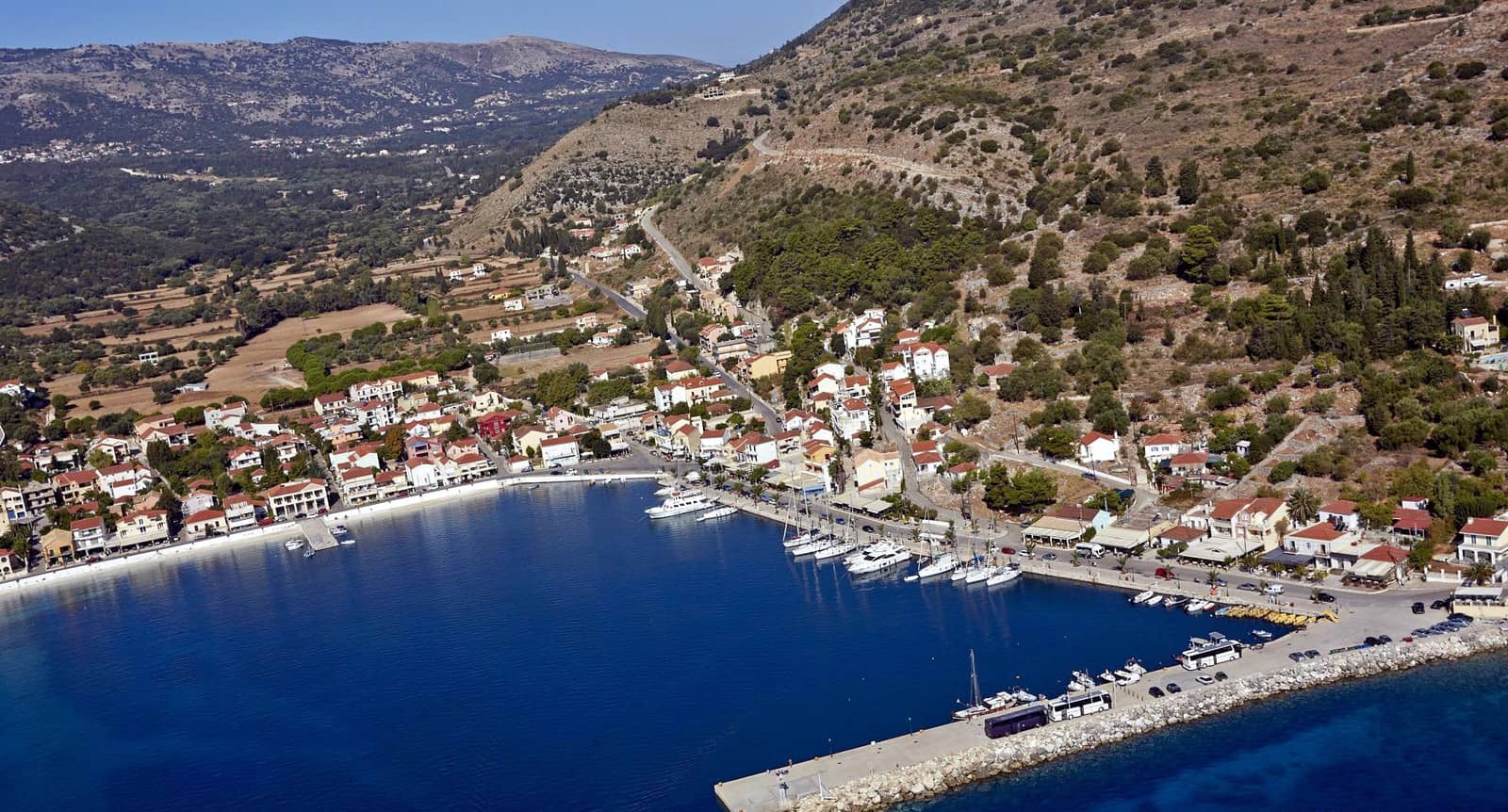
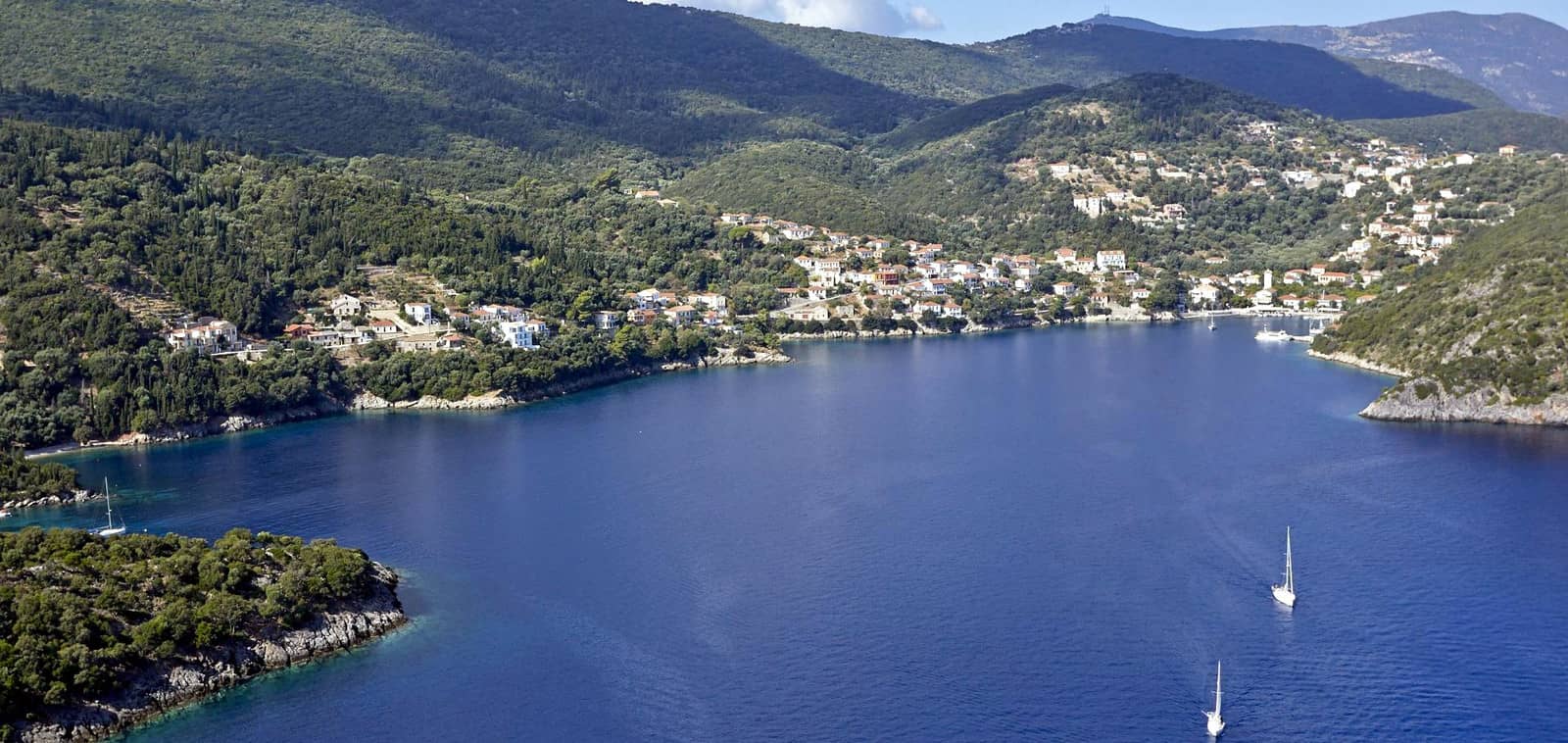
Agia Effimia
Agía Effimía or Eufimía - Αγία Ευφημία is the former main port of Kefalonia. Inauspiciously, few buildings remained unscathed after the 1953 earthquake devastations, but it still has some allure of a traditional fishing village, notwithstanding the embrace of tourism and yacht charters.
Despite lacking some charme, Agia Effimia is a more approachable port than the capital Argostoli to explore Kefalonia's inland from, e.g. the Melissani and Drogarati caves.
On the approach from the north – when turning into the bay of Ay Efimia – there is the petite but worthwhile anchor bay of Kapsolimionas - Καψολιμιώνας; a well-known beach; Kapso - Κάψω means “I burn”, “to burn” which can be reached from a lovely wooded track from the port; two yachts maximum; wasps are a nuisance sometimes.
In Agia Effimia you will be assigned a berth by the obliging harbourmaster VHF 74 (Markos) +30 6934 104 168. The north quay is preferred; the berths on the mole are normally on a lee shore.
Agia Eufimia port in the distance.
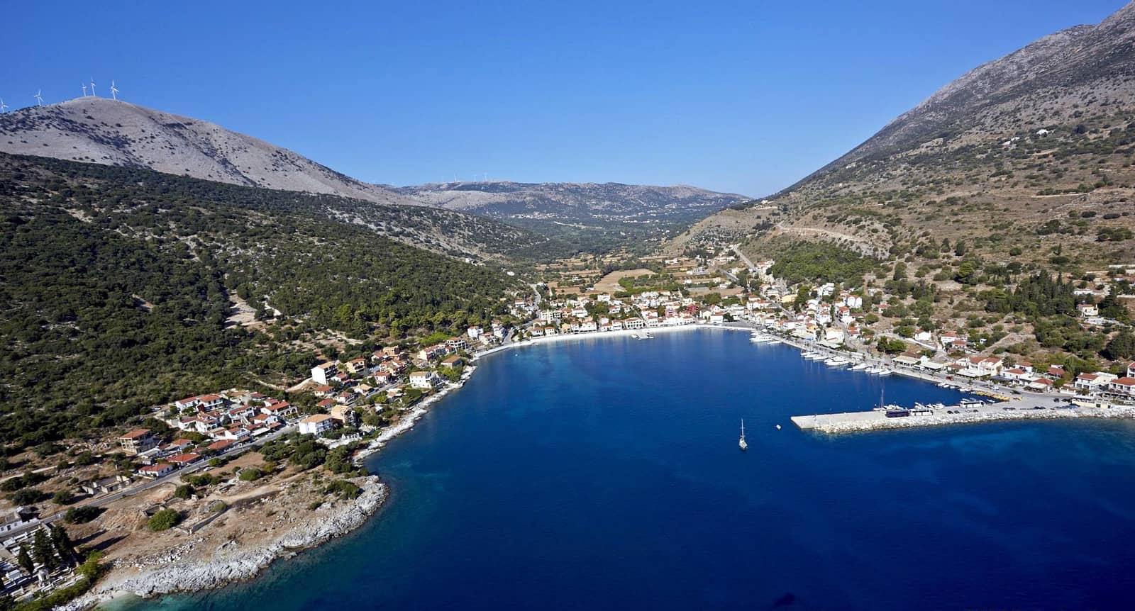
Note the obstruction inside the basin indicated by Eagleray, Garmin and C-Map.
Vicious gusts can / will funnel through the valley from the west or north-west. The port is unsuitable in strong NE – SSE winds.
In the height of season – see the sailing season – dozens of yachts will be at anchor in the middle of the port on a sandy seabed with patches of weed. (Home to) flotilla fleets.
Visit the excavated Roman villa, 100 m from the north-west corner of the port. Quite a few of my visitors urged me to rate this port at least as , but my crew and I are less impressed…
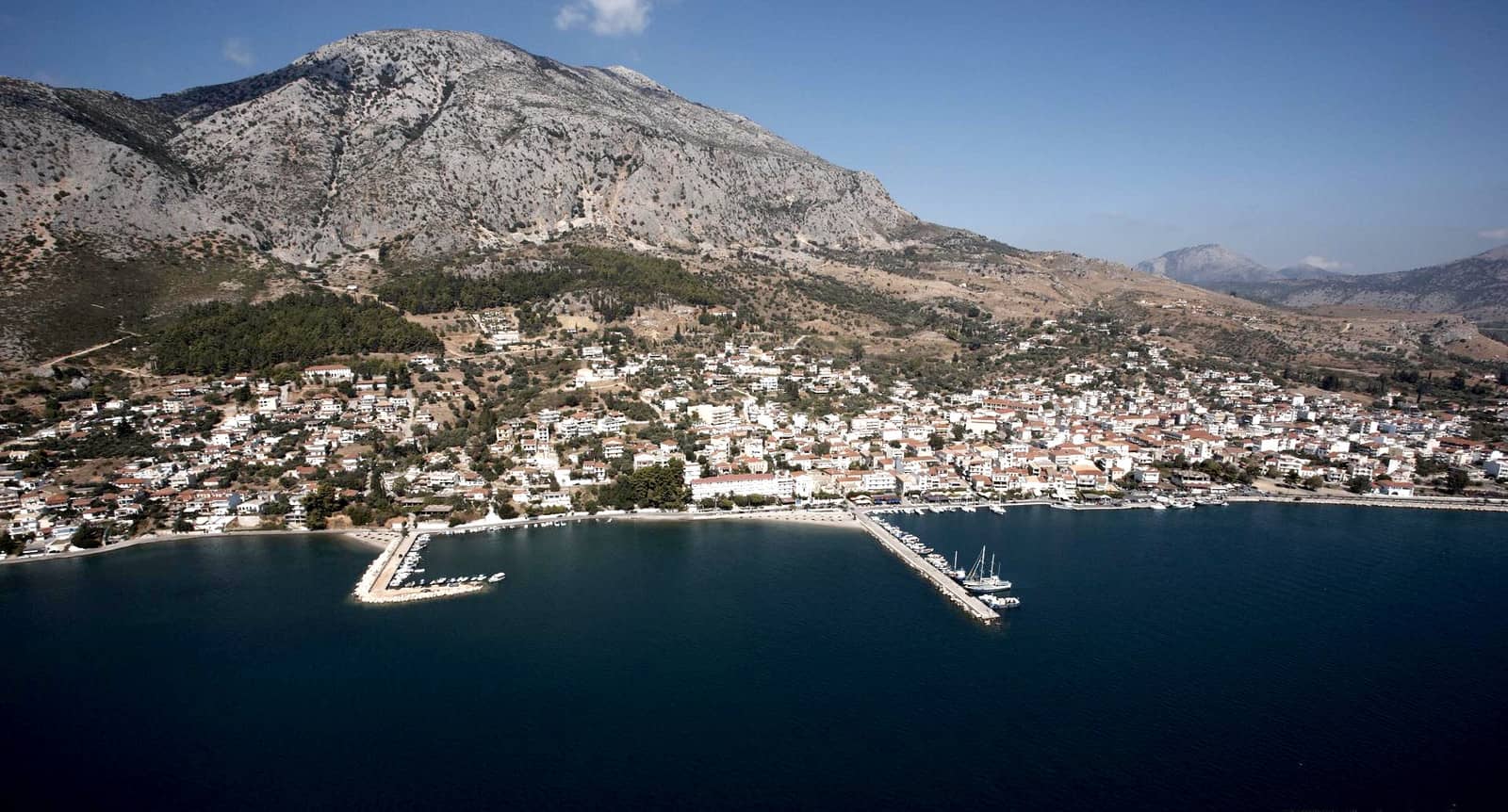
Sami
Sámi - Σάμη, the principal port of Kefalonia since 1953, is a good alternative to Agia Effimia and consists of a main / ferry port and a fishing harbour (Sami marina).
The prevailing NW – N winds plus rebound waves can penetrate the main port, the T-shaped pier is actually an arched bridge which further allows the waves to affect the inner basin.
Although certain sections are too shallow for larger monohulls, the fishing harbour offers allround shelter.
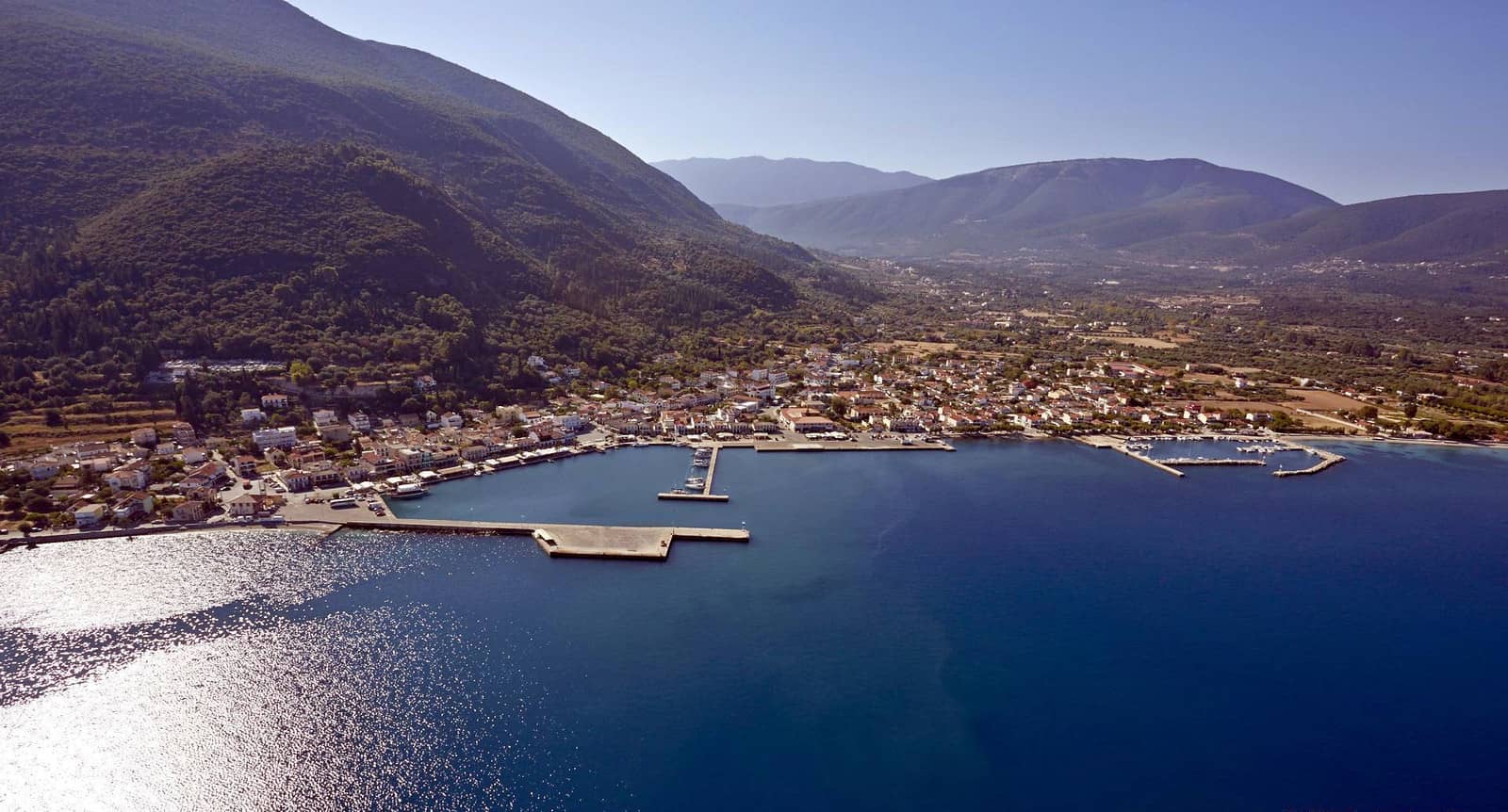

The harbourmaster will allocate a berth, usually at the “hammerhead” T-shaped pier, the berths along the promenade will be taken by local boats.
Good holding in mud, mind the swell that is sent through the arches in stronger W – NW winds.
Note that the fishing port is not Cosmos marina, but Sami marina: very safe with mooring lines, electricity and water; Mr Stamatis +306976558497.
Set in verdant surroundings the port of Sami is a modern, yet pleasant village.
Poros
The port of Póros - Πόρος offers allround protection, and during the classical period this bay was probably the harbour for the city of Pronnoi.
Not to be confused with Poros island in the Saronic Gulf near Athens.
The silts inside the port vary in size and position, the GWP chartlet is out of date; the C-Map and especially the Garmin charts show the current situation.
Once round the green harbour light, steer a course of ~250° towards the west town quay while keeping an eye on the depth sounder; go stern-to; mind the wash from the ferries.
Drinking water is brought in from the lakes further uphill and is therefore free of charge. Dine at “Taverna Ktíma Agrápidos” on Cape Pronou.

Katelios
The unfinished port of Kateliós - (Κάτω) Κατελειός, alias Káto Kateliós or Kateleios, lacks all facilities and isn't dredged, June 2024, now entrance is way less than 2 m.
Some yachtspersons find it an enchanting place, some don't… and the 25 or 27 maximum depths inside (if dredged) will be too little for most yachts anyway Lat Long
The approach is exigent with a plethora of reefs and silts to navigate. Moreover, even once inside there are sediments to avoid.
Abysmal holding due to weeds, best to raft up alongside the east (low!) breakwater. Not appropriate in E – SW winds.
There is a taverna nearby and another two in the village aimed at the tourists who adore the splendid long beach. Note that Kateleios bay has a few uncharted nasty rocks ![]() .
.
Agia Pelagia
Agía Pelagía - Αγία Πελαγία port likewise has a precarious approach, where only an advance from the SW is prudent.
There is, however, perfect allround shelter Lat Long; leaving and entering in high waves or winds is ill advised.
Good holding in the sandy spots, ask the local (fishermen) for a berth.
Moreover, Agia Pelagia is a great stepping-stone to Zakynthos, for instance towards Porto Vromis.
The waterside is deserted except for a hotel, but it is a short walk north to “La Calma Tavern & Cocktail Bar”. Also visit the “DIAS” Apiary further north.
Pelagia of Antioch was a Christian saint and hermit in the 4th or 5th century.
Conclusion
Focus on the north & east coasts of Kefalonia island.
Ithaca island
Itháca, Itháki or Itháka - Ιθάκη (popularly called Thiaki) is a rocky island separated from Kefalonia by the 2 nm wide Ithaca channel and is almost cut into two by the long Gulf of Molos on its east side. The isthmus joining the two halves, at Mount Aetos (380 m), is only 600 m wide.
In the north of the island is the Ani range of hills (Mount Neritos, 806 m), in the south Mount Stefani (669 m). Much of the island has been marked by karstic action, but agriculture is possible in a few fertile valleys.
Present-day Ithaka is wildly acknowledged as being Odysseus's island of Ithaca, as described in the “Odyssey”.
The earliest finds of pottery point to a first settlement of the island towards the end of the 3rd millennium BCE. A number of Mycenaean sites have been identified, though their poverty is difficult to reconcile with the wealthy Homeric Ithaca, which is dated to this very Mycenaean period.
During the 1st millennium BCE, however, the islands seems to have attained a degree of prosperity throught an active trade with mainland Greece and Italy. From Roman times Ithaca shared the destinies of the other Ionian islands.
During the Middle Ages the inhabitants were driven out by pirates, who established their base in what is now Vathy.
In the 17th c. the island was resettled by peasants from Kefalonia.
Ithaca, Kefalonia, Arkoudi, Atokos are part of the UNESCO Kefalonia Geopark which offer also protection for marine life such as whales and dolphins.
After a long history of devastating raids and eathquakes practically all Ithaca's older buildings have been destroyed.
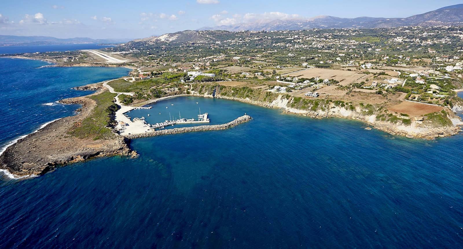
Vathy
The chief place on the island is the sheltered port of Vathý - Βαθύ or Ithaki (pop. 2900), probably founded by the Romans, which is charmingly situated in a bay – generally accepted as being the cove of Phorkys, in which the Phaeacians put the returning Odysseus ashore; “Odyssey, 13, 96 ff.” – defended by two Venetian forts.
See toponym Vathi / Vathy.

The four main berthing options:
- The quay opposite the village, in the NNE corner of the bay offers the best protection north-westerlies and the violent gusts; the road is a bit noisy; often not power or water.
- Along the village esplanade directy south of the ferry jetty (which, by the way, is infrequently used so you could try your luck there as well). To reserve a spot: Makis +30 6979687861; pillars are sometimes shut down, or there are issues with the €15 cards.
- On the outside of the mole that guards the local boats. This is a lee shore, yet often the winds die down during the night.
- In the north of the bay at “Marina Ithakis”; where you are required to eat at Tsiribis Taverna; 10 min. walk to town; water and diesel can be delivered, no electricity; a delight if you want to avoid the nightlife sounds. Note that the Kassianos fuel station in the east of the bay is still not re-opened.

Note the occurance of severe gusts turning from SW in the adjacent Aetou bay towards NW – NNW in Vathy bay or W over the Cave of Nymphs hills.
The best anchorage therefore is west of Lazaréto - Λαζαρέτο islet.
- Visit the small Archaeological Museum; rather dilapidated but free admission & an engaging collection.
- (Lunch) anchorage in Exo Aetou bay Lat Long.
- The ultimate beach Gidáki is accessible only by boat (or via an adventurous path), directly north of Cape Gidakiou, aim for the large white scar Lat Long.
- Rent scooters to visit the inland:
2 km west of Vathy, on the slopes of Mount Ayios Nikolaos, is the Marmaro Spilia, a stalactitic cave and ancient cult site that is identified as the Cave of Nymphs called Naiads.
Further west, on Mount Aetos, is the acropolis of an ancient city (7th c. BCE), perhaps Strabo's Alalkomenai, which was excavated by Schliemann and is popularly known as the Castle of Odysseus.
3 km south of Vathy is the site of Palaiokhora, the island's capital until the 16th c. Further south on a difficult path is the fountain of Arethusa, beneath the Raven's Crag “Odyssey, 13, 408 – 409”. Further south is the plateau of Marathia, with extensive plantations of olive trees and spectacular views.
Sarakiniko
Sarakíniko - Σαρακίνικο is a lovely secluded anchorage on the east coast Lat Long of Ithaca – delightfully devoid of civilization – only open to the SE winds. Choose a sandy spot to anchor near the NW (or SW) corner and take a line to the rocks.
The toponym is quite common, e.g. on Syros island, Milos island, Parga or Kastos and refers to the Saracen pirates who used these bays.
Pera Pigadia
The bay of Péra Pigádia - Πέρα Πηγάδια or “Pera Pigadi” has three suitable coves for anchoring in an arboreal atmosphere close to the beaches; prevailing winds tend to follow the coast.

Moreover, on the islet of Pera Pigadi you'll find the minute harbour of Ag Ilías; go stern-to or alongside the stubby (13 m long) mole or the quay (28 m); mud and weed; the rats on the island were eradicated by introducing a semi-feral cat, you can bring cat-food and especially water; insufficient depths for the larger monohulls to go along-side the quay. Note that this is a lee shore when irregular yet powerful katabatic gusts flow down the hills from the west-north-west.
Ag Andreou
Agíou Andréou - Αγίου Ανδρέου is a profoundly cloistered bay Lat Long west of the Church of Saint John, which ends in a pocket-beach.
Anchor in 4 – 10 m, where you can wedge the stern anchor in the rocks; not everywhere good holding in mud / weed / stones; commercial shipping create a nasty swell , which combined with gusts from the north can make it very uncomfortable; beautiful spot, yet difficult anchorage.
Antri
The alternative further west Lat Long is the lovely deep (and often overcrowded) bay of Ántri - Άντρι.
Pisaetos (Aetos)
Piso Aetós or Pisaetos or simply Aetós - Πισαητος is an unpleasing port accomodating the ferry to Sami on Kafalonia island. With permission of the harbourmaster go stern-to the north side of this squarish slab of concrete; shelter from northerlies and easterlies.
The fishing port is unfinished and so are the plans for a larger (cruise ships? more ferries?) terminal.
Most likely scenerio is anchoring to the North near the NW extremity of the beach in 4 m; mud and weed; mind the submarine cable.
Port Polis
Port Pólis - Πόλις is a stunning bay and port with easy access to the colourful and traditional Stavros village and – amongst other archaeological treasures – the remains of an extensive three-storey building, which is regarded as the palace of Odysseus.
The numerous ancient finds made in the vicinity of Stavros have suggested this area to be the most likely site for Odysseus's town. So, the toponym “polis” correctly refers to a “city”, a 20 min. Take the gravel path through the olive groves on the west side of the beach rather than the asphalt road on the east side of the beach.
On the west coast of the bay, facing the harbour, is the Loizos Cave, which has yielded ancient artifacts showing that the site was a place of worship – and a shrine of Athena and Hera in Mycenaean times – as early as 9th c. BCE. It was destroyed by an earthquake and is underwater / inaccessible, yet the entrance is clearly visible from the yacht.
The cave was named after the discoverer who showed his finds – coins, knife and sword – to Heinrich Schliemann who was able to appreciate the true value: that the Homeric Odysseus was likely a real historical figure. Almost 3000 years after Odysseus' return to his home you can visit the exhibits in Stavros. Although just a theory, it is a delight to imagine that the epic poem might well have had its roots on Ithaca island.
1 km north of the bay, on Mount Pelikata above Port Polis, are remains of a settlement dated between 2200 and 1500 BCE.
In the bay you can anchor south of the port (mind the submarine cable), either near the jetty or further south, and take a line to the rocks or jetty.
The best anchorage is directly north of the cave , take a line ashore. About 10 m from and directly in front of the cave is a submerged rock with a depth of about 1.3 m.
The “Delicious” restaurant in the village is pleased to deliver to the port, or rather to taxi you to them in Stavros +30 2674031645.
Local boats claim most of the berths inside the port, but there will be room outside the season; mind the fixed moorings on the bottom; bad holding and make sure the anchor penetrates the thick layer of weeds.
Lefkas island in the distance.
Ag Nikolaos (Marmagkas)
The little bay of Ágios Nikólaos - Άγιος Νικόλαος is underappreciated, yet it provides excellent shelter Lat Long, unexposed behind the homonymous islet & Chapel. This anchorage is sometimes named after the name of the beach Mármagkas - Μάρμαγκας, the recommended “Kantina” is only opened in the height of summer +306947327102.
In the middle of the northern approach, ~250 m out, is the treacherous 50 m wide Agriógatos (meaning: “wild cat”) reef.
Anchor anywhere in sand / weed close to the beach; open to NE – S winds; luxuriant surroundings with large Tamarisk trees acting as parasols on the hot pebbled beach.
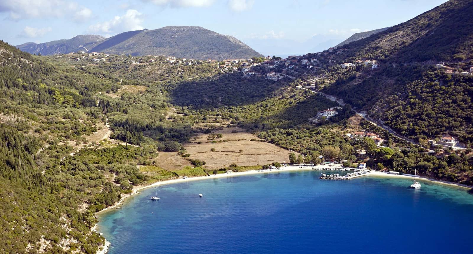
Frikes
The compact port of Fríkes - Φρίκες lies hidden at the narrow head of a wide bay with an undulating coastline. Prevailing wind is NW, whereas the gusts are mostly West.
In 2014 a pontoon got installed opposite the breakwater and broke in four parts during its first season of operation, it has been completely removed in 2015, but is still shown on some charts.

The NW corner of the port doesn't get much shelter from the breakwater – although safer with respect to the gusts – the heavy wake from ferries or other commercial shipping will induce rolling (mind your rigging) and / or push yachts on the quay. Use plenty of fenders.
The premium berths are thereby alongside or stern-to the breakwater & as close as possible to the village; larger yachts with a draft >2.5 m will have to go stern-to on the outerside. Mediocre holding in sand / weed. On the inside <2 m at the breakwater, keep some distance off.
In the open Frikes bay, the anchorages along the north provide shelter against the prevailing NW. Moreover, the southern bays are mostly desecrated by the road that hugs the coastline.
- On the north side aim for Liméni(a) bay (pref. the east cove) Lat Long; gusts W – NW; good holding in mud / weed; anchor in 5 – 8 m.
- On the south side aim for Vathý Limáni bay; good holding in sand Lat Long; open to SW – NE winds; no road.
Visit the village of Stavros (see Port Polis): amongst all treasures is a Cyclopean wall dating 3000 BCE.
Taverna in Frikes port: “Ageri”, at the waterfront, for modern Greek dining.
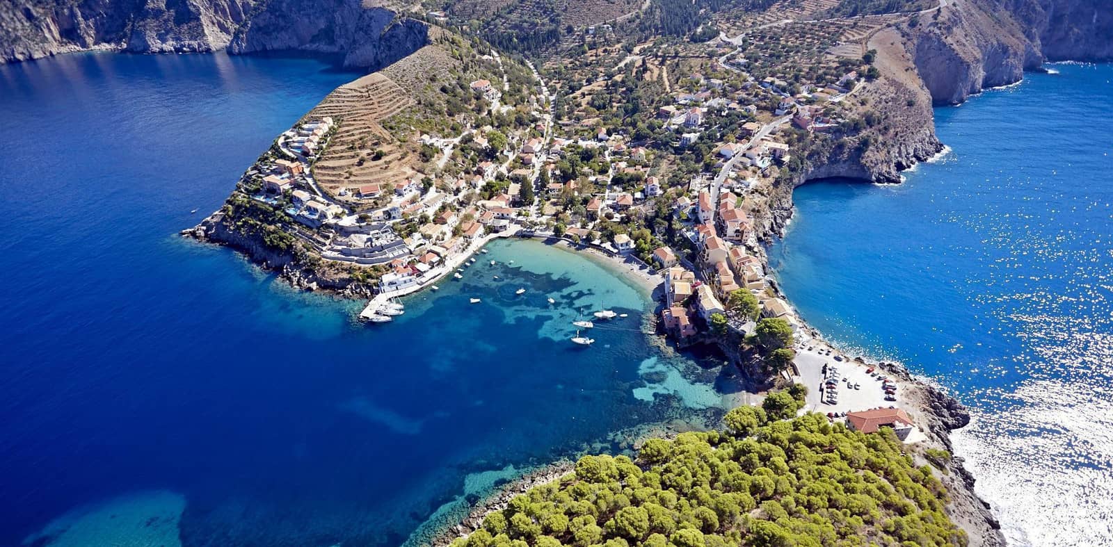
Kioni
Kióni - Κιόνι is a pretty and surprisingly traditional village – just south of the Vathy Limani anchorage – under wonderfully wooded hills. The three ruins of windmills on Cape Psigadi will guide you on the approach.
The winds blow strongest in June and July and peaks in the afternoon, with less vigor in the evening; gusts from the north-west; shelter from all winds except the ESE, rare in the sailing season.
The best berths are stern-to at the quay near the green harbour light.
Across the water are the preferred berths at the quay.
The anchorage opposite the quay is unreliable without a line ashore. In the summer Kioni is crowded, however, and the south bank will also be full of yachts, use the dinghy to go ashore; there are rings available on the rocks.
Delicious (Vegetarian / Vegan) dining at “Lizzy's” near the harbour light and “Piccolo Coffee” in the morning…
Miscellaneous
Arkoudi
The private island of Arkoudi - Αρκούδι, between Meganisi and Ithaca, offers a beautiful anchorage in Aspro bay on its east coast Lat Long. According to Eagleray one cannot stay the night mind the reef extending from the south of the entrance, hug the north side; anchor in 4 – 8 m in sand; cows, bulls and goats on the pebble beach; shepherds arrive early in the morning.
Further south is a low peninsula, in calm weather there will be yachts on the road on either side of the isthmus.
Arkoudi – meaning “bear” in Greek – could well be the Homeric island of Asteris.

Atokos
Átokos - Άτοκος is a breathtaking, rocky and uninhabited island 5 NM east of North-Ithaca with two distinctive camel humps and (at least) three anchorages ↺ :
- “Cliff bay” on the south coast is regarded as too deep – mostly 15 m and deeper – by most yachtspersons, but in light winds you can get close to the cliffs.
- Directly east of Cliff bay is a tiny cove where you can anchor in 7 – 10 m; less sheltered; less sublime.
- A very solid anchorage on the east coast of Atokos – featuring wild but friendly black / grey pigs on the beach – is called “One house bay” in GWP, yet the first building is actually the rather quaint Church of Ag Giannis, that even features a model ship candelabrum hanging from the ceiling. There is a track leading past a second building to the saddle point center of the island. In September this private island is off limits.

Astakos
Astakós - Αστακός town is worth the detour – genuinely off the beaten track and no flotilla fleets – with predominatly Greek tourists further supporting a vivacious fishing and farming community; the name means “lobster”.
The port is unsuitable in stronger southerlies and easterlies; go stern-to the quay between the ferry dock and the long mole; gusts from the north-west; suspicious holding in mud.
A 50 min walk to the north will bring you to the ruins of the fortifications of Ancient Astakos and the medieval Dragamaestos. The total area of the site is about 0.4 km². The ancient wall was built on a natural substrate and its superstructure was brick. The fortification is reinforced by 15 towers. Inside the walls of the Byzantine (northern) area you can visit the preserved ruins of several temples.
Echinades
The island group Echinádes - Ἐχινάδες is severely blemished by pisciculture The Echinades derived their name from the “echinus” or the sea urchin, in consequence of their sharp and prickly outlines. For the same reason they were called Oxeiae, or the Sharp islands.
Oxia
The highest point in the Echinades (421 m) is Oxía or Oxeía - Οξεία: a steep and brambly island Lat Long, which also has been sullied by fish farms in all bays, yet is otherwise splendid; in 1571 the stage of the Battle of Lepanto in which the western fleet commanded by Don John of Austria, a natural son of the Emperor Charles V, defeated the Turkish fleet.