Bücher
Segelkarten

Home
Amazon.de
Home Navigationkurs Segeln Griechenland Türkische küste Yachtcharters Blaue Reise                          
Amazon.com
Amazon.co.uk
Amazon.de

Literatur Griechenland & Türkei


Törnführer
Griechische Küsten
Griechenland bietet dem Skipper eine unglaubliche Vielfalt unterschiedlicher Reviere: rund 2000 Inseln sowie eine Festlandküste von etwa 10 000 Seemeilen Länge stehen für viele Törns zur Verfügung. Dieser nautische Reiseführer beschreibt alle griechischen Küsten sowie die Inseln, die landschaftlich, klimatisch, kulturell und nicht zuletzt navigatorisch überaus vielfältig und reizvoll sind. Greek waters pilot
Türkische Küste, Ostgriechische Inseln
Dieser Nautische Reiseführer beschreibt die türkische Küste am Nordkap der im Westen von Izmir liegenden Karaburun-Halbinsel bis Antalya sowie die ostgriechischen Inseln Psara, Chios, Samos, Phournoi, Agathonisi, den Dodekanes von Patmos bis Rhodos und die kleine Insel Kastellorizon. Mit 263 Plänen und 184 Fotos von Häfen und Ankerplätzen.
Türkische Küste
Vom Bosporus ausgehend, führt Gerd Radspieler den Leser über fast 1500 Seemeilen an der türkischen Küste entlang - bis nach Antalya weit im Südosten. Stimmungsvolle Häfen, kleine Anlegeplätze in zauberhafter Umgebung und viele einsame Buchten mit glasklarem Wasser säumen den Weg. Wissenswertes über Ansteuerungen sowie Häfen und Ankerplätze sind das eine. Das andere aber sind die zahlreichen historischen Stätten, zu denen der Autor uns führt. Und so ist dieses Buch eine geglückte Kombination von Reiseführer und Seehandbuch.
Griechenland, 4 Bde., Bd.1, Ionische Inseln, Westgriechisches Festland, Golf von Patras, Golf von Korinth, Peloponnes, Argolischer Golf, Saronischer Golf
Ionische Inseln, Westgriechisches Festland, Golf von Patras, Golf von Korinth, Peloponnes, Argolischer Golf, Saronischer von Gerd Radspieler.
Griechenland, 4 Bde., Bd.2, Attikaküste, Petalischer Golf, Südlicher Euböa-Golf, Südteil von Euböa, Kykladen
Mit den Kykladen, der bekanntesten Inselgruppe Griechenlands, verbinden sich Träume von Sonne und Meer. Glanzstück ist Santorin im Süden. Im Norden dann Euböa, jene langgestreckte Insel, in deren Südteil der Bootsurlauber Erholung in herrlicher landschaftlicher Umgebung findet. Und da, wo der Südliche Euböa-Golf und der Petalische Golf sich die Hand reichen, tut sich ein weiteres Inselparadies auf. Schließlich die Halbinsel Attika mit dem berühmten Poseidontempel am Kap Sounion und den Yachthäfen von Athen als Ausgangspunkt für einen Kykladentörn. All diese wunderbaren Reviere mit dem Boot zu entdecken, dazu verhilft dieses Buch auf das beste.
Griechenland, 4 Bde., Bd.3, Ostägäische Inseln, Dodekanes, Kreta
Die ostägäischen Inseln Psara, Chios, Ikaria und Samos und das Inselmosaik des Dodekanes von Patmos bis Rhodos liegen wie die Perlen einer Kette vor der türkischen Küste aufgereiht. Kreta begrenzt die griechischen Gewässer im Süden - es ist die größte Insel des Landes. Jede Insel hat ihren eigenen Charakter, den es mit dem Boot zu entdecken gilt. Dazu verhilft dieses Buch, das die Häfen und Ankerplätze vorstellt, kompetent und aktuell, mit 165 Plänen und über 30 Fotos.
Griechenland, 4 Bde., Bd.4, Nördlicher Euböa-Golf ab Chalkis, Pagasäischer Golf (Volos), Nördliche Sporaden, Chalkidiki, Nordgriechische Küste, Thasos, Samothraki, Limnos, Lesvos
Nördlicher Euböa-Golf ab Chalkis, Pagasäischer Golf (Volos), nördliche Sporaden, Chalkidiki, nordgriechische Küste bis Alexandroupolis, Inseln Thasos, Samothraki, Limnos, A. Evstratios, Lesvos.

Segelkarten

Imray Tetra charts Griechenland und Türkische Küste
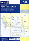
G11 - North Ionian islands
Covers the islands of Erikoussa, Othoni, Kerkira/Corfu, Paxos, Lefkas and the Ambracian Gulf east of Preveza.
Plans O. Gouvion (N. Kérkira), Vorion Stenou Kérkiras, Limín Kérkiras (N. Kérkira), Limín Alipa (N. Kérkira), O. Lákka (N. Paxoí), Limín Paxon (N. Paxoí) Insets Amvrakikos Kólpos, Nísos Othonoí. Scale 1:182,400
Tetra chart G11
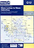
G12 - South Ionian islands
Covers the islands of Lefkas, Meganisi, Kalamos, Kastos, Atoko, Ithaka, Kefalonia and Zakynthos/Zante, as well as the coastline between Preveza and Oxia plus the northwest corner of the Peloponnese.
Plans Kólpos Aetou (N. Itháki), Dhioriga Levkadhos (Levkas Canal), O. Argostolíou (N. Kefallinía), O. Zákinthou (N. Zákinthos). Scale 1:188,200
Imray tetra charts of the south ionian islands
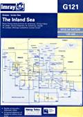
G121 - Inland Sea - Ionian
Covers the standard flotilla routes taken in the Ionian waters (for bareboat sailing use the G12 chart!) and includes just Lefkas, Meganisi, Kalamos, Atoko, Ithaca and the north east of Kefalonia.
Plans O. Ayías Eufimas (N. Kefallína), O. Frikou (N. Itháki), O. Fiskárdho (N. Kefallína), O. Vasilikas (N. Levkas), Dhioriga Levkadhos (Levkas Canal). Scale 1:93,400
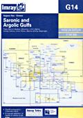
G14 - Saronic and Argolic gulfs
Covers the whole Saronic (Salamis, Aegina, Methana, Poros, sounion) and the north part of the Argolic (Spetses, Navplion, Astros and Leonidio).
Plans Marina Alimos, O. Falírou, Limín Porou (N. Póros), Steno Spétson (N. Spétsai), Limín Aiginis (N. Aigina). Scale 1:189,000
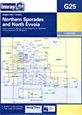
G25 - Northern Sporades and North Evvoia
Covers the islands of Skiathos, Allonisos, Skopelos, Skyros of the Northern Sporades as well as Volos and the north part of Evvia.
Plans Linaria (N. Skíros), O. Skíathou (N. Skiathos), O. Skopelou (N. Skopelos). Scale 1:183,800
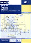
G31 - Northern Cyclades
Covers the islands of Kea, Kythnos, Serifos, Siros, Andros, Tinos, Mykonos, Delos and the south tip of Evvia as well as the north tips of Paros and Naxos.
Plans O. Mikonou (N. Mikonos) O. Gávriou (N. Andros), Limín A. Nikolaou (Nísos Kea), Limín Sirou (N. Siros). Scale 1:189,700
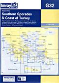
G32 - Southern Sporades and the coast of Turkey
Covers the islands of Samos, Ikaria, Fournoi, Patmos, Agathonisi, Farmakonisi, Arki, Lipso, Leros as well as the Turkish coastline between Kusadasi and the promontory just north of Bodrum.
Plans Kusadasi Liman (Turkey), Limín Karlóvasi - N. Sámos (Greece), Limín A. Kirikou - N. Ikaria, Steno Samou - N. Sámos, Limín Pithagóriou - N. Sámos, O. Patmou - N. Pátmos Scale 1:189,700
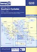
G33 - Southern Cyclades
Covers the islands of Serifos, Sifnos, Antiparos, Paros, Naxos, The little Cyclades (Karos, Iraklia, Skinoussa, etc), Ios, Santorini (Thira), Sikinos, Folegandros, Poliagos, Kimolos and Milos.
Plans Steno Kimolou (N. Kímolos), O. Livadhiou (N. Sérifos), Steno Andíparou (N. Paros), O. Náxou (N. Naxos). 1:190,000 Scale 1:189,700
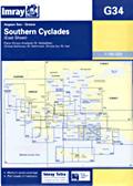
G34 - Southeastern Cyclades
Covers the islands of Naxos, The little Cyclades (Karos, Iraklia, Skinoussa, etc), Dhenoussa, Amorgos, Kinaros, Levitha, Leros, Kalymnos, (east tip of) Kos, Astypalaia, Anafi, Santorini (Thira) and Ios.
Plans O. Kalímnou (N. Kalimnos), O. Maltezana (N. Astipálaia) Scale 1:190,000
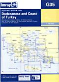
G35 - Dodecanese and Coast of Turkey
Covers the islands of (south tip of) Leros, Kalymnos, Pserimos, Kos, Yiali, Nisyros, Tilos, Chalki, Symi and north half of Rhodes as well as the Turkish coast from Bodrum to Marmaris.
Plans Bodrum (Turkey), Rodhos - N. Rodhos (Greece), Kós & Kos Marina - N. Kós (Greece), Marmaris (Turkey), Limin Simi - N. Sími (Greece). Scale 1:190,000

Viel Spaß!


E-mail:
E-mail:
Bücher EN Übersicht A-Z Kontakt| Sprachen
Diederik Willemsen | E-mail mij
Übersicht | A-Z | Registrierung

Thanks to Helmut Hansig & Kerstin Funnemann for their translation.  RSS XML Feed | Level AA conformance icon, W3C-WAI Web Content Accessibility Guidelines 1.0 ! | |