Skopelos sailing holidays
Skopelos - Σκόπελος, known in antiquity and until the 3rd c. CE as Peparethos, is a hilly and well-wooded island. The steep North-East coast is unwelcoming, and, apart from the wide Bay of Skopelos (Ormos Skopelou) near the East end, without anchorages or inlets of any consequence. The gentler South-West coast is also relatively featureless, yet holds a range of breathtaking anchorages like Stafylos, Agnondas and Panormos.
- All Greek islands
- Northern Sporades overview
- Skiathos
- Skopelos
- Alonissos
- Pelagos (Kira Panayia)
- Skyros
- Thasos
Next island: Alonnisos
Skopelos thrives on its agriculture and the island is devoted to the growing of olives, plums, almonds & walnut trees.
Where the slopes are too steep for cultivation, pine trees grow, giving an overall impression of green fertility not found on many Greek islands. There is an abundance of springs and streams, and much like it's neighbouring island of Skiathos, it reflects the lushness of the Pelion Peninsula nearby.
There are many Convents in which the nuns make woven goods and other craft products. The tourist trade also makes a big contribution to the economy.
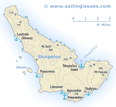
Skopelos island ports & anchorages
Clockwise ↻
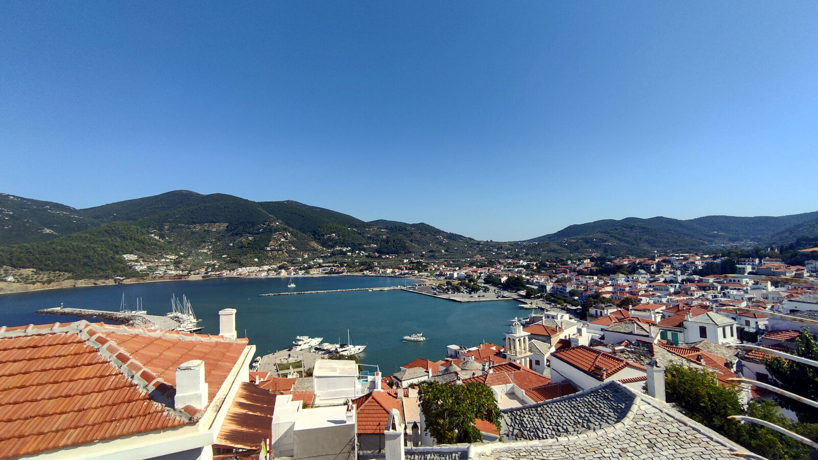
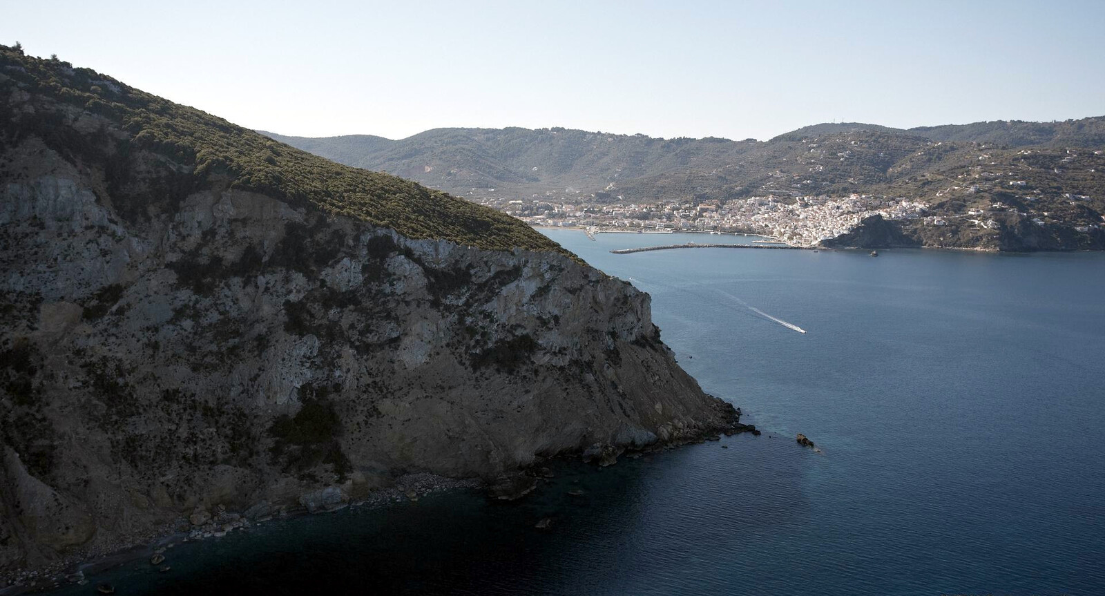
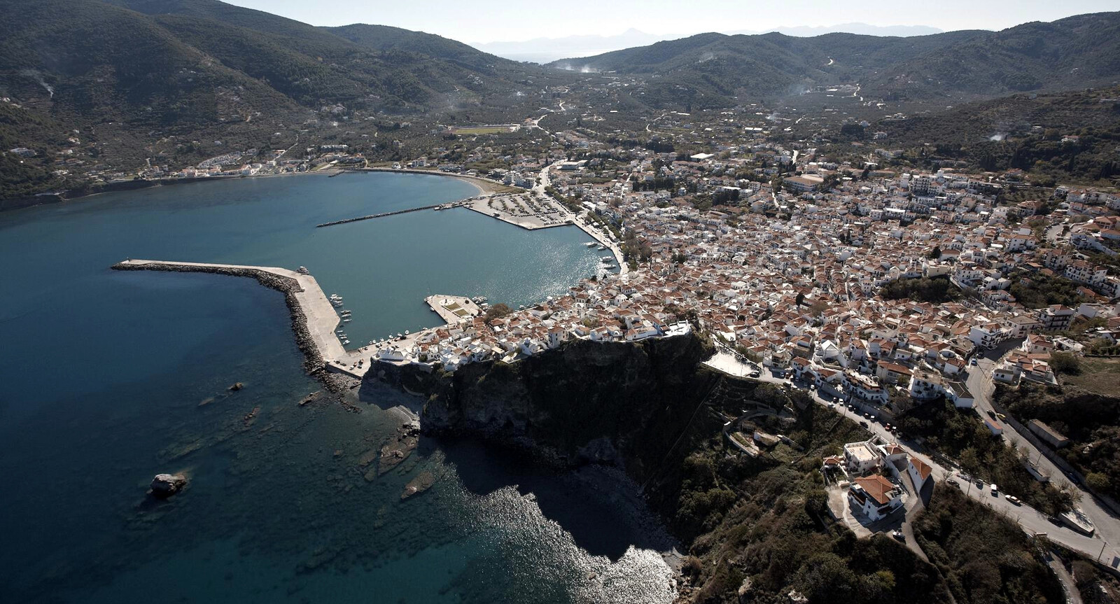
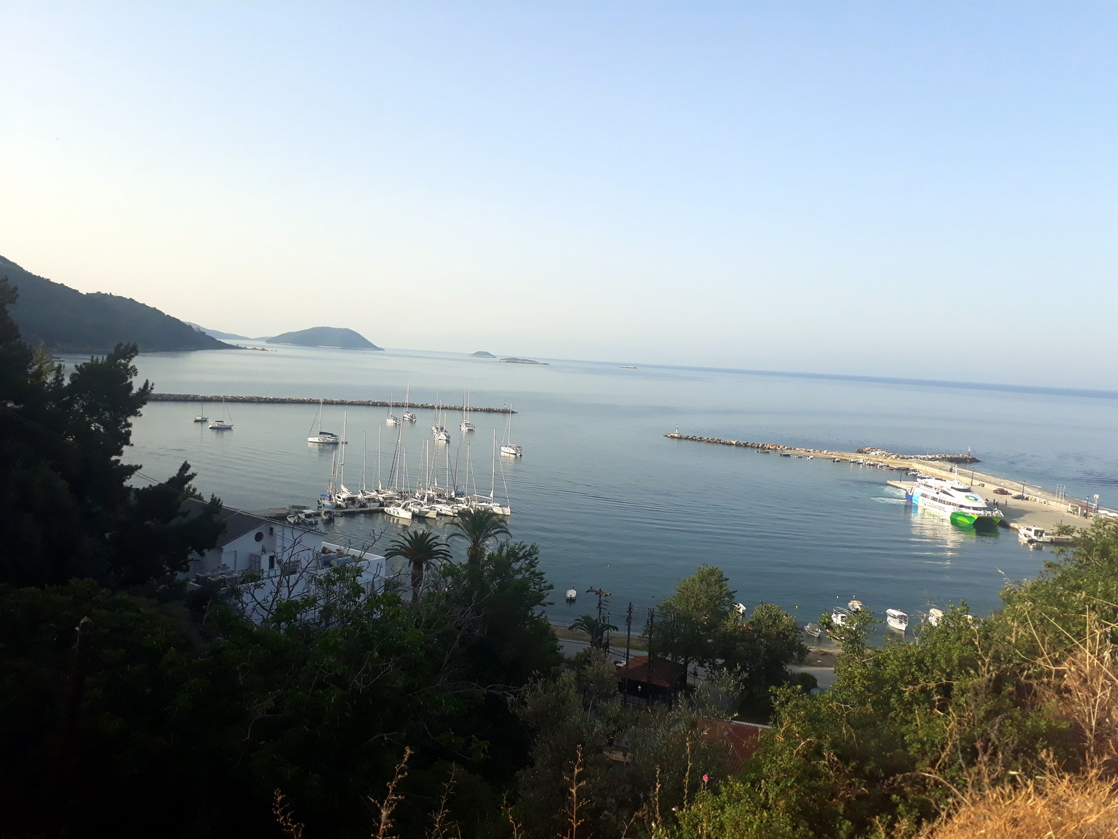
Skopelos port
The port of Skópelos - Λιμένος Σκοπέλου gives direct access to the charming town of Skopelos. Regardless, the location and orientation of Skopelos port in the prevailing N – NE winds is far from ideal, and when the shallow bay is too storm-tossed and tempestuous, ferries will dock in Agnondas instead. Indisputably, in (Meltemi-)storm conditions the shelter is average: yachts will dance and roll with vigour. Furthermore, the ferries can be almost as worse as in Naxos, while rounding the red buoy in the basin these produce a problematic swell – the closer your berth is to the green light the greater the risk of damage, see the chartlet.
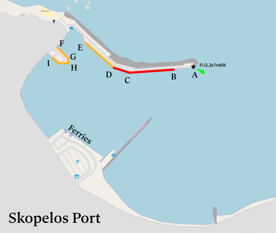
Red – dangerous in storms and prone to damage caused by ferry wake.
Green – the preferred berths.
A-B (30 m) ro-ro passenger ships, which cannot enter the wet dock.
B-C (174 m) rafting up long yachts and sailing vessels.
C-D (54 m) sailing vessels and recreational craft of up to 12 m.
D-E (100 m) sailing vessels and recreational craft of up to 15 m.
E-F (60 m) commercial and (high speed) recreational sailing vessels.
F-G (53 m) commercial and recreational sailing vessels.
G-H (16 m) commercial and recreational sailing vessels.
H-I (73 m) commercial and recreational sailing vessels or Coast Guard.
For such a major port there are no showers, laundrettes and few electricity and water points. Yet, there are plenty of berths; holding is good; VHF 12 Harbour office. Keep the yacht well off the quay, you will need a well dug in anchor, and the gangway raised.
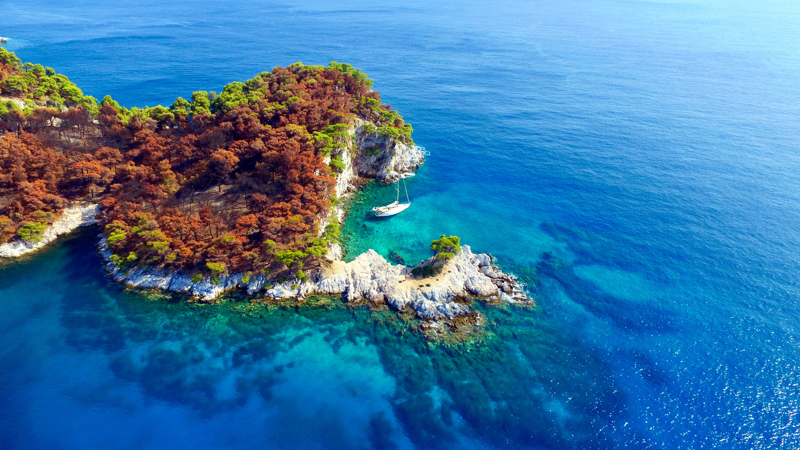
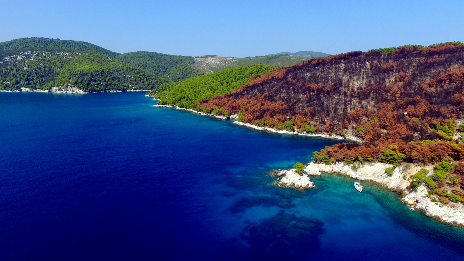
Stafylos
Double headed bay of Stáfylos - Στάφυλος is provides shelter in SW – SE winds Lat Long excellent taverna “Stafilos” overlooking the beach. Swell can become uncomfortable but not dangerous. Anchor in 5 – 9 m over sand and plenty of opportunities to take a line ashore. When there are more than 10 yachts it is necessary to prevent swinging into eachother. The swimming buoys are not always installed; very good beach for young children and perfect reefs / rocks for snorkeling.


A visit to the Bronze Age “Tomb of King Staphylos” is a total disillusion, since there is only a marker. This bay owes its name to this Minoan King whose ships are supposed to have landed in this cove.
Amarandos
Amárandos - Αμάραντος is an idyllic lunch-stop anchorage Lat Long where you can opt to go on all three sides of the small headland; only suitable in lighter winds and anchor watch during the night; crystal clear waters; no nasty hidden obstacles / dangers.
A “Mamma Mia” filming location.
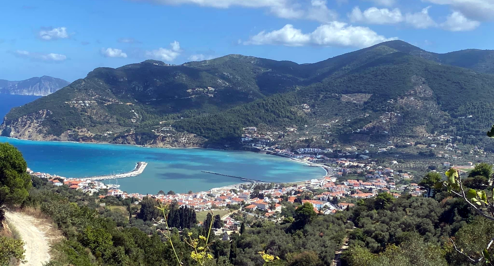
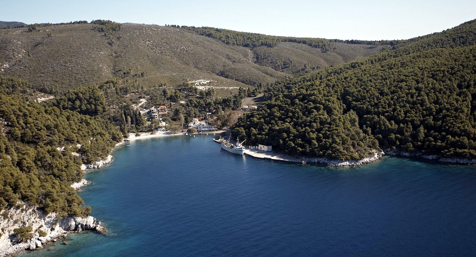
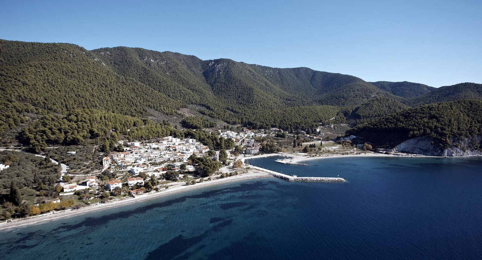
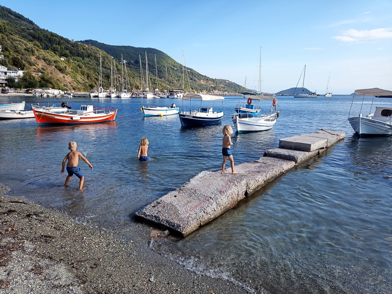
Agnontas
The bay of Agnóntas - Αγνώντας is the third ferry port of Skopelos, which offers all-round protection.
Go alongside or stern-to the middle or the East section Lat Long solid holding in sand. A sign will tell you to go stern-to; in NW stronger winds and Meltemi it is subject to an unpleasant swell. Moreover, the quay suddenly descends into chaos when a big ferry arrives, which is at least twice a day. Note that ferries can also dock to the East of the corner in the quay (ignore the GWP chartlet); Port Facilities; heavy propellor wash has caused damage to visiting yachts, best berths on the Eastern side.
Electric and water is available through card payment.
The beach area offers two restaurants, a mini-market and the fine “4M Coffee House” for breakfast.

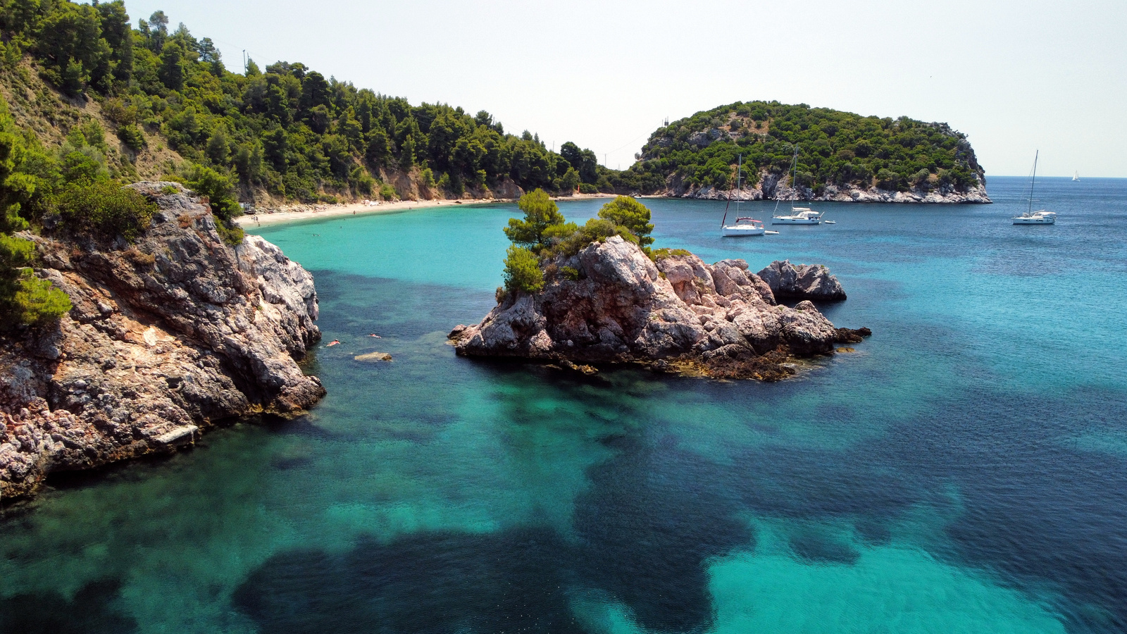
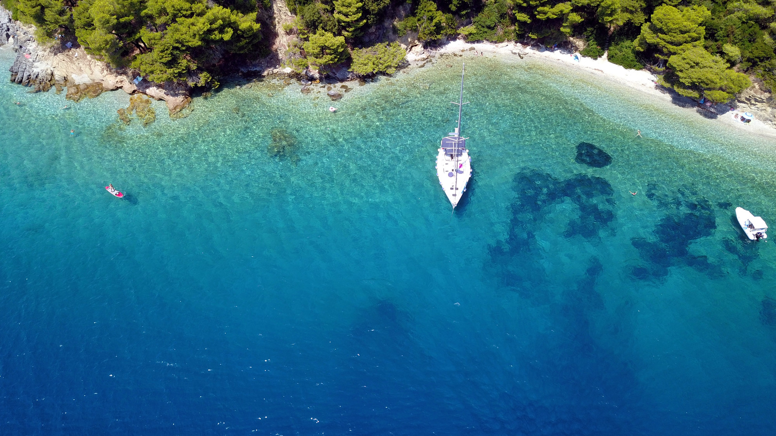
Limnonari beach
The small bay and beach of Limnonári - Λιμνονάρι
Lat Long
is a stunning anchorage with lush and verdant shores.
The restaurant and beach operator “Apanemo” has more or less taken over the whole seafront with deck chairs and parosols, yet not in a distasteful way: the building is adorned with bougainvillea, palms and such, plus a clean swimming pool.
Limnonari is fully open to Southerlies; deeper than 10 metres depths will be full of weeds, closer in you will find much more sand to drop anchor;
with ±15 yachts and catamarans at anchor (most swinging at their anchor) it can be tight; outside the main season there will only be a few vessels.
Trip boats will be coming and going till the end of the afternoon.
Many guides (notably Eagleray) mention that it is forbidden to anchor here due to the telephone cable that run from Skopelos to Skyros.
In strong Southerlies relocate to Panormos or Agnondas.
In light winds from the South or East you should try Trachili beach (between Panormos and Limnonari), on the North side Lat Long of cape Mýti. Some plogging is needed: the beach amasses garbage due to its position; anchor in 7 – 12 m; perfect solitude there is only room for a single yacht.
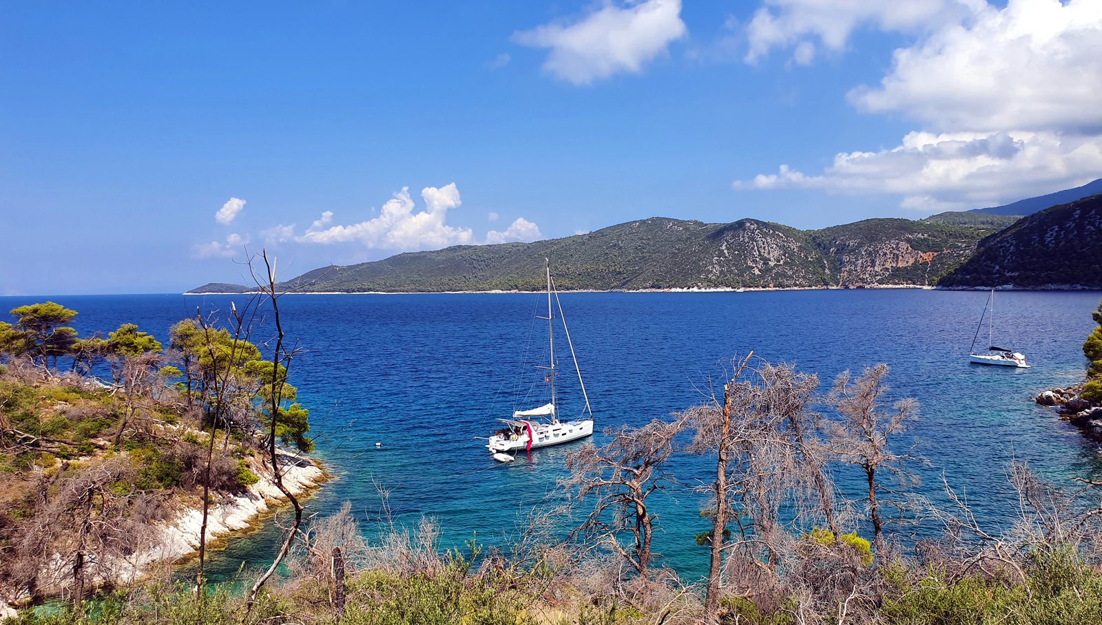
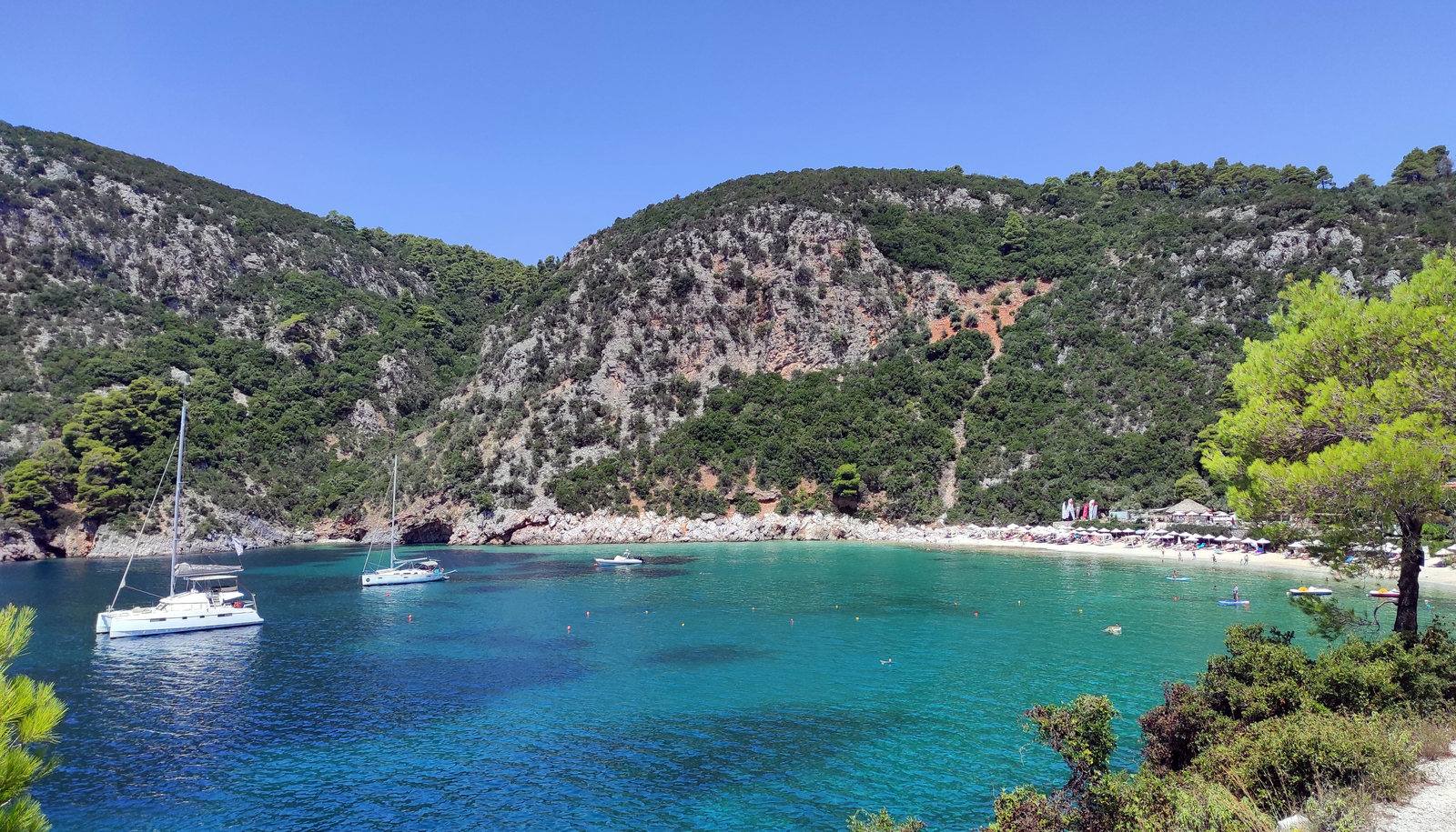
Panormos bay
The delightful bay of Pánormos - Πάνορμος is a famous and therefore often crowded anchorage. Moreover, the charter yachts based in Skiathos use this fjord-like bay as their first night or last night stop. Rightly so, since this sheltered bay combines truly spectacular greens with crystal clear waters; good snorkeling. Moreover, the safe conditions mean that you can take the dinghy to the beach for cocktails at the “Kraken” bar, followed by dinner at Taverna “Vasiliki”.
In weekends – markedly in the main season – you should arrive before noon to ensure a good spot.
Gusts are typically from N or NE, and prolonged katabatic winds can blow from the North during the night. Moroever, Panormos is deep, so anchoring here is done mostly with lines to the shore.
At the beach there is a shamefully expensive grocery shop to avoid.
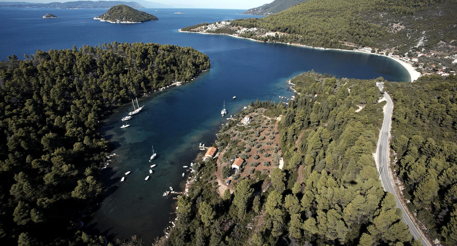
Locals also use the name “Panormou bay”, i.e. Ormos Panórmou - Όρμος Πανόρμου, from “pan” all-round + “ormos” harboured (sheltered) bay, see more toponyms.
- North shore – suitable in light winds or N – SE winds; the short beach of Antrines - Αντρινες felt too exposed for us: outside NNW almost blows West inside; note that the GWP chartlet shows this anchorage too far East.
- East – the anchorage at the main beach can suffer from severe nightly gusts, not recommended and awfully deep.
- South cove – offers all-round protection; winds will likely blow through the length of the cove. Some yachts will anchor on the E side directly N of the house + jetty; use a tripline here to cope with a concrete block with section of chain.
The West side much preferred; sandy rocky seabed and further N there is moor weed: mediocre holding. Best spot on the this side is in the middle. Lat Long Seabed is sand, weeds and rock; you will want to take two lines ashore: hawsers or stern anchor for instance; drop anchor as deep as possible.
Reverse slowly towards the shore: plenty of shallow areas and rocks. Keep your distance from the shore 15 – 20 m; the South part is bit more protected in Meltemi storm conditions, yet a lee-shore and a bit spoilt by the fishing boats and stagnant water: stick to the northern half of the cove.
Neo Klima • Elios
Néo Klíma - Νέο Κλήμα (or, for the veterans: Élios - Έλιος) is the expanded version of the previous fishing port Lat Long now focussing on tourist boats and visiting sailing yachts.
Moor stern-to to the NE quay where there are ±15 berths directly West of the slip; farther West – marked yellow – is reserved for trip boats / commercial vessels; there are no ferries here. The short North section of the quay is sometimes available for visiting yachts (very poor holding there); gust from SE – SW can be problematic; go alongside in the off-season near the slip.
Aside from the gusts, in the prevailing winds the stern lines will do the work.
Electricity & water available on a metered card (tourist office).

with the islet of Dasia in the distance, and Skiathos on the horizon. Hi-res image
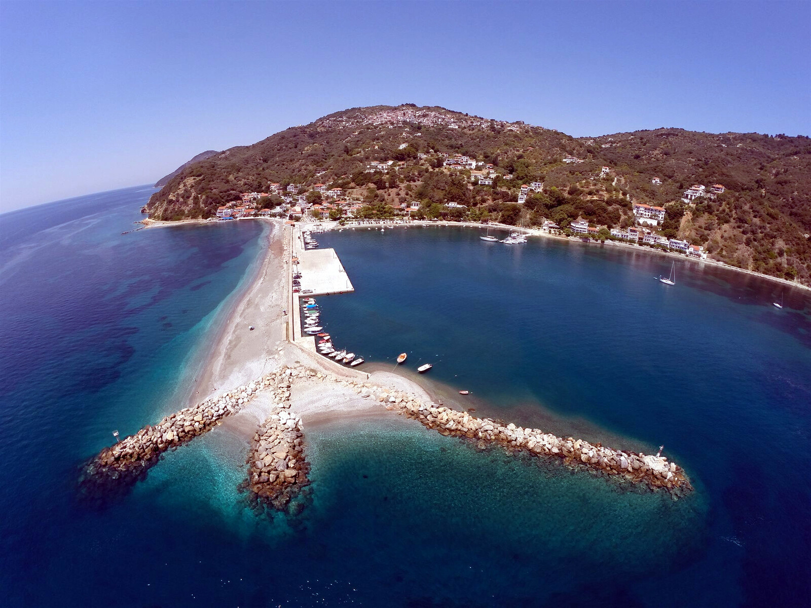
Loutraki • Glossa
The port of Glóssa - Γλώσσα – known as Loutráki - Λουτράκι – serves as a ferry hub between Volos, Skiathos etc. and Skopelos. Glossa village can be reached by a lovely 40 min hike uphill.
Contact a representative of sailaegean.eu via VHF 69 or +306944148699 for a berth near the ferry dock.
The floating dock Lat Long has room for 5-7 monohulls on either side; there are a few lazy lines, though not always obvious. Note that this pontoon is only available in the summer months; installed around the end of May; remove near the end of October; a colourful local resident (Angelo) will assist you; the northern side has 2.5 m depth over the full length of the floating part; the southern side has 2 m depths or less. On terra firma there are 2 electricity and water pillars, card services via the supermarket.

some berths with lazy lines; 10 – 15 places.
The two electricity and water pillars have been relocated to the shore. Hi-res image
At the head of the port is the Ekklisia Ag Nikolaos (St Nicholas Church) erected on the remains of an older Byzantine temple of the 7th c.; of course, Saint Nicholas of Myra is the patron saint of sailors and fishermen.
The Port Authority building has a sign with phone numbers for fuel, taxi, boat repairs etc.;
anchoring in the basin is not recommended in windier conditions: poor holding (weeds and soft mud), ferries need room to manoeuvre, etc.; the supermarket delivers to the yacht; warm and clean showers near the grill house; for dining consider “Vrahos” on the beach, and “Petrino” at the pontoon.
Anchoring and engine noises plus the swell from manoeuvring ferries make sleeping difficult.
History of Skopelos
The oldest traces of human settlement date from the Neolithic period. The ancient city of Peparethos was said to have been founded by the Cretan hero Stafylos, son of Dionysos and Ariadne.
In the so-called Tomb of Stafylos gold jewellery, idols, a variety of implements and utensils and Minoan double axes were found; they are now in the Volos Museum. The archaeological evidence indicates, however, that from an early stage the inhabitants of Skopelos were influenced by Mycenaean rather than Minoan culture.
After the 7th c. BCE Skopelos prospered, and the tribute it paid as a member of the first Attic maritime league was substantial. The Peloponnesian War, however, quickly and finally put an end to its prosperity.
Thereafter it had a series of different masters – Macedonians, Romans, Byzantines, Venetians and finally Turks – who allowed this remote and economically unimportant island a considerable measure of autonomy.
In 1830 it became part of the new Greek kingdom.