Ios island sailing holidays
Touristy Ios - Ίος is a hilly island, largely fringed by cliffs, roughly half-way between Paros or Naxos and Santorini.
Until quite recently its only source of income was agriculture on the terraced slopes of the Kato Kampos and its adjacent valleys, but since 25 years it has been invaded by large number of backpackers / beach tourists who maraud – at any rate during the summer months – the peace and harmony of the island.
The significant port of Ios – with the conspicuous white-domed Church of Ayia Irini (17th c.) inviting yachts from above – lies in a sheltered bay on the west coast of the island.

- All Greek islands
- Cyclades overview
- Kea
- Kythnos
- Syros
- Tinos • Andros
- Mykonos • Delos
- Serifos
- Sifnos
- Paros • Antiparos
- Naxos • Little Cyclades
- Milos • Kimolos
- Folegandros • Sikinos
- Ios island
- Amorgos
- Santorini
- Itineraries in the Cyclades
Previous islands: Folegandros • Sikinos ↑

Next island: Amorgos ↓
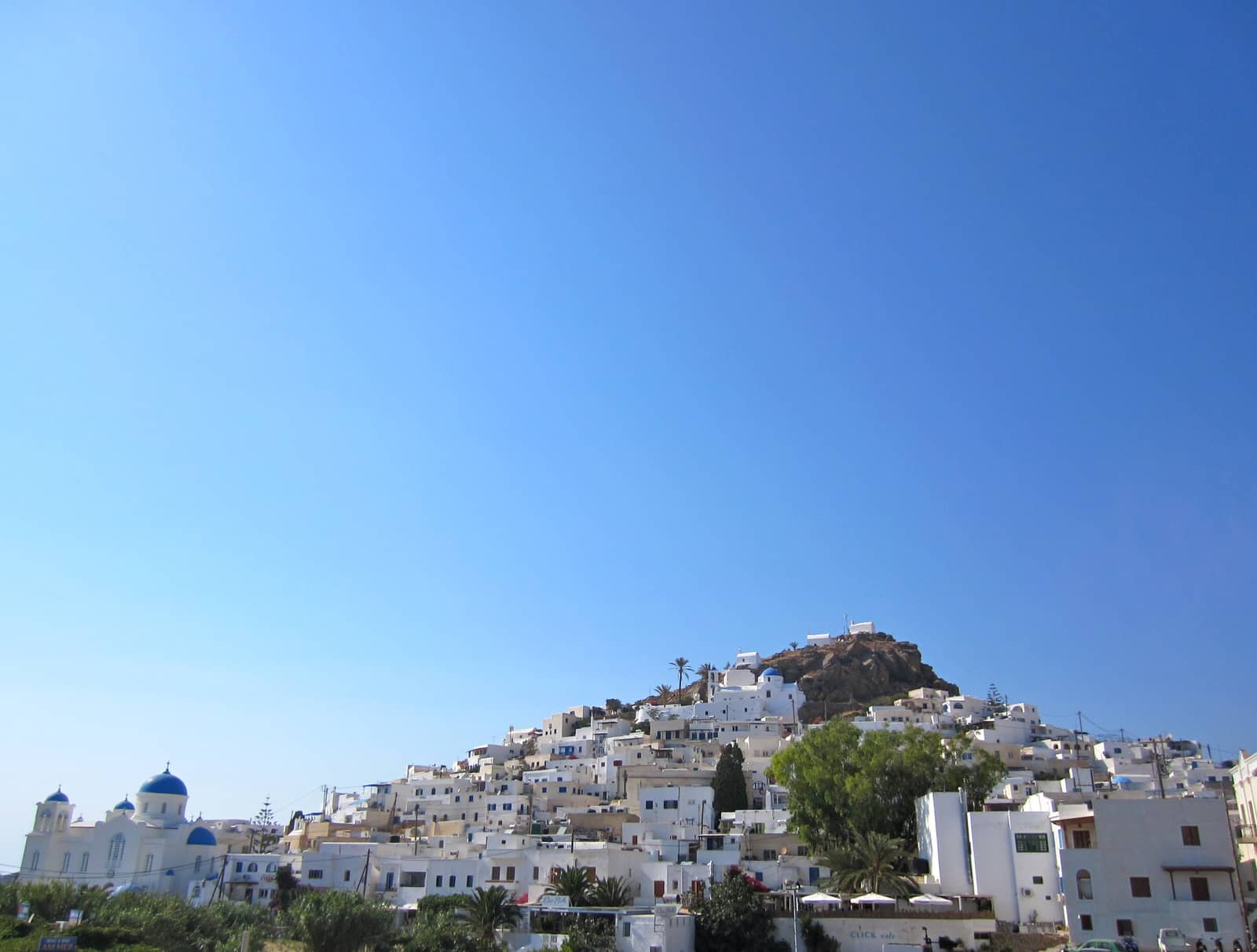
One kilometre up the fertile Kato Kampos valley, picturesquely situated on the hillside, is the chief place on the island, Ios. Its white Cycladic houses and 20 or so churches and chapels are enclosed within a dilapidated circuit of medieval walls. On the hill above the village stands a double of typical windmills.
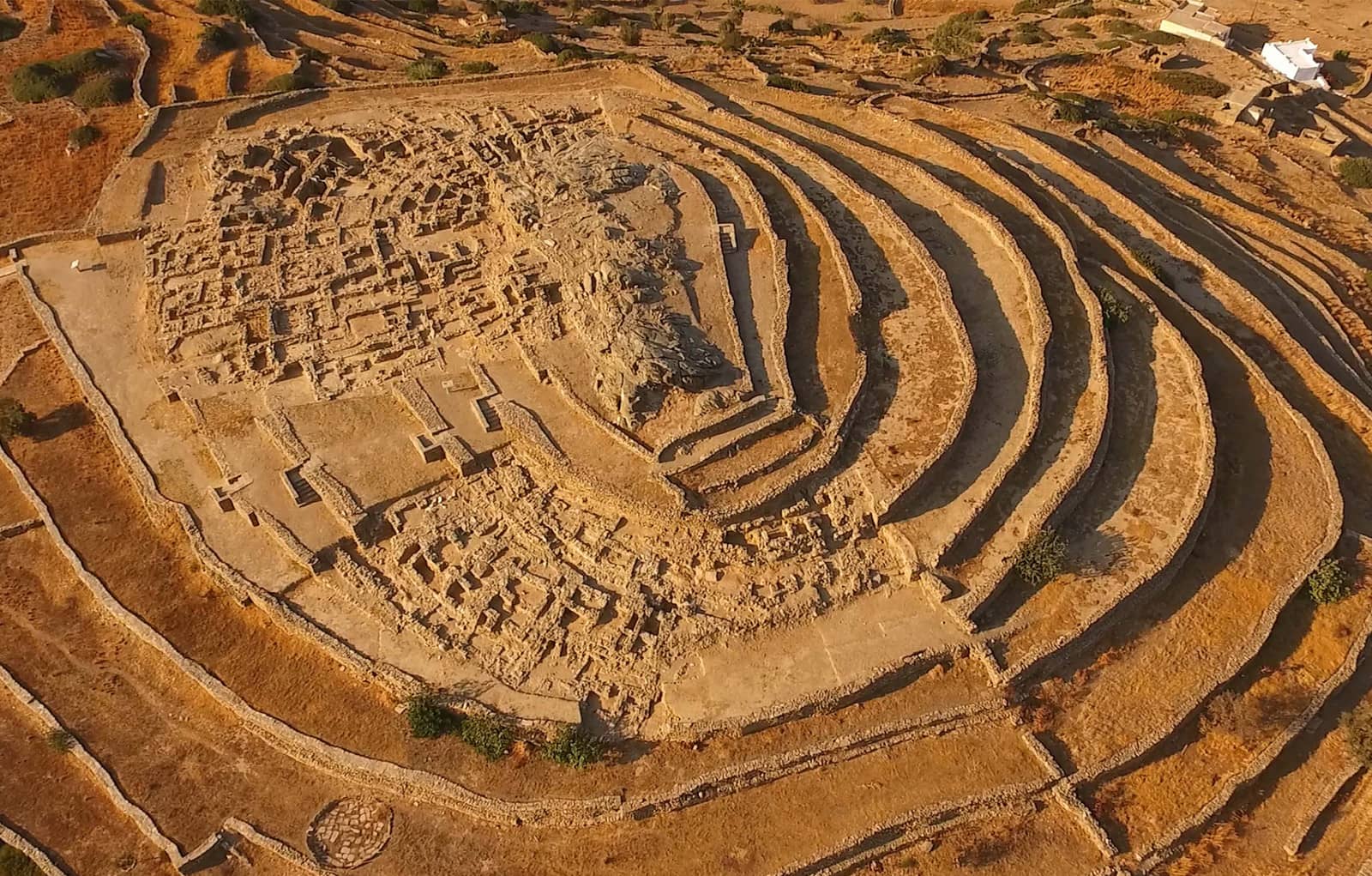
We rented scooters to visit the unique Skarkos - Σκάρκος excavations, an absolute must-see!
Moreover, the Archaeological museum of Chora harbours the findings from Skarkos area (3rd – 2nd millennium BCE), as well as exhibits from from the ancient Chora until the 7th c.
Outside the main sailing season Ios has a relaxed atmosphere, there isn't much to do but you can wander around, get good provisions and the capital isn't overrun by tourists.
Recently the island and the port have become far more appealing.


Apart from its nightlife, (nudists) beaches and the crucial Skarkos archaeological site, Ios island is the more practical stopover between Paros and Santorini, considering that Alopronia/Skala port on Sikinos offers only limited provisions. The Chora on Sikinos, however, is unfrequented and even more alluring.
Ios island ports & anchorages
Clockwise ↻
See my guide to Mediterranean mooring and anchoring.
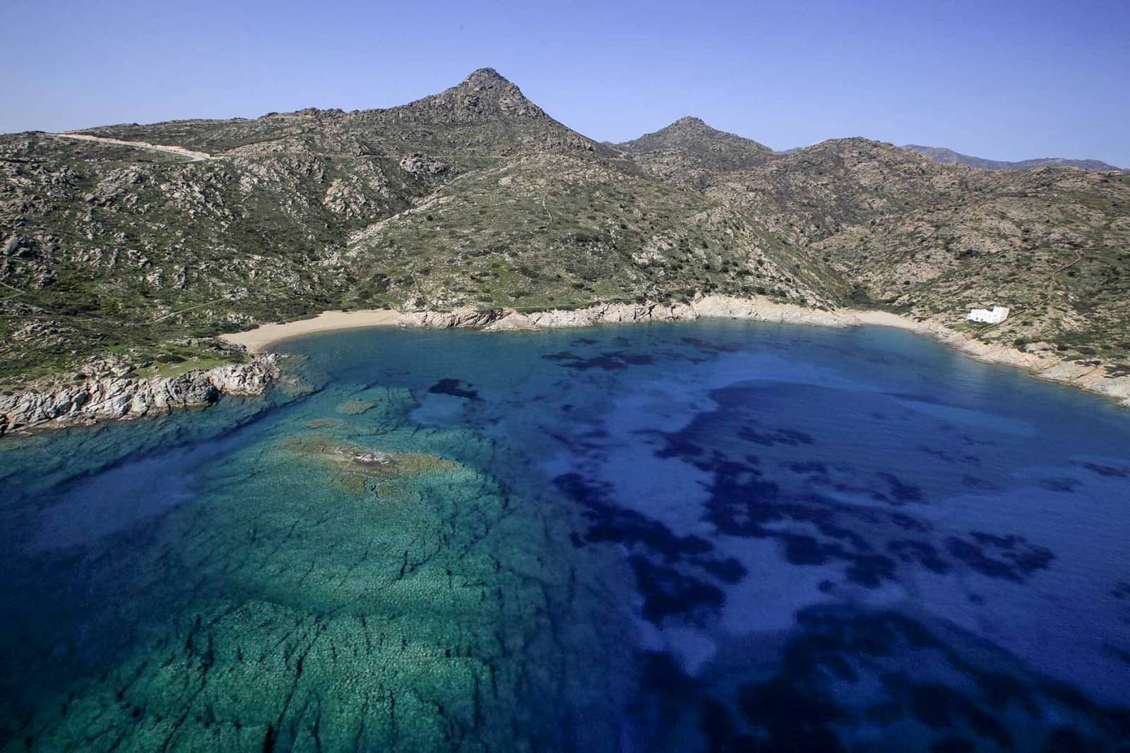
Ag Theodotis
On the NE coast of Ios island is the delightful Agia Theodotis - Αγία Θεοδότη bay – open however to N – E winds – with an equally enjoyable beach Lat Long
Quiet surroundings; “Koukos” taverna with tasty dishes; fecund valley in spring; use a tripline to cope with several sections of black (discarted telephone?) cables on the seabed.
Views towards Irakleia island in the distance.
Psathi
The rather exposed beach of Psathi - Ψάθη can only be used in calm weather Lat Long Cables on the seabed reported here as well. There is the excellent “Alonistra” taverna - Ταβέρνα Αλωνίστρα further inland.
The importance of Psathi was clearly greater in ancient times.
There are spolia from an Ionic Temple to Poseidon Phytalmios “the Nourisher of plants”, which stood stood below the church of Ag Nikolaos, also known locally as the Panagia “tou Pori”; follow the coast ±400 m south of the anchorage until you see the palm tree. The high podium built of eroded schists is visible below the north side of the church: other spolia lie in the vicinity.
Furthermore, there is an arch of an aqueduct, and on the islet of Psathonisi there are proto-cycladic remains, not recognisable.
The Venetian Castle “Palaiokastro” is a highly recommended one hour hike from the anchorage, alternatively via scooter from Ios port.
Tris Klises
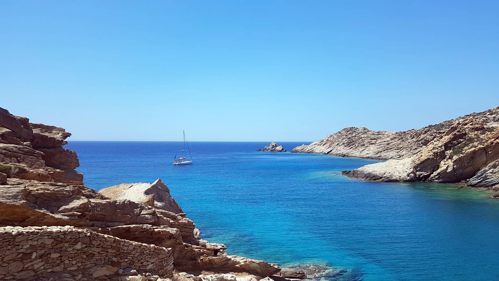
Tris Klisies or Tris Klises - Τρεις Κλησιές bay is one of the highlights of the Cyclades: drop anchor south of the colourful reef or in either of the two northern coves, my preference is the NE corner in 4 – 6 m Lat Long
Great snorkeling and fishing; seabed is sand / weed / rock, make sure the anchor is holding, in Meltemi conditions consider moving to Manganari bay.
Agonisingly, this ravishing area is under attack and might well be turned into an ugly “marina” .
Fortunately, since 2019 an opposition has formed to campaign for the preservation of the natural beauty of the bay, see Save Tris Klises. As for now it remains an engaging anchorage where sailing yachts and supporters are very welcome.
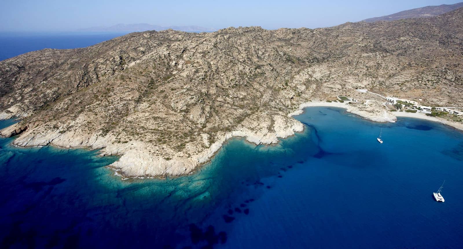
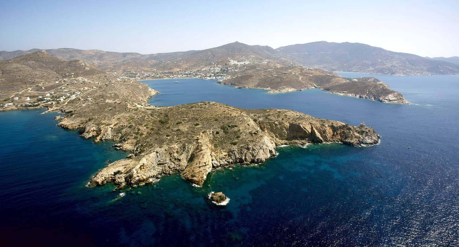
Manganari
The sheltered and shallower bay of Manganari - Μαγγανάρι is more frequented. On the east shore some holiday villas, a bar and a taverna make for a livelier but still very attractive venue. Sun bathing tourists – including nudists – will arrive over land or via tripper boat.
The east anchorage (indicated in GPW) is not really convenient, aim for the north and especially the west coves Lat Long
Both Navionics and Eagleray attentively show the submerged rock / obstruction east of these two tiny beaches.
See chart symbols for the meaning of e.g.Mediterranean mooring and anchoring and
See chart symbols for the meaning of e.g. ![]()
Moreover, EagleRay mentions an abandoned rope in the middle of the bay, in depths of 12 m.
In stronger northerlies anchor in 3 – 5 m as close to the beaches as possible; more Meltemi-proof than Tris Klises due to ideal sandy bottom; strong gusts from the north.
Trypiti
Trypiti - Τρυπητή bay on the SW coast of Ios island is virtually unknown to the sailing community, yet there is adequate shelter in strong northerlies in a quite spectacular setting Lat Long
The NE cove with the miniature beach is too shallow for keeled yachts; the area is uncharted; sand / rock / weed, doublecheck your anchor; open to SE – WNW winds; totally off the beaten track; beach dwellers can reach it through a canyon just wide enough for a car.
Aside from two small villas there are just a few tamarisk trees and inquisitive goats.
Mylopotas
Mylopotas or Mylopotamos - Μυλοποτας in Mylopotamou bay is the vivacious and famous beach of Ios island, with plentiful restaurants, bars, shops and even a “beach club” with swimming pool, as well as water skiing and scuba diving.
Gusts are either north or north-east and the safest anchorages are 400 m west of the beach, right under the cliffs of a tiny double headed bay Lat Long or further west in Kolitsani - Κολιτσάνι cove Lat Long
Note the perilous Xeres reef off Cape Xeres between Ios port and Mylopotamos bay.
Koumbaras bay to the left and Mylopotamos bay on the right (south) of the entrance.
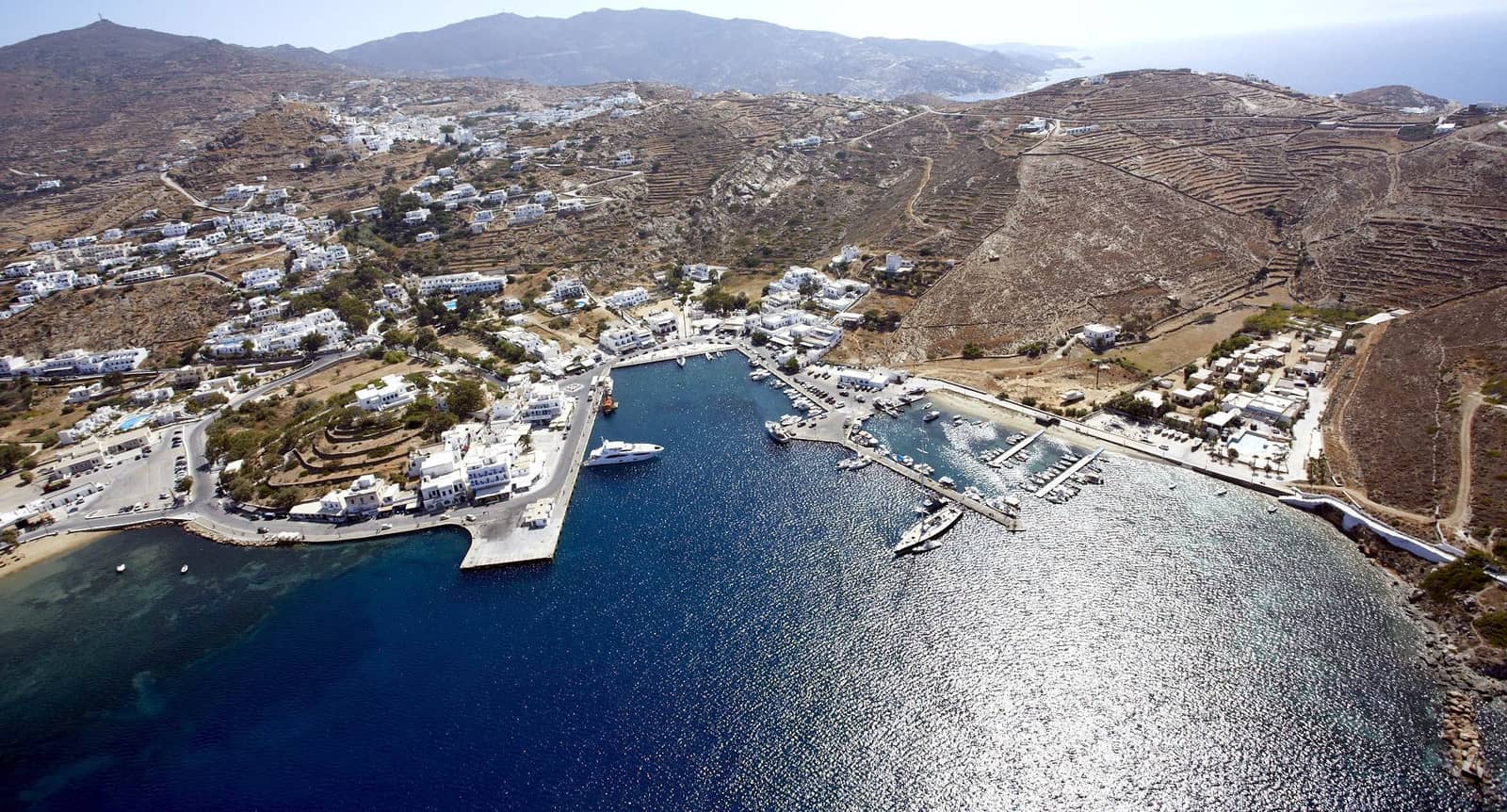
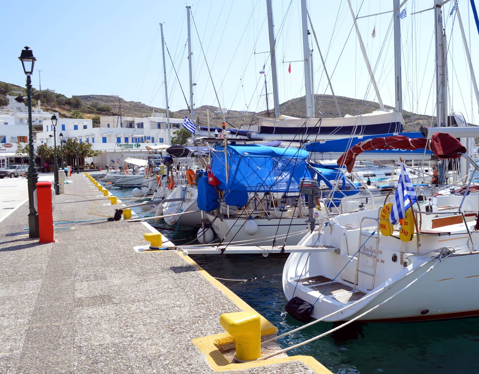
Ios port
The bustling port of Ios - Ίος is one of the few places in the southern Cyclades that provides sufficient and carefree berths for visiting yachts.
The approach is straightforward except for the myriad of fast ferries and hydrofoils as well as the Xeres reef. The strong Meltemi gusts are NE.
VHF 12 or 19. In the east basin visiting yachts can pick up laid moorings (no anchoring allowed) and go stern-to the immaculate boulevard. From there it is a lovely shaded walk up to the Chora, be sure to include a visit to the local Archaeological Museum.
Rent scooters to visit Palaiokastro, Skarkos and to pay homage to Homer at his “Tomb” in the north of the island.
Koumbaras
Koumpara or Koumbaras - Κουμπάρα bay directly north of Ios port offers much less shelter than Mylopotas, also anchoring is largely prohibited, so overrated. Strong gusts from the north; not our cup of tea due to tourist resorts and beach clubs.