Corfu sailing holidays
Corfu - Κέρκυρα, or “Kerkira” as the Greeks call it, is the most important and most northerly of the Ionian Islands and is situated only 1 NM off the coast of Albania and the Greek region of Epirus (mainland Greece). “North Ionian” and “Corfu island” are used interchangeable.
It houses one of the main charter bases for most yacht charter companies and offers gentle green uplands in the south and rugged limestone hills in the north, rising to 911 m in the double peak of Pantokrator, and more than 10 must-see ports along its coasts and double that on the surrounding Paxos islands, Diapontia islands and mainland.
The bucolic landscape is a blend of long slender cypresses, ancient silvery-gleaming light-green olive trees and a capital with Italian flair.
During Venetian times a premium was paid for every new olive tree planted; now these have grown into forests reaching 25 m high.
Even back in the late 19th c. the picturesque island with its lush green landscapes, peaceful villages and superb bathing coves, was attracting holiday guests. The islands interior is the most delightful, particularly in the mountainous north, with its secluded towns and villages where times seems to stand still. Heavy tourism, however, has left its mark on Corfu.
- All Greek islands
- Ionian overview
- Corfu, North Ionian
- Lefkas, Meganisi
- Kefalonia, Ithaca
- Zakynthos
- Sailing itineraries Ionian islands
British Admiralty Chart 205
Mythology and history
Corfu is thought to be the Homeric Scheria, the land of the Phaeacians and their king Alcinous.
Odysseus, who was stranded on the shores of Scheria during his Odyssey, was brought to Alcinous by Nausikaa, the beautiful daughter of the king. There he related his adventures and was finally able to continue his journey home in one of the Phaeacian king's ships.
Corfu was colonized by Corinth in 734 BCE, but developed into a powerful State, which threatened the mother city. A naval victory by the Corinthians over the Corcyraeans in the Sybota Islands – probably round the mouth of the River Kalamas – was a major factor in the outbreak of the Peloponnesian War.
In 229 BCE the island was captured by Rome, and when the Empire was finally split in two in 395 CE became part of the Byzantine Empire.
The medieval name of the island is believed to be derived from the Greek Koryphoi: “Peaks”.
From 1386 to 1797 Corfu was held by Venice, thereafter it was briefly part of the Napoleonic empire; and in 1815, together with the rest of the Ionian islands, it was assigned to Britain. It was reunited with Greece in 1864.
In the course of its eventful history the island was frequently devastated and plundered, so that it has preserved few relics of ancient or medieval times.
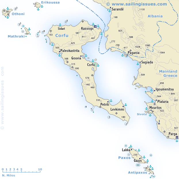
North Ionian ports & anchorages
Corfu island
Clockwise ↻
Diapontia islands
Paxos & Antipaxos
From north → south :
Mainland Greece
From north → south :
Corfu island
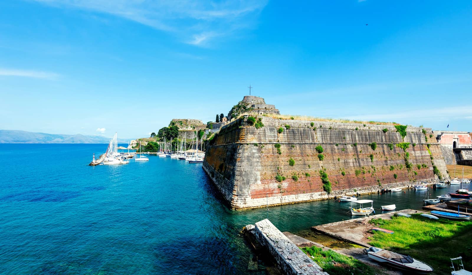
Corfu town
The appearance of the island's capital, Corfu - Κέρκυρα, situated on a promontory on the east coast, is dominated by two mighty fortresses with the elegant old town spread out between them.
The old town has been added to the UNESCO's list of World Heritage sites. It is a maze of lanes spanned by buttress arches alternating with splendid palazzi and ornate wrought-iron balconies, the product of Venetian, French and British occupations.

Most ports lies on the northern edge of town, towered over by the massive New Fortress (1546 – 1588). From these harbours, the main shopping street leads to the Spianada “esplanade”, one of the most enchanting squares in all of Greece.
The west side, with its arcades and cafés, is called Liston.
Standing on the north side is the Neo-classical former Governor's Palace (1818 – 1823), built for the British High Commissioner and later becoming the summer residence of the Greek king in 1864. A bridge on the east side of the esplanade leads across a canal to the old Fortress.
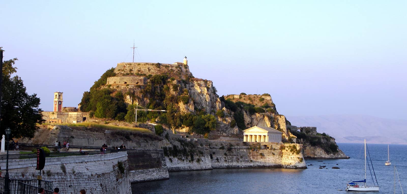
The fortress dates back to 1386 and was expanded between 1572 and 1645. An explosion in the powder tower destroyed most of the buildings in the 18th c., which is why the present buildings date largely from the British period.
The Anglican Church of St George was built in the style of a Doric temple in 1840.
Spreading out to the north of Nikiforou Theotoki street is the picturesque old part of town, Kambiello, with its Italianate and Venetian-style houses and a number of interesting ecclesiastical buildings.
Visit the Archaeological Museum plus the following marvels south of Garitsas bay: the Mon Repos Villa, The Church of Iasona (Jason) and Sosipatros (Sosipater) – dating from the 12th c. – who brought Christianity to Corfu in 45 CE, the Temple of Kardaki and the Temple of Artemis
There are four options, ranging from anchorage to marina:
- Spilia: the “new” marina, not safe in strong notherlies
- Mandraki: stunning place and best shelter against the prevailing summer winds; permanent moorings; TEL 6945 377674, VHF Ch 68
- Garitsas bay: anchorage south of the citadel
- NAOK directly south; VHF Ch 72, TEL 6972 117 001
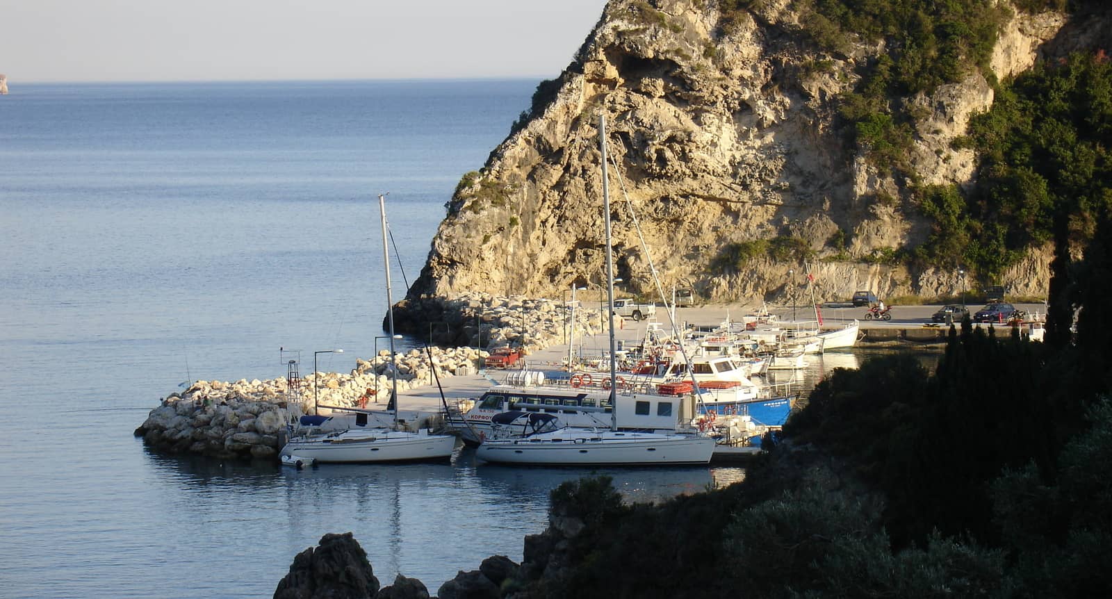
Benitses
The once truly charming fishing village of Benitses - Μπενίτσες now has the stamp of tourism on it, even though its pebble beach is tiny. The Shell Museum – 100 m south of the port / marina – has a rich collection of shells and corals. The scant remains of the bath from a 2nd c. Roman villa are 150 m west of the beach.
Contrary to the info in – otherwise formidable – GWP, you will find allround shelter in the marina (~2014) where there is usually ample space for charter yachts; keep some distance from the red light: shoals /stones; good holding in mud.
Petriti
Petriti - Πετρίτη has remained remarkably unspoilt by tourism and still resembles a small fishing community. Besides the fresh fish there are also flavoursome vegetables and fruits cultivated on this fertile estuary.
The port is fully open to the southeasterlies and over 5 Bft you should leave for Benitses.
If there are berths available go stern or bows-to the mole between the street light (stone!) and the extremity.
Often the outside of the mole is used, yet commercial shipping can cause a nasty swell.
Solid holding in mud/weed, so in summer you anchor in the bay and go ashore by dinghy: steer towards “Taverna Mythos”.
Lefkimmi
Lefkimmi - Λευκίμμη is the hidden gem & capital of south Corfu. The river mouth – Skala Potamou Lefkemmi – might seem the logical entrance to town, yet the river Bouka is too shallow.
The river leads to Lefkimmi, 2 km inland, a town that is relatively untouched by tourism and has managed to stay traditional in a charming way. “Agkali /Agali Café Restaurant” facing the canal.
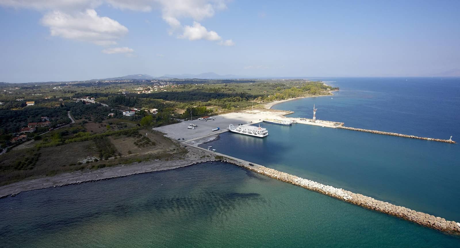
The actual port is Limani Lefkimmi further south, which serves as a hub for Paxos and Igoumenitsa. A harbour official will appoint you a spot, VHF Ch 12, likely alongside on the north quay; there are silts in the south-west of the basin.
In summer the prevailing NW can cause confusing seas making the port untenable over 20 – 25 knots. Also the coming and going of ferries will make it difficult to leave the yacht unattended in such conditions. Best to be stubborn and go stern-to and as far east as possible.
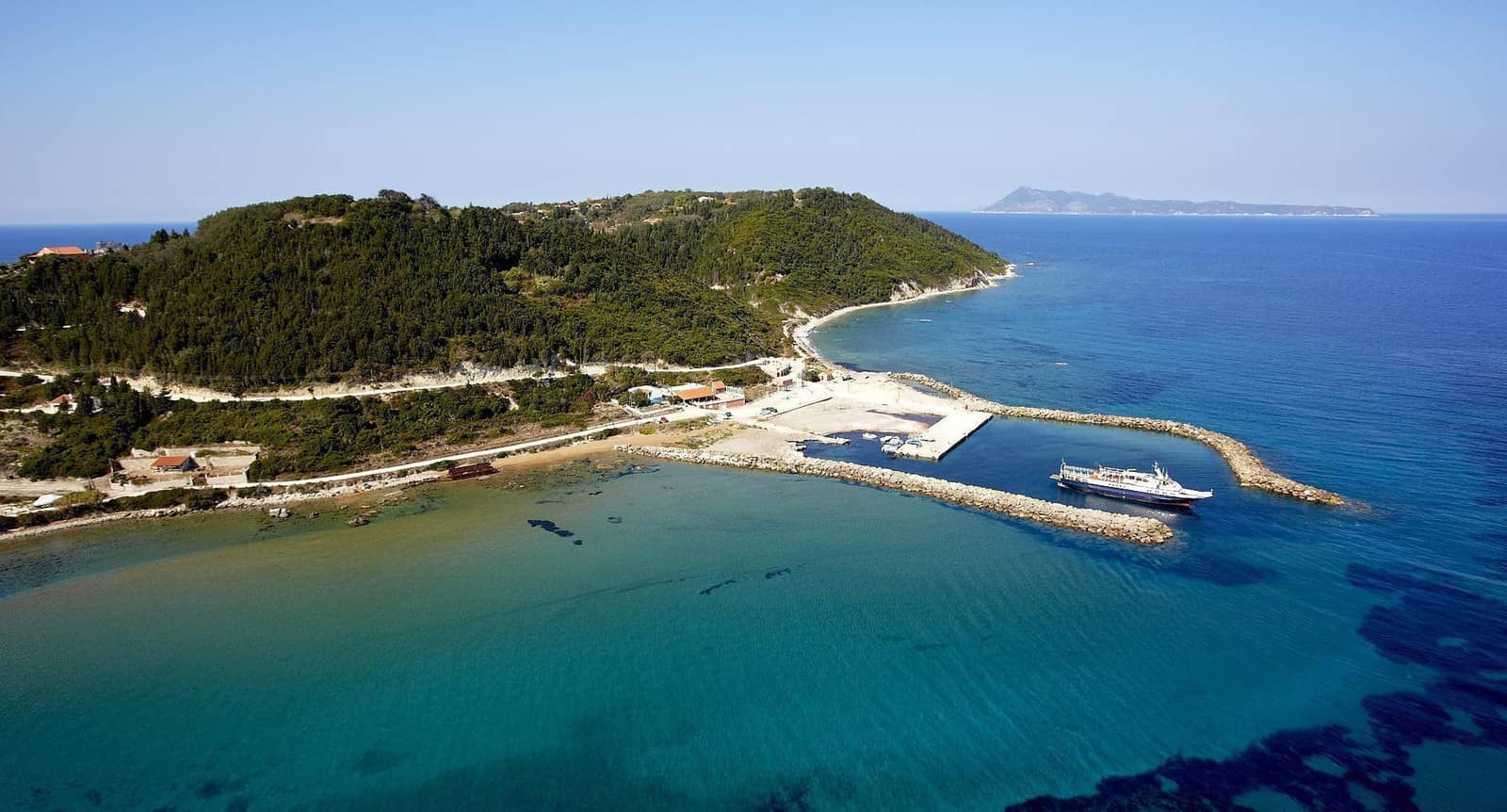
Palaiokastritsa
Palaiokastritsa - Παλαιοκαστρίτσα is nested in exceptionally beautifully environs. Explore the Monastery of Panagia Theotokos (Spiridonas), built in 1228 on the peninsula on the outskirts of town. Adorned in luxuriant flowers, it presents a pretty picture with its campanile and a small museum.

The pontoons in the middle of Alipa port are for locals boats, whereas visiting yachts can go stern-to the mole (or use the small pontoon near the light, when present); the already large fleet of tiny motor yachts (day trips without captain) is taking up more berths, post-COVID ; strong southerlies and easterlies can cause huge swell in the area.
With north or east winds, you can anchor in Liapades bay around Cape Kosteri; good holding in sand.
In lighter air the anchorages directly north and east of the port can be used, mind the abundant rocks, islets and reefs.
Spiridonos bay is my crew's favourite. Moreover, you will no doubt appreciate the Corfu Aquarium.


Ag Georgios
The wide bay of Ag Georgios - Άγιος Γεώργιος – with its long curved beach and aquamarine waters – is guarded by the peninsular Cape Arilla, which yields two additional anchorages:
- At the beach in the north corner of Agios Georgios bay
- East of the isthmus of Cape Arilla Lat Long
- West of the isthmus: Porto Timoni bay , which is open to the prevailing NW but otherwise a glorious spot Lat Long
At the isthmus you will find the path that leads to the Agios Stylianós Chapel which is almost hidden in the rocks.
Kassiopi
Kassiopi - Κασσιόπη differs from Corfu's other tourist centres in that its heart, centred on an idyllic harbour with the remains of a 13th c. Byzantine castle rising over it, is still seemingly quite original. Standing not far from the harbour is the peculiar Church of Panagia Kassopitra (1590); the residence of the priest is above the nave.
The harbour of Kassiopi offers shelter from the NW – S – E winds and in case of a strong NE move to the anchorage.
The east part of the mole is to be preferred: deeper and with less rocks. You might want to go bows-to often with a long line (up to 10 m !) and use the dinghy as a ferry to keep the rudder out of harm's way. A strong WSW will hug the coast and locally become a WNW or even a NW wind.
The anchorage of Kassiopi is in the Imerolia bay just to the west. Anchor in the east cove; open to the north-west (Eagleray mentions safe upto 5 Bft); plans for a marina in this bay with first 60 berths and eventually 300+ berths.
Ag Stefanos
Ag Stefanos - Άγιος Στέφανος bay is a very solid anchorage in the prevailing NW winds. In the approach from the north keep well clear of the coast and the lighted Serpa Reef
The GWP suggests that it is possible to anchor and take a line to the pier in Ag Stefanos, but depths are less than 2½ in the vicinity and commercial ships can send in a swell.
We haven't tried one of the “wooden jetty + taverna diner” combinations.
Notable anchor bays further south:
- Kerasia beach; the homonymous taverna has gourmet fish dishes
- Kouloura; a small fishermen's port (too shallow), anchor near the beach
- Kalami; beach, tourists and tavernas, not our cup of tea…
- Gialiskari Lat Long the best option in easterlies
- Agni; three piers to take a long! line to – allow for possible swell – and visit “Korina's Kitchen & Cocktail Bar“.
Ypsos
Ypsos - Ύψος port is touristy, and therefore often overlooked, yet offers allround shelter and good holding Lat Long Go bows-to the breakwater, which has a wide flat top but smaller ballasting on the bottom.
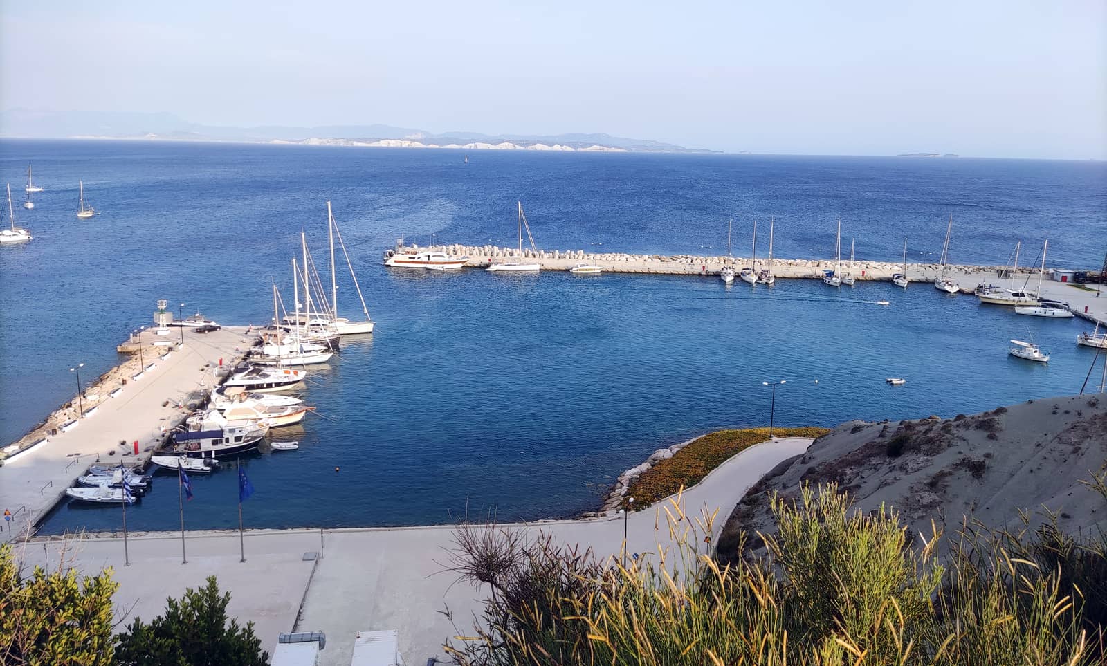
Gouvia
Gouvia - Γουβιά is were nearly all yacht charters (sailing, motor boats, catamarans) start and end in the North Ionian – aside from one-way itineraries to and from Lefkas or Prevaza in the south Ionian.
The channel is marked by 2 pairs of red & green buoys. Anchoring in the north bay is now prohibited. The Gouvia marina is one of the prime marinas in the east Mediterranean.

On both failed attempts to conquer Corfu, the Ottomans made landfall in Gouvia bay, and – also because of the secluded nature of the bay and surrounding forests – the Venetians chose to establish their arsenal (or ship yard) here. Three docks with arches, skeleton-like, can still be seen near the marina.
Diapontia islands
The Orthonian or Diapontia islands are an archipelago north-west of Corfu, consisting of a number of islets with increasing numbers in both tourists and inhabitants – but still very much idyllic – Othoni (Italian “Fano”, meaning lamp), Erikousa (Italian “Merlera”), Mathraki, as well as some smaller isles plus a broad range of rocks and dangerous reefs.
From Othonoi it is just 47 NM to Italy's Santa Maria di Leuca

Othonoi
The westernmost point of Greece: Othonoi - Οθωνοί is a (small) hiker's paradise with trails connecting all settlements and leading up mount Merovigli, which offers majestic views across the archipelago and the Adriatic. Most of the pristine beaches are accessible only by boat.
Keep well clear of the east cape of the island, which is surrounded on all sides by shoals and rocks.
Moreover, the Ammos and Aflakia approach should be done from the SW; note Aspri Petra reef south off Ammou bay.
The anchorage of Ammos is open to the southerlies; good holding; anchor in 3 m away from ferry quay; we used a tripline here; tavernas ashore.
The newer harbour of Aflakia offers allround protection, the buoys that mark the adjacent shoals could well be repositioned again due to continuous dredging; depths will increase; final approach from SE; moor alongside on either side of the entrance.
Fyki bay is a gorgeous and safe anchorage in southern winds on the north side of the island Lat Long drag the second anchor onto the beach or take a line to the isolated rock directly west of the Fyki beach; the use of a tripline is advised.
Ereikoussa
Ereikoussa - Ερείκουσσα is a fertile island (cypress and olive) situated east of Othonoi. The last decades, a sizeable part of the population emigrated to the USA, their properties turned into holiday homes. These former inhabitants – e.g. over 300 Erikoussian families in New York – frequently return to their island.
Recently the port renovations have more or less finished, the South quay and breakwater have been straightened.
Safe laid moorings on both the East and South corners, and the whole basin is now squared and dredged to 3 – 4 m.
Approach from the south to avoid the reefs running from both capes. As before it is also possible to anchor in the bay; preferably west of the submarine cables (Navionics) away from the electricity generating plant and nearer to the noteworthy “Beach Taverna Anemomylos”; good holding in sand. In strong southerlies move to Mathraki or Fyki bay on Othonoi or Kassiopi on Corfu.

Mathraki
Mathraki - Μαθράκι island is enveloped by reefs, (awash) stones and rocks, especially on the south and east where these shoals connect almost continuously with Corfu island: approach from the N – E.
The inner basin is protected against all waves / winds, while heaving swell affects the outer basin also in southerlies; <5 Bft you can use the outer quay but mind the wash of the ferry. Mediocre holding due to dead weeds, set both anchors.
Note, that the inner basin is often silted up and has depths <2 m, currently partially dredged.
In lighter air, anchor in 5 m roughly in between the harbour entrance and the stone awash to the SE; dead weeds.
The northern part of the island is the prettiest; wooded hills with footpaths; enjoy the sunset from Cape Sakki.
Paxos & Antipaxos
Located to the south of Corfu island are the isles of Paxos and Antipaxos - Παξοί και Αντίπαξοι, which are numbered among the most attractive destinations in the North Ionian because of the exceptionally picturesque landscape, its exciting coves and fine diving locations. Alternative names are Paxi and Antipaxi or Paxoi and Antipaxoi.
See Greek chart terms.
Innumerable olive trees and cypresses dot the countryside of Paxos, its west coast features stunning cliffs and numerous caves (called “gráves” by the locals), arches and domes. Moreover, even a few of the endangered Monk Seals make their home here. Drop anchor at the Achai beach + Blue Cave Lat Long and the Sea cave of Ypapanti which served as a hiding-place for submarines Lat Long
The east coast runs along gently and also has a few pretty pebble beaches.
There is a Venetian fortress from 1423 as well as the former Panagia Monastery on an islet just offshore of the harbour and main town of Gaios.
To the south-east of Paxos is its smaller, rocky “sister island”, Antipaxos, with alluring, isolated beaches, especially Vrika and Voutoumi on the east coast. There are a few inhabitants raising sheep and producing delicious wine.
Lakka
Lakka - Λάκκα bay on the far north of Paxos offers mesmerizing sceneries, that unfortunately can only be fully appreciated outside the tourist season.
On the approach from the SE, hugging the coast, mind Arkoudaki reef ~120 m offshore; likewise mind the Marmara / Xolitharo islets and reefs that extend NW of Cape Lakka.
Prevailing wind is NW. In N – NE winds >6 Bft it will be difficult to enter Lakka bay. Furthermore, strong westerlies will cause too much swell near the village area.
Taking a line ashore on the west Lat Long – as GWP suggest – and still have 1 m of water under the keel will require a very long line for most vessels
There are 3 excellent local restaurants: “O Diogenis Taverna”, “Nionios Taverna” and “Stasinos Garden Restaurant”.
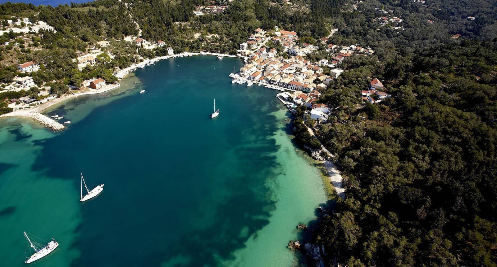
Longos
Longos - Λόγγος is a charming fishing village with fish restaurants where the little port, unfortunately, is fully reserved for the fishing boats, but sometimes it is possible to use the extremity or the outside of the mole. The bay is open to the N – SE; Lithária rocks and Paxoi reef make the approach from the south-east and east difficult ; two spots to take a line ashore: Lat Long and Lat Long
Kipiadi
The bay of Kipiadi - Κιπιάδι is a surprisingly good anchorage with just flora & fauna and a beach Lat Long
Gaios

Gaios - Γάιος is the main port of Paxos which attracts herds of tourists from Corfu. The village with its Symi-coloured mansions and wooded surroundings is indeed very appealing. Italian flagged yachts also arrive in abundance at this port of entry.
When entering or leaving the canal through the north passage, keep well clear of the larger islet's NW tip. The southern passage is uncomfortably shallow. Arrive early to secure a berth; anchors will cross and ferries will create chaos and wash.
Between Parga on the mainland and Gaios port is the Panagia / Madonna reef.

Mongonisi
The islet of Mongonisi - Μογγονήσι nearly touches the south tip of Paxos island and offers enthralling scenery: grottos and sulphurous fumes in the east of the inlet. Go stern-to the N quay (rocks protruding) or the E short quay section (Carnayo bar); good holding once through the weeds; not suitable in strong NE winds. Taxi to Gaios €10; fine taverna; swim in the cave on the south side of Mongonisi.
A lunch-stop anchorage between Monogonisi and Kaltsonisi islets, near the chapel.
Eddies SE of Kaltsonisi.
Agrapidia
Agrapidia - Αγραπιδιά is a tiny harbour for local fishing boats on Antipaxos. Anchor north of the breakwater and take a line to it. Amazing clear waters, pebbled beach and lush tree-clad hills; open to the N – NE Lat Long
Kalamitsa
Kalamitsa - Καλαμίτσα on the south-east coast of Antipaxos is spectacular so you won't be alone, but the bay is long enough to provide privacy. Sea caves on the coast directly south of Kalamitsa; the bay is open to the S – E; not always good holding in sand / weed / stones Lat Long
Further reading
- See chart symbols for the meaning of e.g.

- Mediterranean mooring and anchoring
- The sailing season
Mainland ports
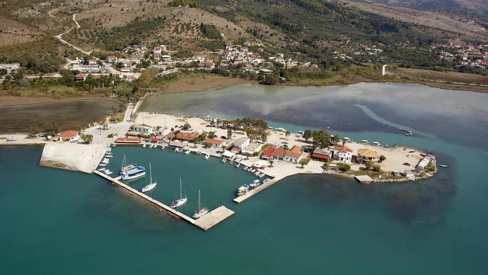
Pagania
The dogleg bay of Pagania - Παγανιά offers allround shelter. Like this whole northernmost coast of mainland Greece, this bay is home to several fish farms (now also in the W cove).
Sagiada
Sagiada - Σαγιάδα port and village is located in the Kalamas river delta, where the inhabitants make a living with fish (farms) and tangerines.
The port entrance is too narrow – just 12 m – to navigate safely in rough weather. Moreover, the depths inside are 2 m at best, so only catamarans and smaller keelyachts should enter and plow through the muddy bottom. Best to moor alongside on the outside where the depths are slight over 2 m.
Most of the Kalamas estuary is protected by the “Natura 2000” program. Dozens of trails, info at the beach and at the visitor centre.
The rich history of the area can be seen at:
- Gitani: Near the river dam: City of Hellenistic times.
- Mastilitsa: On the homonymous hill in the center of the plain: Settlement of Hellenistic times.
- Strovil: On the conical hill: Byzantine fortress.
- Sagiada Tower: Inside the sea in the salt marsh area. Medieval fort.
Igoumenitsa
In the approach of Igoumenitsa - Ηγουμενίτσα there is Valtou bay – south of the old Kalamas river estuary – which has three coves with allround shelter. Only the west cove currently hosts a fish farm; the larger central anchorage is premium.
Igoumenitsa channel is a VTS but you can motor just outside the buoys where depths are sufficient.
The waterfront of Igoumenitsa is one enormous stretch of concrete, the former new port can be found “under” the park, a wooded hill within the cityscape.
Go alongside or stern-to where directed.
In 2016 plans for a marina were drawn: €40 million and 361 berths… Still no progress in August 2021.
Visit the Archaeological Museum
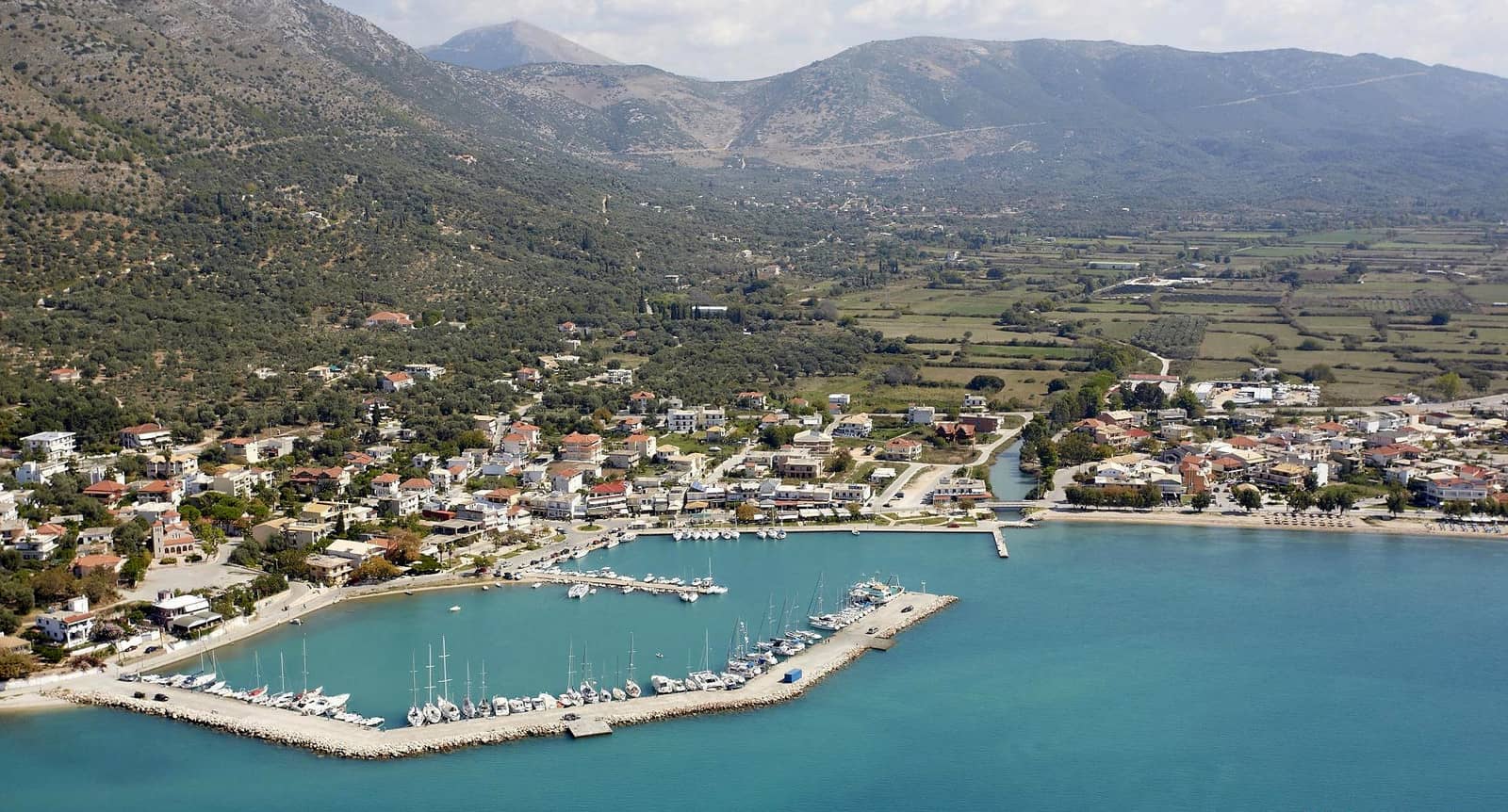
Plataria
Plataria - Πλαταριά is a modern and gentle settlement and the bay is marvellous. Both inside the port and on the quay at the village there are ample berths. Good holding, but make sure your anchor is dug in well: in low barometric weather the breakwater can become submerged by the waves, it is not always a tranquil and safe haven. The village is probably named after an old plane tree (Platanus) and indeed many plane trees provide the required cooling.
Syvota / Mourtos
The name of Mourtos - Μούρτος village was changed in 1959 into Syvota - Σύβοτα to honour the massive naval Battle of Sybota, which was fought in these waters in 433 BCE between the Corinthian and the renegade Corfu fleets, leading up to the Peloponnese War.

The village quay is affected by strong W – NW winds (and prevailing winds are NW) as well as the wake of ferries . The enclosed port, however, provides allround shelter with mostly laid moorings.
Seductive waterfront with many decent tavernas. Note, that Sivota is the small port on Lefkas' south coast.
Zeris bay just NW of the Syvota: cerulean waters, take a line to the wooden pier; modern holiday real-estate along these coasts somewhat spoils the ambience, in lighter air you can anchor further away.
The minimal depths between Ag Nikolaos island and mainland are 22 m according to most charts (C-Map gives 25 , but we made no attempt); currents will match a sustained wind direction.
East of the Mourtemeno islets – in End Bay – is a swimming area, less room to swing at anchor.
Arilla
Arilla - Αρίλλα is a tiny port at the south end of a tremendous crescent beach, built under a rocky promontory. Good holding in sand; open to N – NE; catamarans can moor at the small pier, most monohulls will have to go stern-to the breakwater Lat Long
Parga
Parga - Πάργα is a small town in a truly picturesque setting with islets and its Venetian castle, the lovely Valtos bay on the west and the Ali Pasha ruins in the highland.
The port of Parga is untenable in southerlies and even westerlies bring in an uncomfortable swell. Moreover, water taxis and ferries will occupy at least the end of the pier, which can best be described as a concrete bridge 2 m above sea level → instead of a gangway use the metal ladders; meagre holding reported.

There will be a lack of berths in the height of season, yet the surplus of tourists in the myriad and clamorous tavernas & ouzeries mean you will be more content in Valtou bay anyway.
Likewise inside the port of Valtos there won't be plenty of room for visiting yachts (mind the mooring lines and chains on the bottom). The alternative is to anchor on either side of the new breakwater, or go bows-to or stern-to to the pier or breakwater.
Octopus
8 arms and 3 plural forms:
octopi, octopuses, and octopodes,
yet one is grammatically incorrect… →
It is a short distance to marvel at Parga or the Vlacherna Monastery (early 12th c.) with its conspicuous campanile on cape Ay Spiridon.
The Venetian castle that guards the port is a great exponent of Venetian architecture, with interesting details, such as the Lion of Venice in the entrance, emblems of Ali Pasha's “two-headed eagles”, and a secret path to the sea; all surrounded by cypress trees.
Also very worthwhile are the impressive ruins of the Ali Pasha castle, 5½ km uphill, with grand views over the bays.
Agiou Ioannou
Agiou Ioannou - Αγίου Ιωάννου is a magnificent enclosed bay offering allround shelter in Ay Gianniki beach Lat Long (sand and mud; meagre holding) and especially in Skouliki bay Lat Long (sand and weed, better holding). In light air you can anchor anywhere; in the east use a tripline.
When entering, in front of the first cove on port, there is a fresh water spring 
Prevailing winds are NW – NNW. In earlier days the Parga fishing fleet wintered here.
Fanari /Ammoudia
The bay of Fanari /Ammoudia - Φανάρι / Αμμουδιά rapidly decreases in depth near the eastern shores. Anchor in the north-west of the bay and use the dinghy to get to “Roxani Taverna” at the north side of the village.
The depths of the adjacent river Acheron are often insufficient for keel yachts to reach the quay on the northern bank. This famous river flows gently into the Ionian sea and the entrance – roughly 25 m wide – can easily be identified. In mythology, the Acheron was known as the “river of woe”, and was one of the five rivers of the Greek underworld.
A nearby bay to the south offers turquoise waters and shelter from northerlies Lat Long
Ligia
The approach to Ligia / Lygia - Λυγιά port is precarious with shoals extending over 60 m out to the west and south, and the narrow entrance is silted up to 25 m. Leaving or entering in rough (southerly) winds is ill-advised. If possible take a line to the breakwater and go bows-to the mole; good holding; sandy bottom with stones.
The nearby village has several tavernas, but aim for the “Ψαροταβέρνα SIMOS”, the fish restaurant overlooking the beach to the south.