Alonissos sailing holidays
The long rocky island of Alonissos - Αλόννησος or Alonisos, Allonisos (formerly Khiliondromia; ancient Ikos), still one of the most remote places in Greece, lies half-way along the chain of the Northern Sporades and is the only inhabited island in the NMPANS (National Marine Park Alonissos, Northern Sporades).
- All Greek islands
- Northern Sporades overview
- Skiathos
- Skopelos
- Alonissos
- Pelagos (Kira Panayia)
- Skyros
- Thasos
Next island: Pelagos (Kira Panayia)
A ridge of hills runs along the island from end to end, reaching its highest point in Mount Kouvouli (476 m).
The North-West coast is edged by steep cliffs and has few indentations, but the South-East coast is more hospitable, with numerous sheltered bays and anchorages. In this area there are surprising traces of human settlement reaching back to the Neolithic times.
The population, mostly farmers and fishermen, live almost exclusively in the fertile southern part of Alonissos. On this side are the lovely little port of Patitiri and the Chora of Alonissos / Alonnisos, formerly the chief place of the island, which was largely abandoned after and earthquake in 1965. Commandingly situated above the sea, with extensive views, the village is now increasingly being rehabilitated for tourists.
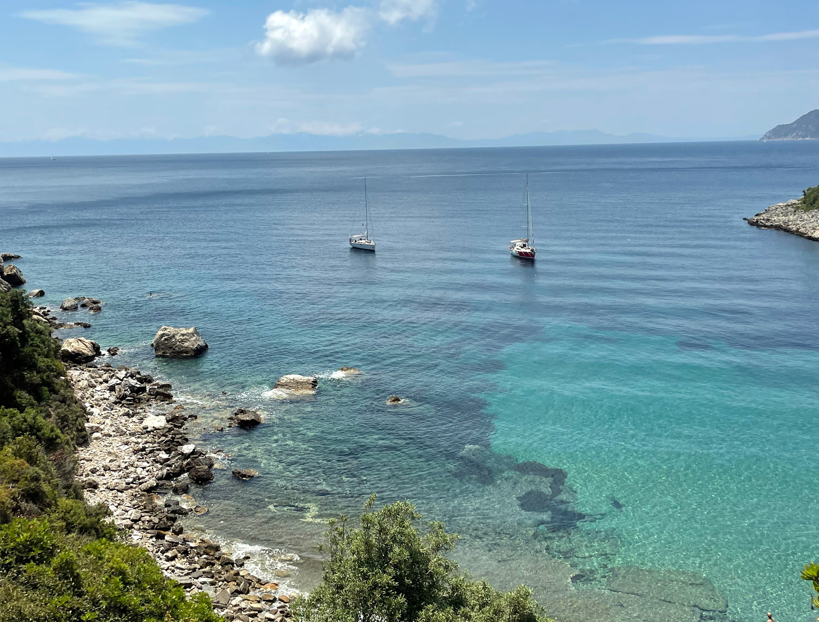
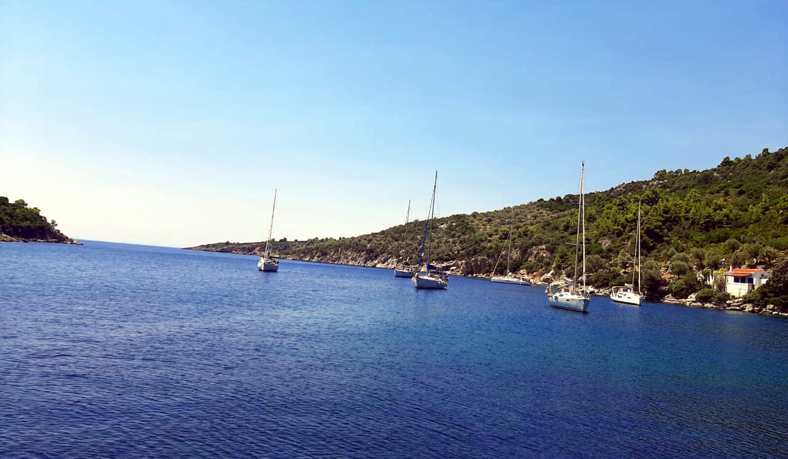
Off the South-East coast of Alonissos, separated from it by a wide sound, is the bare island of Peristera, or “Xero”. Both these islands have an abundance of safe and attractive anchorages which makes this area ideal for sailing holidays. Moreover, ports like Steni Vala, Votsi and Patitiri – are beautifully located and will offer most provisions. Further South-East is the island of Skantzoura, which belongs to the Monastic Republic of Athos (Chalkidiki) and is used for the grazing of goats. Skantzoura has a couple of Meltemi-proof anchorages in the Limani bay and yachts are permitted to visit.
Marine park – Zone B:
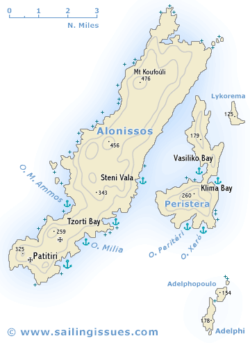
Alonissos • Peristera ports & anchorages
Clockwise ↻
Alonissos
Clockwise ↻
Peristera or Peristeri or Xero
Adelphi
Alonissos island
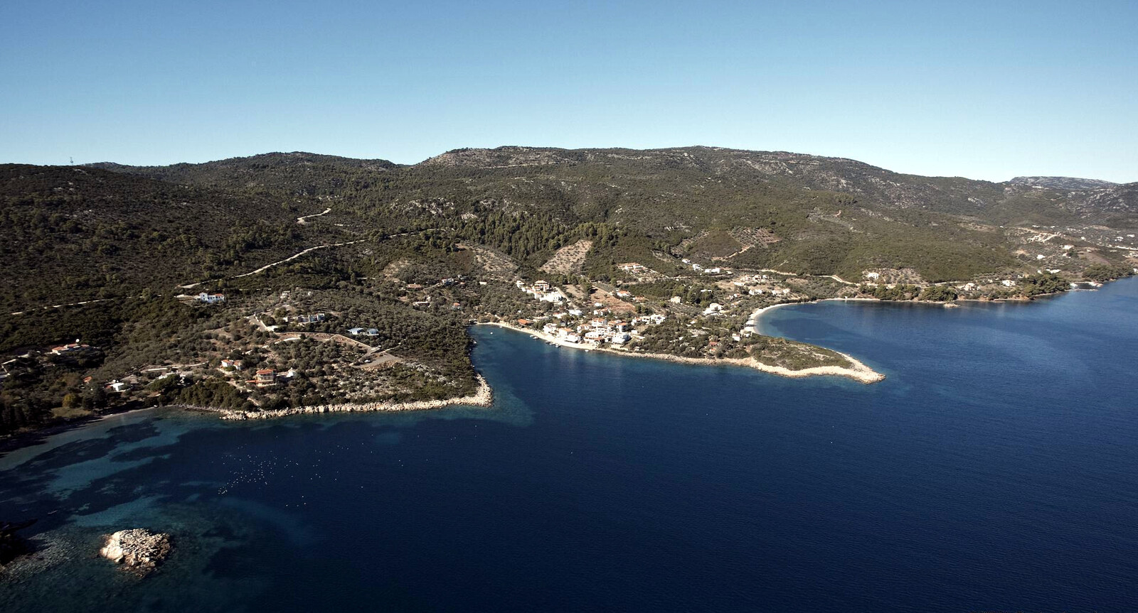
Votsi
Vótsi - Βότση is a dreamy fishing port set in an amazing natural harbour Lat Long inclosed by steep ochre-yellow cliffs on three sides. The West breakwater (added in 2016) means that shelter is now all round.
Approach from the South, since there is at least a rock that covers & uncovers, as well as a shoal just South of the headland; we couldn't locate the buoy that is shown on Navionics.
Once inside, on the West, you will see the pristine EU-funded quay (4 million Euros in 2016) where berths were created for about 30 visiting yachts. Sadly (nearly) all places are filled by boats of fishermen and locals.
There are mainly three solutions when this new quayside is blocked by local craft, and with a little fitting 15+ visiting yachts can be moored:
- Take long lines to the rocks in the East under the highest section of the cliff face, or closer to the swimming area; drop anchor in 8 m and go stern-to taking lines to the rocks; keep your rudder well away and settle in 4 – 5 m depths. There are half a dozen small rings (difficult to make out from a distance) embedded in the rock only along the Southern half of the cliff.
- Take lines to the old (i.e. Southern) breakwater, rather close to the wooded area; anchor in 10 – 13 m depth; good holding and protection.
- Swinging on your anchor is inadvisable as you will risk crossing the anchor chains of the yachts that are stern-to on anchor. Nevertheless, you will find a few yachts or catamarans taking a chance in calm weather.
Mind the old anchors scattered on the South side of the bay
We enjoyed dining at Dendrolimano & Panoulis; taxi to Chora is €12; wear bathing shoes because of the sea urchins; amazing water for swimming and snorkeling, caves! ; a supermarket and a few mini-markets within walking distance.
The port is named in honour of Admiral Nikolaos Votsis, who made Alonissos his base for the Greek naval fleet during the Balkan wars. He is famous for his daring destruction of the Turkish vessel “Feth-i Bülend“, slipping in and out of the port of Thessaloniki with his submarine without being detected.
Rousoumi
Rousoúmi (Rousoum Gialos) - Ρουσούμ Γιαλός lays claim to the most popular beach in the area due to its proximity to Patitiri. The formerly wooded area is now taken over by hotels, apartments and studios blighting some of the scenery.
“Rsoum” (now Rousoum), means “tax” in Turkish.
During the long period when the islands were under the rule of the Ottoman Turks, wine was shipped from this beach and all the island's taxes were collected here by the Turks.
Anchor in 6 – 12 m over weed and sand Lat Long mediocre holding; an (extremely) rolly and shallow bay, and the anchorage is tighter than you might deduce from the chart; swinging on anchor rather than taking a line ashore. The rectangular quay has <2 m depths and was smelly with fish garbage; good snorkeling on the SE corner; the islet to the South is almost a peninsula, there is no passage;.
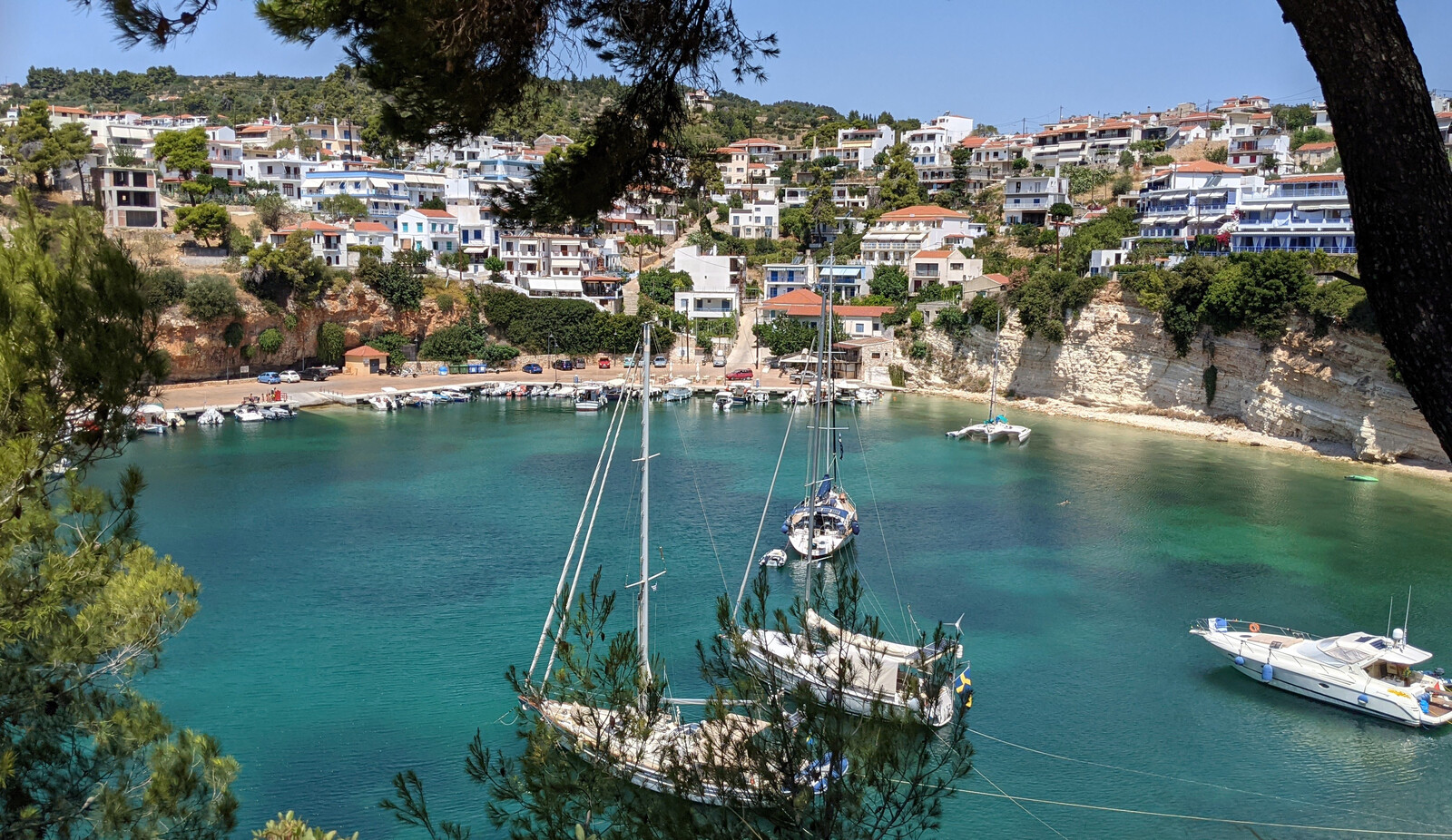
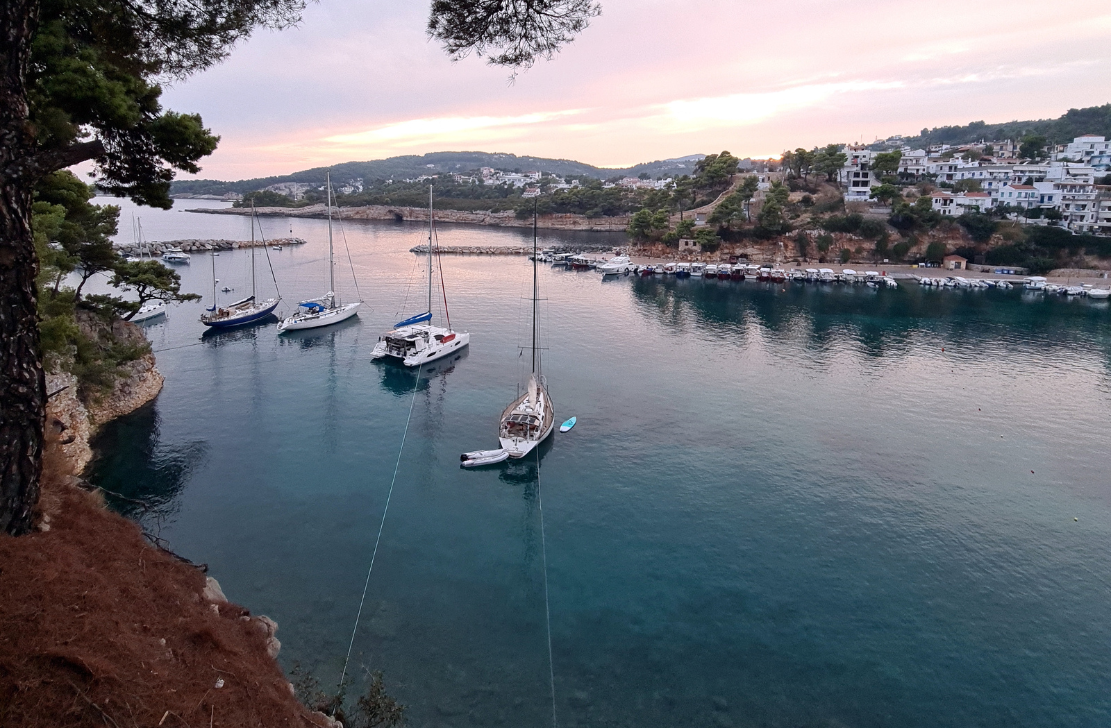
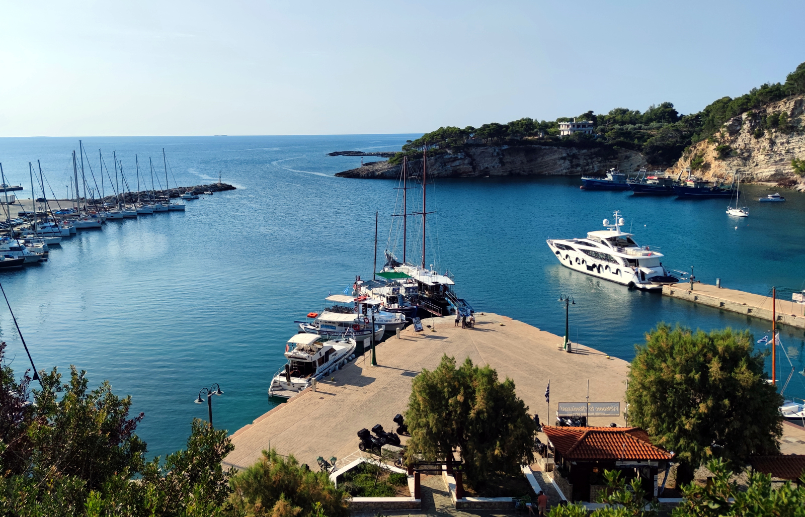
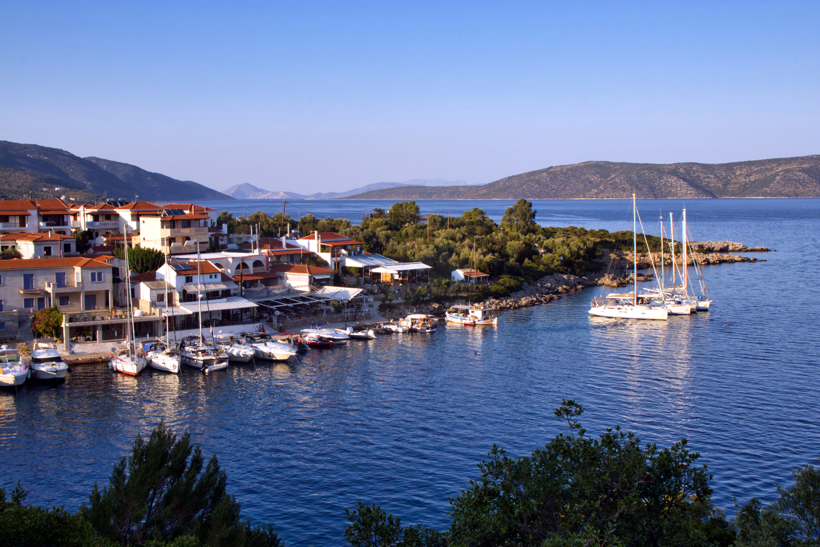
Patitiri
Patitíri - Πατητήρι is the main and ferry port of Alonissos offering all round shelter against the prevailing Northerlies in summer. However, there is substantial rolling especially during Meltemia; in fact, swell is the main hazard here, and you will need to keep your stern well off the quay, utilise shock absorbers (i.e. snubbers) and mind mast-positions with neighbors if you leave your yacht unattended, mind that swell situations can deteriorate rapidly without (wind) indication.
The port is named after the “patitíria”, Greek for “grape presses”, and before 1950 – when the Phylloxera bugs started wiping out the ubiquitous grapevines – half the island was covered with vineyards, with the village being a major producer of wines.
Go stern-to the quay on the NE side (in season contact the harbour Office for a berth, VHF 12) and aim for the quay section that faces SW and avoid the section that faces West. It is near this inward turning corner where most damage occurs: moor >30 m NW of this corner. Worse still, anchor spaghetti is guaranteed because of the concave angle of this corner.
€10 or €20 electricity + water cards are available throughout the port (ferry office, certain cafes, car rental shop and there is a vending machine). These cards can only be used in Alonissos, and you might want to supply newcomers with your partially used cards.
Alternatively, swing on anchor in the basin but mind the permanent moorings on the seabed; the SE cove is clear but open to the prevailing winds.
Aside from a lovely lively atmosphere, there are glorious cliff faces, snorkeling in the basin and good restaurants.
Visit the private museum of Kostas Mavrikis, who also operates “Íkaros” in Steni Vala and discovered the ancient Peristera wreck.
The famous inquisitive seal that frequented the port was killed – likely by a fisherman – with a harpoon in July 2021.
Noisy ferries arrive and depart during the night as well as some fishing trawlers, plus there are a few blaring bars. So when you add the (likely volatile) swell, it can make sleeping cumbersome.
Chora is situated a 35 min. hike uphill (and 25 min. hike downhill) via the old mule track. This village was the capital of the island until the earthquake of 1965, after which the residents moved down to Patitiri. It is marvelously situated and offers grand seascapes. Hearteningly, foreigners and other enthousiasts of the traditional style of the island have restored many of the old houses. Enjoy the winding streets with plenty of pleasant tavernas and small shops, creating an ambience quite different from the rest of Alonissos.

The larger ferries dock behind the breakwater on the left (East), smaller ferries and hydrofoils use the dock in the centre. Hi-res image
Mourtia bays
The largest one is obviously the bay of Megálos Mourtias - Μεγάλος Μουρτιάς where you should only
anchor on the West side of the headland Lat Long to avoid possible electrocution, see below.
The headland has an improvised walkway – with marginally sufficient depths for a dinghy (handy cleats and rings) – that is perhaps within reach with a decent-sized mooring line; large sandy areas to choose from, but best to huddle up in the NW corner; drop anchor in 3 – 5 m; solid holding; an annoying swell can enter; options to take a line ashore; enjoyable “Meltémi” taverna; good snorkeling; charming hike to Chora, follow the red dots.
There are two submarine power cables signalled on the East side of the bay: one sign is posted on the roof of the Meltemi taverna, while the second sign is 200 m East and slightly higher up. These signs are identical – not pointing toward each other – which therefore indicates two separate cables entering the sea.
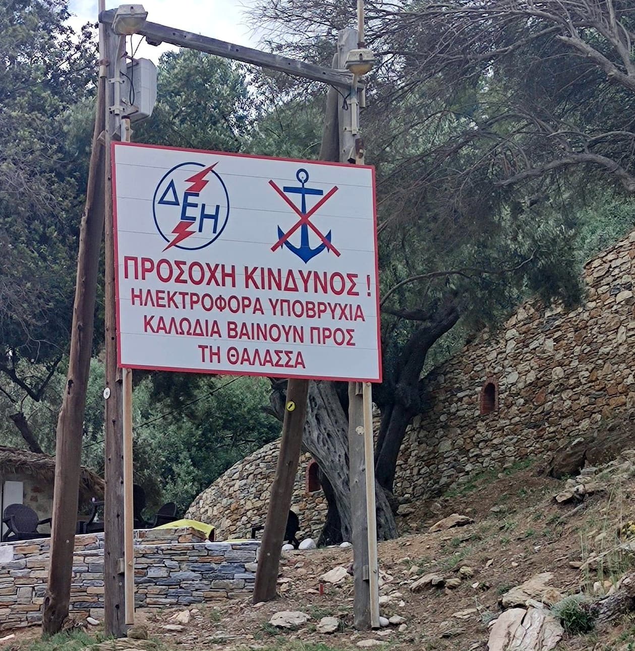
Greek Public Power Corporation logo | Anchoring prohibited symbol
ΠΡΟΣΟΧΗ ΚΙΝΔΥΝΟΣ !
ΗΛΕΚΤΡΟΦΟΡΑ ΥΠΟΒΡΥΧΙΑ ΚΑΛΩΔΙΑ ΒΑΙΝΟΥΝ ΠΡΟΣ ΤΗ ΘΑΛΑΣΣΑ
CAUTION – DANGER !
UNDERWATER POWER CABLES GO TO THE SEA !
Nonetheless, some yachtspersons think that the two signs should be seen as a pair that signals just a single cable – suggesting that a smaller area is to be avoided. It would be prudent to assume two cables and allow for the extra 200 m on either side.
The smaller bay of
Mikrós Mourtiás - Μικρός Μουρτιάς offers more shelter than Megalos Mourtias, although with a partially rocky seabed.
Fortunately, there is a bit of good sand Lat Long near the naturist beach, mostly in <4 m, but worth looking for deeper sandy areas; ±4 yachts can fit at most.
Confusingly, Navionics shows a submarine cable in this bay.
The smallest bay is Kórakas - Κόρακας situated almost near the island's southernmost Téleio / Fanári Cape. Lat Long This anchorage feels tight, room for 1 or 2 yachts; no beach, just cliffs.

Giala
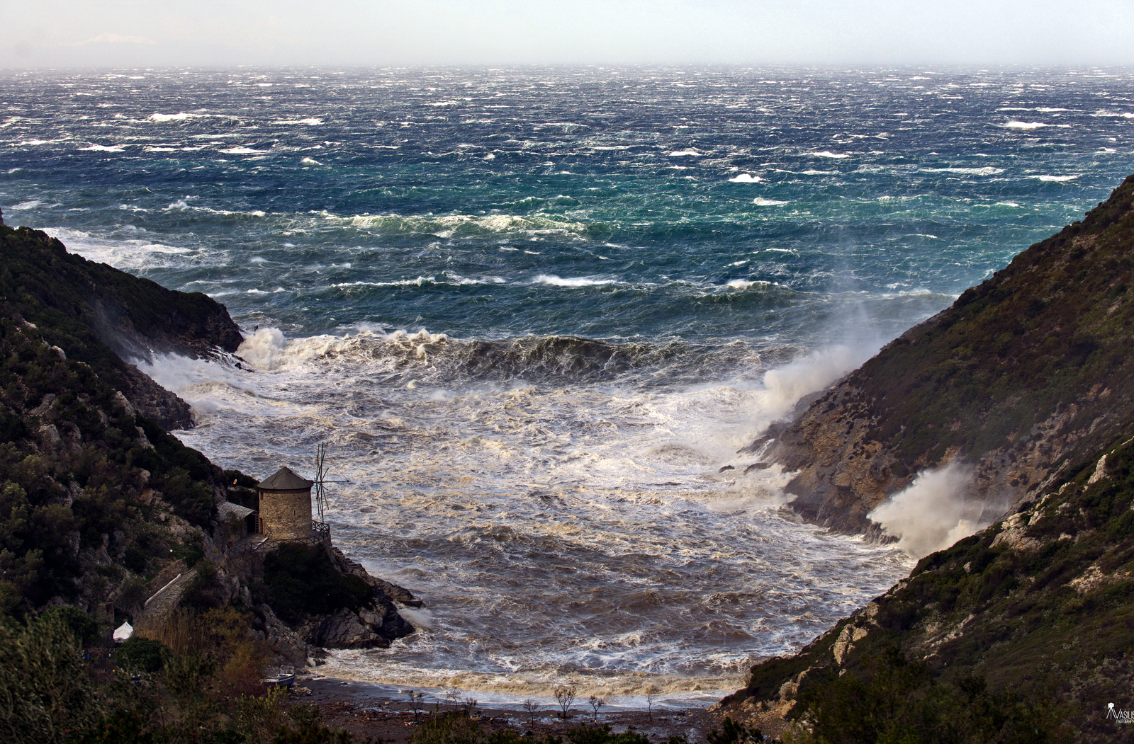
The fjord-like bay of Giála - Γυάλα is justifiably known as Windmill bay Lat Long since it features a freshly refurbished specimen on the South side; dangerous in all but lighter winds and ideally only from NE – S.
Note that, if you follow the coast NE, there is also a white windmill inland of the wider Tsoukalia bay; Lat Long sheltered in ENE – S winds; great snorkeling; seabed is boulders and sand, a tripline is recommended; equally deserted.
When in the winter or early spring the Sirocco blows (SE) these bays become handy + satisfying stop-overs.
Exclusion zone Alonissos island
It is prohibited to approach the NW coast of Alonissos between Cape Kalamos and Cape Amoni; keep a distance of 200 m.
Gerakas (Firakos)
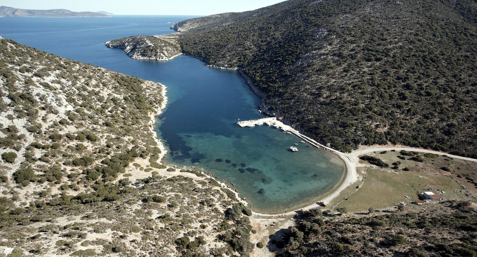
The bay of Gérakas - Γέρακας (i.e. Firakós - Φιρακός) is a deep indentation on the North side Lat Long of Alonissos island. There is room for a few visiting yachts behind a small mole that was built for the local fishing boats and Marine park vessels. This is one of the few ports in the Aegean where you should go alongside (at least if there is space). The rocky seabed, old chains and litter are problematic: use only the outer third section to moor stern-to. At the red light the mole has 4.2 m depth.
Beware of the 1.3 m obstruction (not shown on C-Map or Imray & GWP) that lies 28 m West of the red light. The prevailing N, NE and E winds will funnel into the bay: so even with calm winds outside, the orography can produce fierce winds inside.
Fresh fish is available directly from the fishermen, and a “Kantina” food truck arrives in the summer months.
Anchoring in the bay is also cumbersome – go to Toúrkiko Mníma cove on the East side where it is possible to take lines ashore, anchor 5 – 7 m.
Steni Vala
The peaceful fishing village of Stení Vála - Στενή Βάλα offers all round shelter in the summer months – only affected by ENE – SSE winds (SE winds normally only in winter) – and is inhabited by generous and friendly locals.
Depths near the quay on the North shore Lat Long are too shallow <1.5 m (underwater rocks throughout) for most catamarans and sailing yachts to use the gangway when going stern-to. Moreover, the local summer wind turns East inside the bay – a crosswind during the docking manoeuvre. Finally, the weeds in this bay can prevent the anchor to set properly.
To cope with these three hurdles: prepare longer mooring lines than normal; drop anchor close to the opposite shore maximiseU chain lenght; use the dinghy to get the windward mooring-line ashore.
Keep your stern well off, and either use your dinghy as a ferry or borrow one of the long passarelle planks provided by the Ikaros people.
The quay has room for approximately 10 visiting monohulls depending on the amount of locals that are in port; arrive early in the afternoon to be sure of a berth.
Fuel can be delivered on the quay, tel: (+30) 697 91 91 817; water (& electricity at one pillar, enquire at Sossinola) also available via one of the tavernas.
The mini-market / cafe / bakery “Íkaros” on the waterfront is run by Kostas Mavrikis who as a teen discovered the ancient Peristera wreck with his father.
Very good Greek food at the restaurants, e.g. family taverna Sossinola.
A good substitude is the delightful verdant Ágios Pétros - Άγιος Πέτρος bay immediately to the South; good holding in sand, less weeds than in Steni Vala bay; but not suitable in stronger NE winds and certainly not in a Meltemi.
When you leave Ag Petros bay, note that there is no short-cut between the small islet off Ag Petros' Southern entrance and Alonissos island.
Leftos Gialos • Tzortzi • Kokkinokastro • Chrysi Milia • Milia • Spartines
These bays can have jellyfish (including injurious stinging species like compass jellyfish or mauve stinger) during and after hot summers.
From North to South:
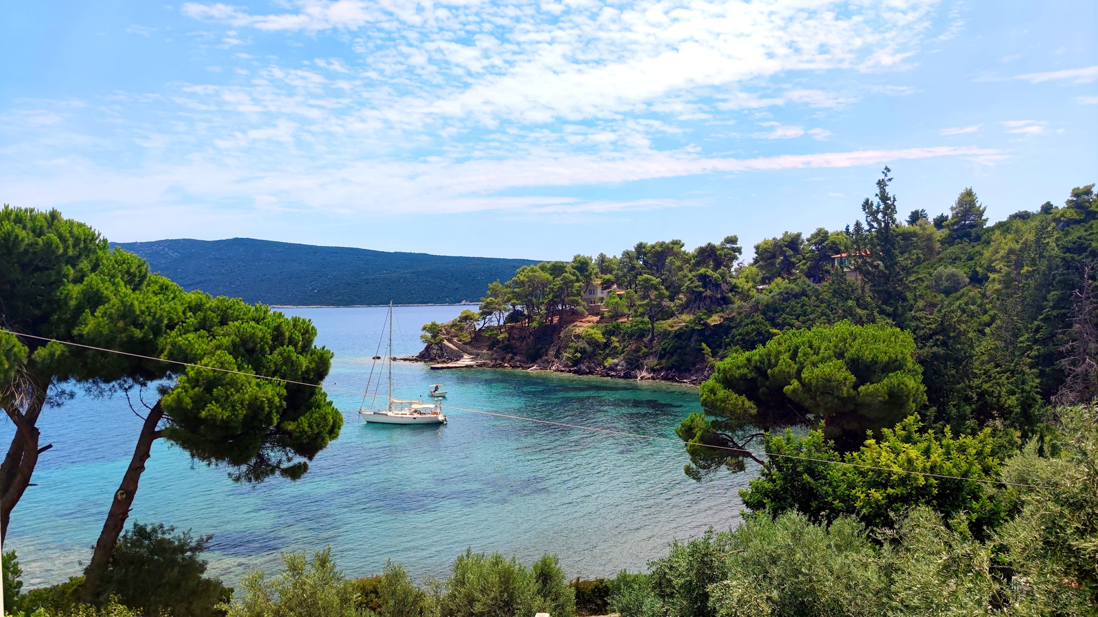
- The picturesque bay of Leftós Gialós - Λεφτός Γιαλός is less celebrated than Tzortzi bay, yet we favour anchoring here.
A little ferry drops of tourists in the NW corner, where there are buoys marking swimming area, populated beach; “Eleonas Seafood” overlooking the beach, as well as the more modest “Dolopes” restaurant; drop anchor anywhere Lat Long while avoiding the poseidonia fields. - Tzórtzi - Τζώρτζη is a reasonably Meltemi-proof plus attractive bay, although the Kokkinokastro headland is less spectacular from this angle, and a swell can enter.
Caiques and tourist buses bring bathers, but in the evening the biggest hustle and bustle will be over, even in high season.
You will need to anchor in the shallower region Lat Long 3 – 5 m to avoid the weeds .
Visit the very lovely Taverna Παρά θιν' αλός (meaning: “In spite of everything”, closed in the off-season) on the beach beneath the immense tamarisk trees.
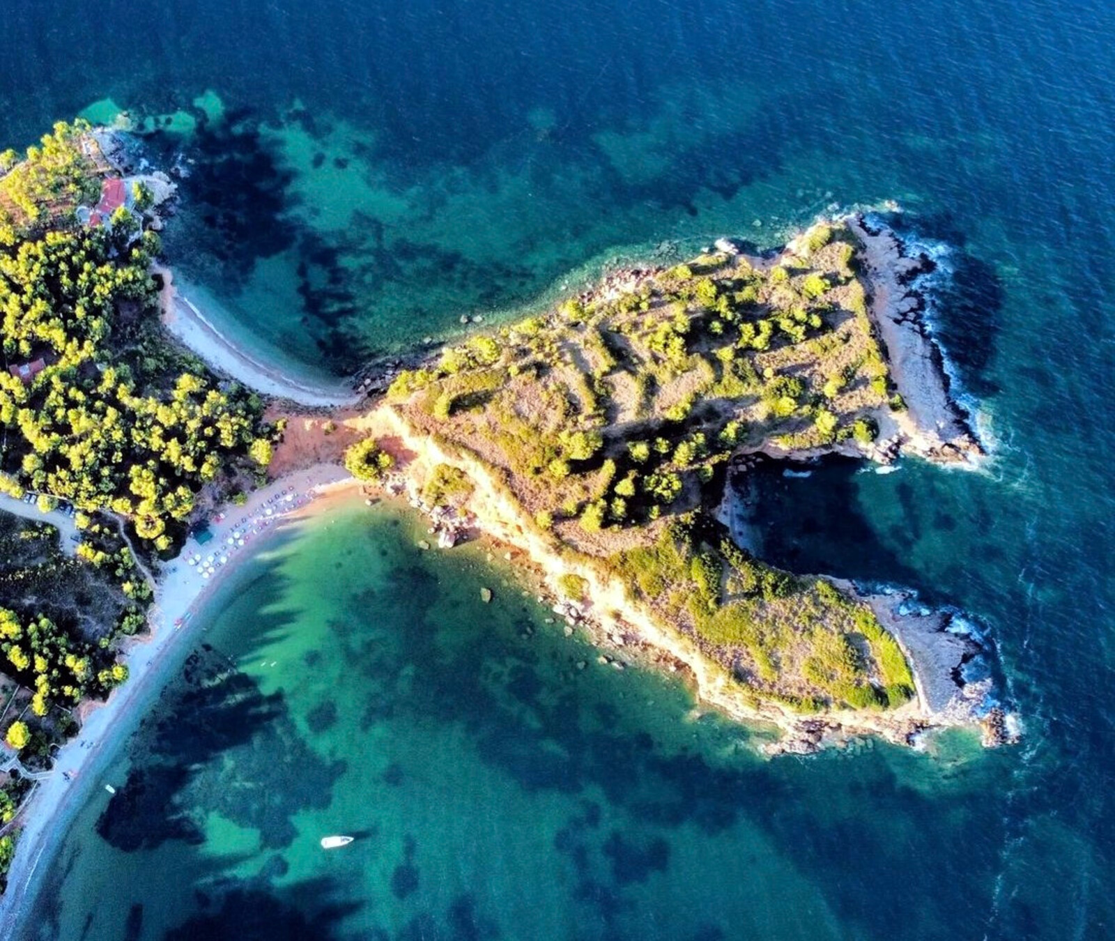
There is also a nice tiny anchorage, suitable in light conditions or SE-W winds, just North of the isthmus of Cape Kokkinokastro. - Kokkinókastro - Κοκκινόκαστρο is a must-see scenic bay. This picture-perfect anchorage is named after the recognisable Akrotiri Kokkinokastro, meaning ”Cape of the Red Castle”, where you can explore some scant 3 m high remains of city walls, likely from the ancient town of Ikos.
Bone finds from prehistoric animals and people, as well as tools, were dated to around 100,000 BCE, suggesting the oldest settlement in the Aegean islands. Probably Alonnisos was at this time connected to the neighbouring western islands and Thessaly via a land bridge.
Make the approach from the East; also, Navionics shows a non-existing tiny islet NW of Kokkinonisi; very well protected in SW – SE winds, thus only open to Southerlies but even then the beach and anchorage is reasonably guarded by the islet of Kokkinonisi; it is tight with room for ±4 yachts or a few catamarans, but often you will be the only one; there is solid holding in 4 – 6 m on a mix of sand, poseidonia and small boulders. Lat Long You should definitely try to stay the night when the weather forecast allows it.
The beach bar is very basic but with good service; superb snorkeling; take the dinghy around to the enclosed beach at the head of the cape. - The shallow bay of Chrysí Miliá - Χρυσή Μηλιά lies immediatly South of Kokkinonisi and seems more open, yet offers adequate protection against a light Meltemi. Lat Long Keep your distance from the beach since the seabed rises early. This makes this beach ideal for children as well as some real sand. Chrysi means “golden”. Beautiful scenery nearby, and Adelphi islets - Αδελφοί on the horizon.
- The bay of Miliá - Μηλιά is a narrow secluded with a crowded beach in the NW Lat Long offering quite good shelter in windy Northerlies. The rest of the bay opens up to the South and is in fact called Spartínes bay, see below!
- Spartínes - Σπαρτίνες is a wide bay with a majestic arch of mint-cream coloured cliffs and three beaches. Lat Long Rocks under the cliffs can be used to take a line to; a heavy swell can penetrate easily; anchor in 5 – 10 meters anywhere over sand, solid holding, snorkeling and sea urchins in the SSW corner, mind the reefs there; further away from Kokkinokastro, the cliff faces are whiter here;
excellent lunch bay; staying overnight is possible in lighter conditions; not much shelter in the prevalent northeasterly.
The next bay over to the South is Votsi.
Peristera island
The island of Peristera (meaning “common pigeon” or “dove”) or Áspro - Άσπρο (meaning “white”) is locally known as Xero - Ξηρό (meaning “dry”).
The North and South parts of the island are connected by a wooded, 220 meter wide isthmus, the highest "mountain" is a mere 259 m.
Gusts in the North and South of Peristera result in greater wind strengths compared to Alonissos, yet the swell remains relatively low. The island itself is said to have been populated in ancient times, but today you can only find a few fishing huts and holiday homes. Contrary to the large Sporades islands, it has very little vegetation; several semi-wild herds of goats roam the hills.
Peristeri • Xero • Kokkalias
The bay of Peristéri - Περιστέρι is named after the island, being the default anchorage Lat Long providing the best protection against the Meltemia; anchor is shallow waters 3 – 5 m to avoid the fields of weed; in Northerlies take a line ashore; gusts are NE – ENE; swell will enter the bay; some scattered holiday homes; bay remains deep till close to the shoreline.
Also named after the island is the smaller double headed Xeró - Ξηρό bay directly East. Lat Long Be aware that Imray (GWP) charts show this bay imprecise; anchor in 4 – 7 m, and preferably in the West corner; in light conditions you can go very close to the beach in the East corner and take a line to the rocks.
There is more swell and somewhat less protection in Xero than in Peristeri, yet the surroundings are even more dazzling.
Also consider the neighbouring bay of Kokkaliás - Κοκκαλιάς, West of Peristeri bay. Lat Long Mind that Navionics shows a mini-islet near the beach that doesn't exist.
Vasiliko
The bay of Vasilikó - Βασιλικό
Lat Long is used by a shipyard, and fishing trawlers with running generators are sometimes stationed here overnight; this anchorage is then rather uninviting.
When approaching from the North, mind the reefs extending from the headland. The bottom rises evenly from a great depth; because of a heavy mooring chain (mostly within 5 m depths) and an abandoned telephone cable, it is prudent to stay on the West side of the bay and anchor at 6 – 8 m of water with plenty of chain; reasonable holding in (soft) sand and weeds; very good shelter against the prevailing NE wind. Despite the industrial structures, it can sometimes be a pleasant and quiet anchorage.
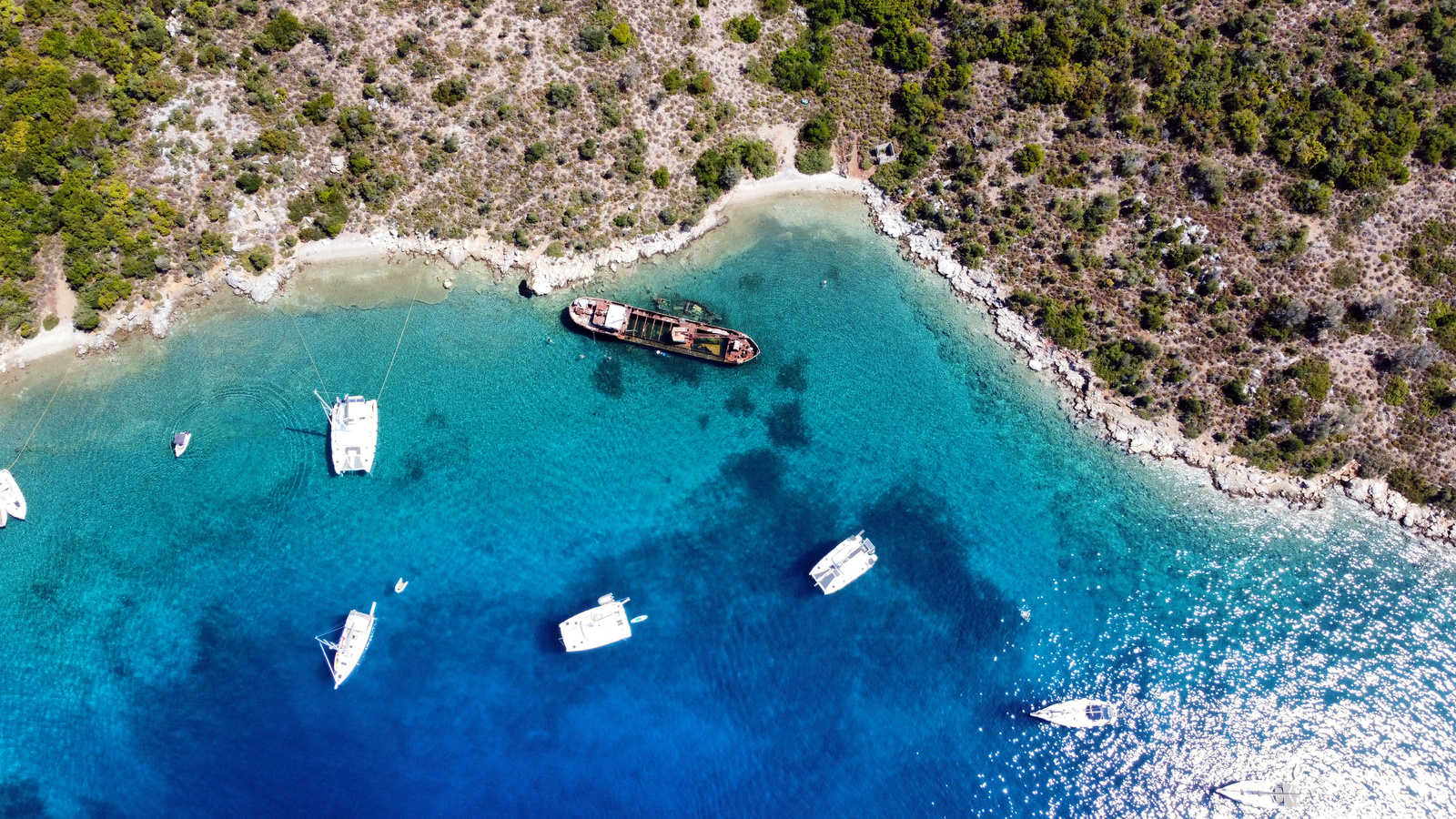
Navagio “shipwreck”
The bay of Navagío - Ναυαγίο
is informally named after the shipwreck of the “Alonissos” barge that once carried the supplies of the island; originally this bay was known as Kalámi. There is excellent snorkeling, the wreck abounds with fish; the bight Lat Long is sheltered against the prevailing winds, nearly as well as Vasiliko, though without fishing trawlers, noisy generators and fouled anchors.
Navagio means “shipwreck”; see the homonymous but far more famous Zakynthos bay.
The far more interesting Peristera wreck dates from 425 BCE. Lat Long
The ship was one of the biggest merchant vessels of the classical period (5th through 4th centuries BCE) and carried an impressive cargo: 4,000 wine amphorae (large two-handled jars) originating from the ancient Greek cities of Mende and Peparethus, plus black-glazed bowls, cups, plates, and tableware – essential items for the lavish banquets, or symposia, of the time.
A virtual dive can be made at the Alonissos Underwater Museum.
The demise of the ship, likely Athenian, came at the end of the Peloponnesian War – those turbulent decades when two superpowers, Athens and Sparta, battled each other.
Since 2020 the wreck can also be viewed via webcam.
Livadakia
The bay of Livadákia - Λιβαδάκια is rarely used; completely open to N – NE winds; anchor in 5 – 10 m over sand, small pebbles Lat Long; a shepherd tends his flock from this beach; Livadakia literally means “small livadi”, so “small port”.
Klima
The bay of Klíma - Κλήμα on the East side of Peristera's isthmus, is affected by the prevailing NE winds. Hence, this beach collects debris, branches, whole logs. Only the SW cove Lat Long is really used; low cliffs; wonderful clear water with turquoise colours; no dangers in the approach – seabed rises suddenly from sufficient depths only near the pebble beach; fresh water spring ashore; untenable in Meltemia, but a delight in all but N – ENE winds.
The Northern cove seems unsuitable (not tried).
In the SE cove there is room – lengthwise – for one yacht with lines ashore.
As an exception, under water fishing is allowed in Klima bay.
Adelphi
The Southern islet of Adélfi - Αδέλφι of the Adelfí - Αδελφοί twin islets offers a narrow secluded anchorage sliced in its South coast. Lat Long Although remote, these islets are still within Zone B, so no ticket is needed. This gorgeous anchorage isn't a secret anymore, and in the main season you will have company here. Moreover, there is room only for a few yachts. Good holding; deep and mixed seabed; protected against SW – SE winds; take a line (or two) ashore.
History of Alonissos
Ancient Ikos is believed to have been at Kokkinokastro (Meaning: Red Castle), near the South cape of Tzortzi Bay, where remains of town walls and tombs have been brought to light.
From the anchorages of Tzortzi or Kokkinokastro it is only a small walk to explore this site.
At Agios Dimitris there are ruins of an unknown ancient city, and at Agios Petros there is a sunken Byzantine ship.